MyTopo
Nine Meadow Ridge Maine US Topo Map
Couldn't load pickup availability
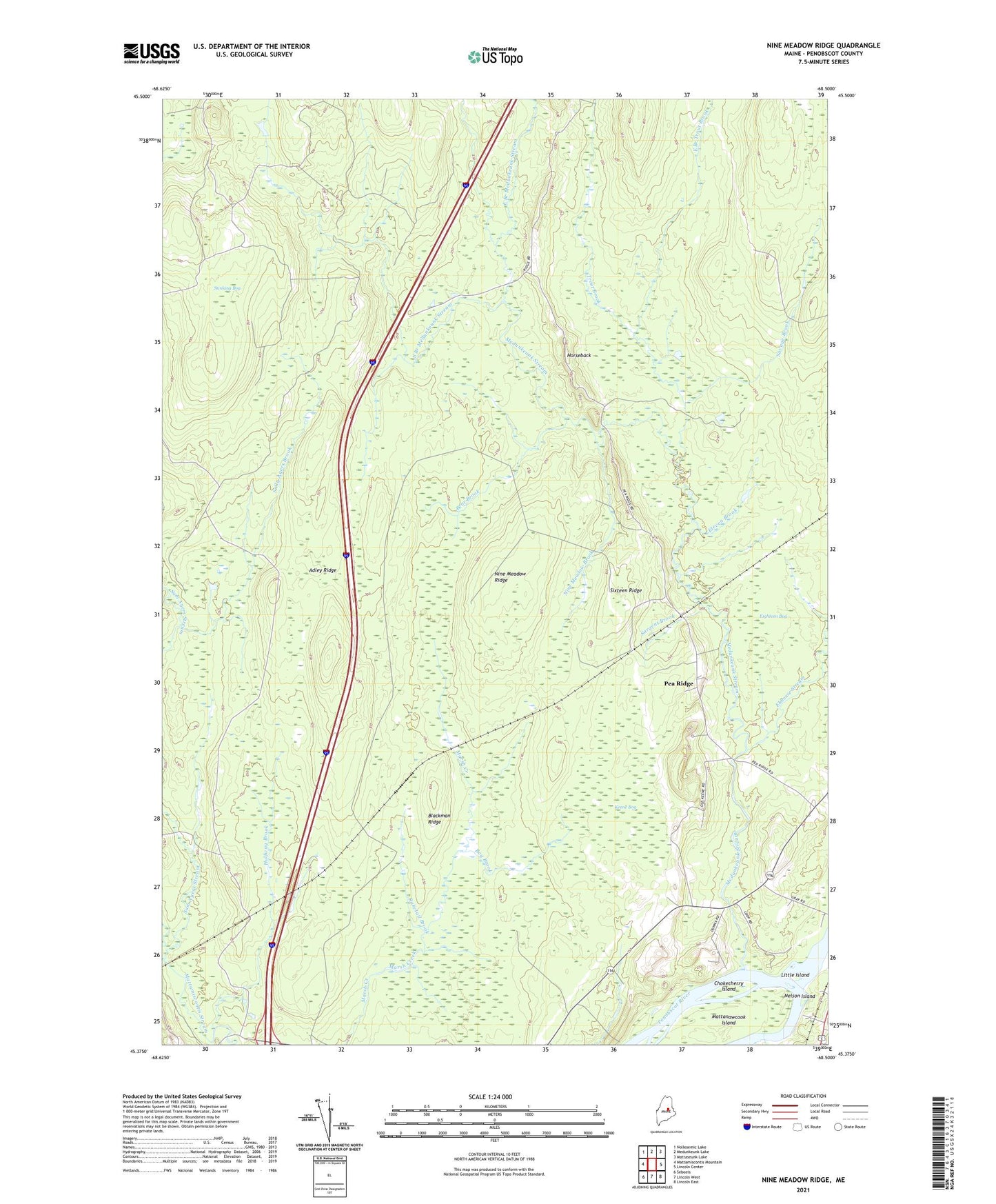
2021 topographic map quadrangle Nine Meadow Ridge in the state of Maine. Scale: 1:24000. Based on the newly updated USGS 7.5' US Topo map series, this map is in the following counties: Penobscot. The map contains contour data, water features, and other items you are used to seeing on USGS maps, but also has updated roads and other features. This is the next generation of topographic maps. Printed on high-quality waterproof paper with UV fade-resistant inks.
Quads adjacent to this one:
West: Mattamiscontis Mountain
Northwest: Nollesemic Lake
North: Medunkeunk Lake
Northeast: Mattaseunk Lake
East: Lincoln Center
Southeast: Lincoln East
South: Lincoln West
Southwest: Seboeis
Contains the following named places: Adley Ridge, Bear Brook, Blackman Ridge, Bog Brook, Bowerbank, Chokecherry Island, East Branch Medunkeunk Stream, East Branch Trout Brook, Ebhorse Stream, Eighteen Bog, Eleven Brook, Fairfield School, Halfway Brook, Horseback, Keene Bog, Little Island, Mattanawcook Island, Medunkeunk Stream, Nelson Island, Nine Meadow Brook, Nine Meadow Ridge, Pea Ridge, Penobscot Island Indian Reservation, Raketail Brook, Sally Ayers Brook, Sargent Brook, Savage Brook, Sixteen Ridge, South Branch Medunkeunk Stream, Stinking Bog, T2 R8 NWP, Town of Chester, Trout Brook, Woodard