MyTopo
Mattaseunk Lake Maine US Topo Map
Couldn't load pickup availability
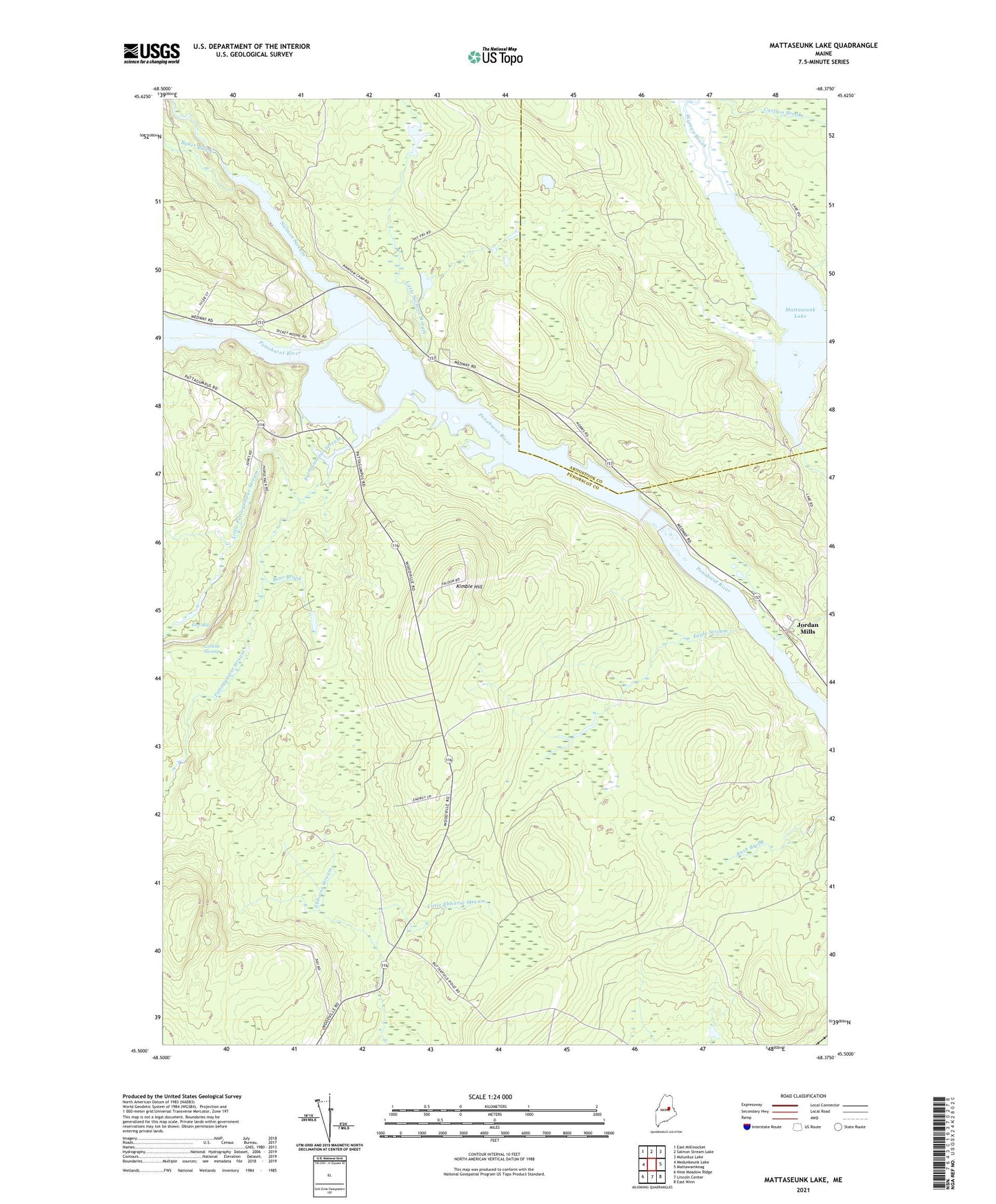
2024 topographic map quadrangle Mattaseunk Lake in the state of Maine. Scale: 1:24000. Based on the newly updated USGS 7.5' US Topo map series, this map is in the following counties: Penobscot, Aroostook. The map contains contour data, water features, and other items you are used to seeing on USGS maps, but also has updated roads and other features. This is the next generation of topographic maps. Printed on high-quality waterproof paper with UV fade-resistant inks.
Quads adjacent to this one:
West: Medunkeunk Lake
Northwest: East Millinocket
North: Salmon Stream Lake
Northeast: Molunkus Lake
East: Mattawamkeag
Southeast: East Winn
South: Lincoln Center
Southwest: Nine Meadow Ridge
This map covers the same area as the classic USGS quad with code o45068e4.
Contains the following named places: Baker Brook, Bear Brook, Carlisle Swamp, Carlton Brook, Eagle Stream, Five Bog, Jordan Mills, Kimble Hill, Little Ebhorse Stream, Little Pattagumpus Stream, Little Salmon Stream, Mattaseunk Dam, Mattaseunk Lake, Mattaseunk Stream, North Woodville School, Pattagumpus Stream, Penobscott River Reservoir, Salmon Stream, South Woodville School, Town of Medway, Town of Woodville, Wyman Brook