MyTopo
Oxbow East Maine US Topo Map
Couldn't load pickup availability
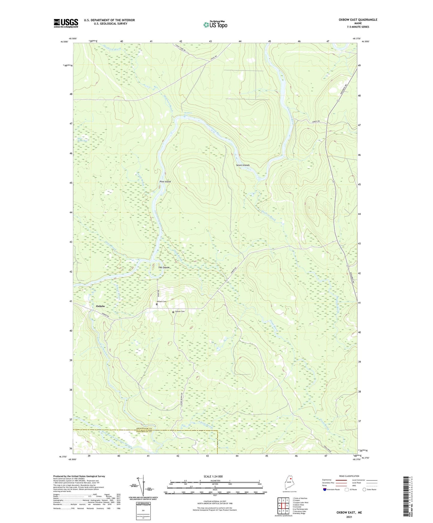
2024 topographic map quadrangle Oxbow East in the state of Maine. Scale: 1:24000. Based on the newly updated USGS 7.5' US Topo map series, this map is in the following counties: Aroostook, Penobscot. The map contains contour data, water features, and other items you are used to seeing on USGS maps, but also has updated roads and other features. This is the next generation of topographic maps. Printed on high-quality waterproof paper with UV fade-resistant inks.
Quads adjacent to this one:
West: Oxbow West
Northwest: Forks of Machias
North: Scopan
Northeast: Scopan Lake West
East: Griswold
Southeast: McNally Ridge
South: Umcolcus Lake
Southwest: La Pomkeag Lake
This map covers the same area as the classic USGS quad with code o46068d4.
Contains the following named places: Aikens Brook, Camp Dana, Cold Spring Campsite, East Branch Umcolcus Stream, East End School, Houlton Brook, Otter Brook, Otter Brook Bog, Oxbow, Oxbow Cemetery, Pine Island, School Brook, Seven Islands, Shephard Brook, Shephard Rips, The Oxbow, Trout Brook, Turtle Brook, Umcolcus Stream, Willard Cemetery