MyTopo
Parmachenee Lake Maine US Topo Map
Couldn't load pickup availability
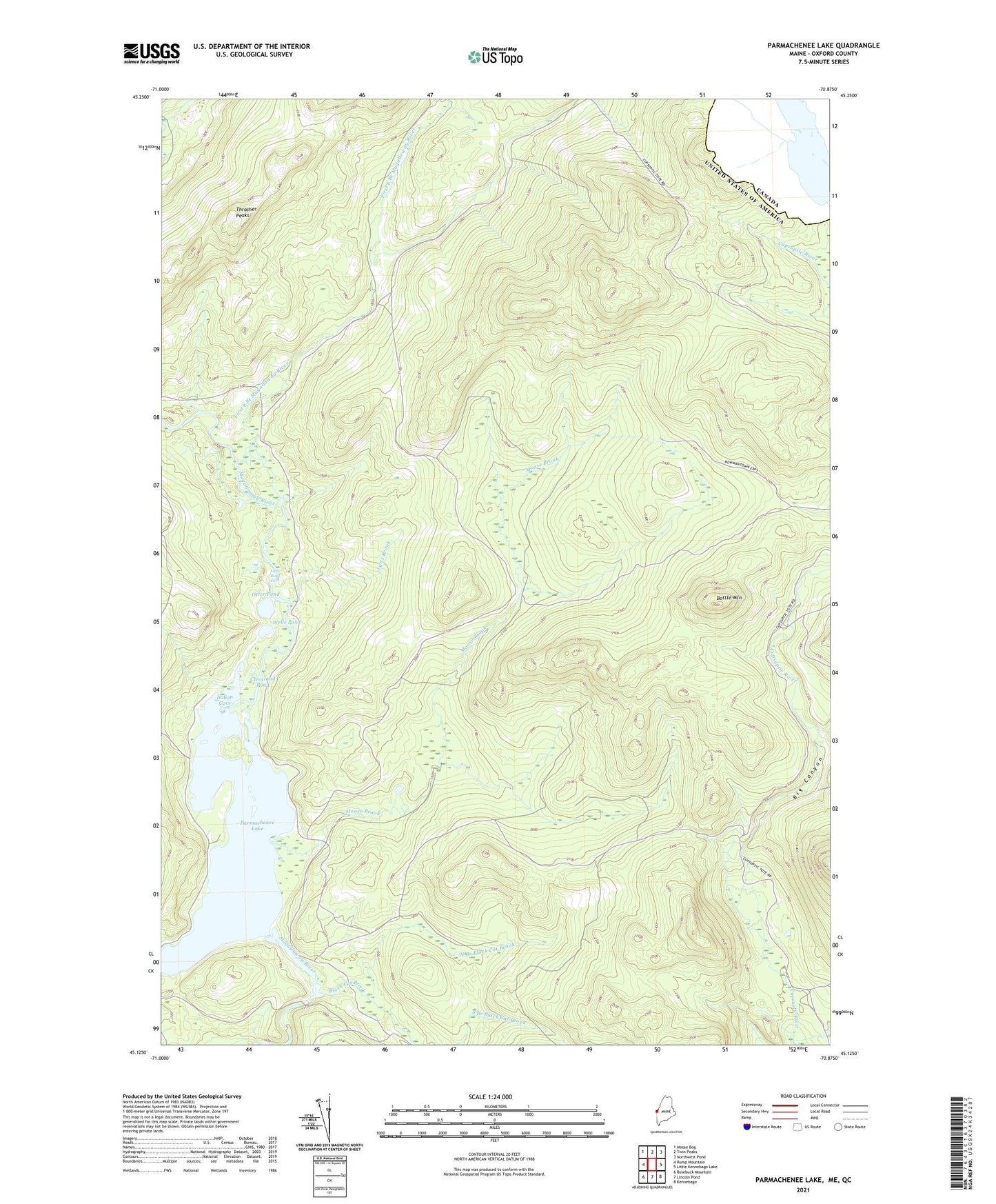
2024 topographic map quadrangle Parmachenee Lake in the state of Maine. Scale: 1:24000. Based on the newly updated USGS 7.5' US Topo map series, this map is in the following counties: Oxford. The map contains contour data, water features, and other items you are used to seeing on USGS maps, but also has updated roads and other features. This is the next generation of topographic maps. Printed on high-quality waterproof paper with UV fade-resistant inks.
Quads adjacent to this one:
West: Rump Mountain
Northwest: Moose Bog
North: Twin Peaks
Northeast: Northwest Pond
East: Little Kennebago Lake
Southeast: Kennebago
South: Lincoln Pond
Southwest: Bosebuck Mountain
This map covers the same area as the classic USGS quad with code o45070b8.
Contains the following named places: Big Canyon, Black Cat Brook, Bottle Mountain, Cleveland Pond, East Branch Cupsuptic River, First East Branch Magalloway River, Indian Cove, Little Boy Falls, Lynx Brook, Moose Brook, Moose Brook Camp, North Branch Black Cat Brook, Number Two Camp, Otter Pond, Oxbow Township, Parmachenee Club, Parmachenee Lake, Saturday Pond, Snow Mountain Brook, South Branch Black Cat Brook, Thrasher Peaks, Township of Parmachenee, Wells Pond