MyTopo
Rump Mountain Maine US Topo Map
Couldn't load pickup availability
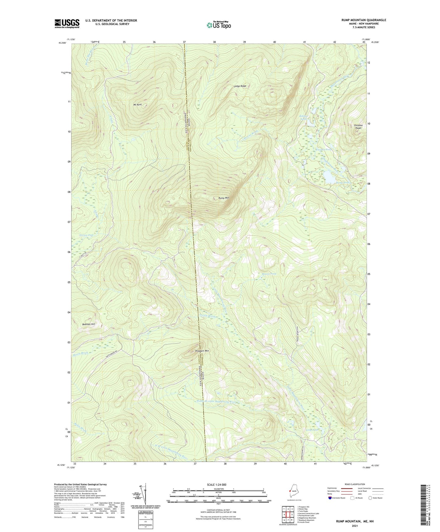
2024 topographic map quadrangle Rump Mountain in the states of Maine, New Hampshire. Scale: 1:24000. Based on the newly updated USGS 7.5' US Topo map series, this map is in the following counties: Oxford, Coos. The map contains contour data, water features, and other items you are used to seeing on USGS maps, but also has updated roads and other features. This is the next generation of topographic maps. Printed on high-quality waterproof paper with UV fade-resistant inks.
Quads adjacent to this one:
West: Second Connecticut Lake
Northwest: Prospect Hill
North: Moose Bog
Northeast: Twin Peaks
East: Parmachenee Lake
Southeast: Lincoln Pond
South: Bosebuck Mountain
Southwest: Magalloway Mountain
Contains the following named places: Beaman Hill, Beaver Pond, Bereau Brook, Billings Ponds, Camp Number 32, Camp Number 36, Camp Number Thirty-Four, Camp Number Thirty-Two, Caribou Pond, Depot Camp, Ledge Ridge, Long Pond, Middle Branch Little Magalloway River, Mount Kent, Norton Pool, Prospect Mountain, Rump Mountain, Rump Pond, Second East Branch Magalloway River, Trestle Brook, West Branch Little Magalloway River, West Branch Magalloway River