MyTopo
Moose Bog Maine US Topo Map
Couldn't load pickup availability
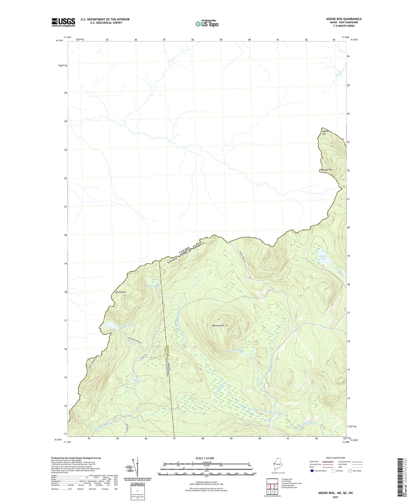
2024 topographic map quadrangle Moose Bog in the states of Maine, New Hampshire. Scale: 1:24000. Based on the newly updated USGS 7.5' US Topo map series, this map is in the following counties: Oxford, Coos. The map contains contour data, water features, and other items you are used to seeing on USGS maps, but also has updated roads and other features. This is the next generation of topographic maps. Printed on high-quality waterproof paper with UV fade-resistant inks.
Quads adjacent to this one:
West: Prospect Hill
East: Twin Peaks
Southeast: Parmachenee Lake
South: Rump Mountain
Southwest: Second Connecticut Lake
Contains the following named places: Barker Pond, Boundary Pond, Bowman Farm, Bowman Hill, Bowman Ponds, Bowmantown Township, Marble Mountain, Moose Bog, Moose Bog Brook, Moose Bog Camp, Mount D'Urban, Mountain Pond, Mountain Pond Dam, Rhubarb Pond, Saddle Hill, Snag Pond, Third East Branch Magalloway River