MyTopo
Fayette Maine US Topo Map
Couldn't load pickup availability
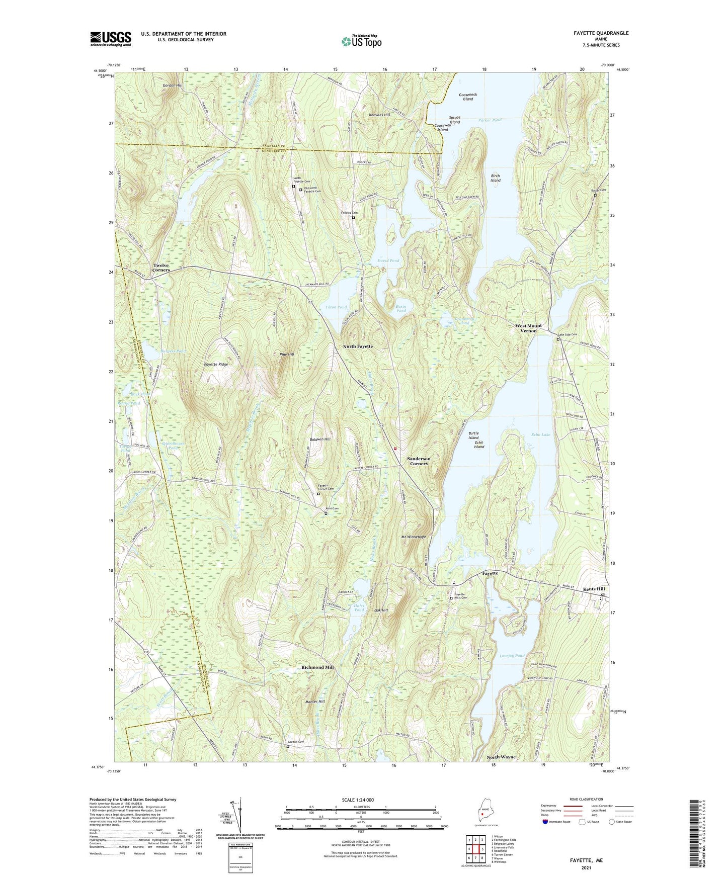
2024 topographic map quadrangle Fayette in the state of Maine. Scale: 1:24000. Based on the newly updated USGS 7.5' US Topo map series, this map is in the following counties: Kennebec, Androscoggin, Franklin. The map contains contour data, water features, and other items you are used to seeing on USGS maps, but also has updated roads and other features. This is the next generation of topographic maps. Printed on high-quality waterproof paper with UV fade-resistant inks.
Quads adjacent to this one:
West: Livermore Falls
Northwest: Wilton
North: Farmington Falls
Northeast: Belgrade Lakes
East: Readfield
Southeast: Winthrop
South: Wayne
Southwest: Turner Center
This map covers the same area as the classic USGS quad with code o44070d1.
Contains the following named places: Baldwin Hill, Basin Pond, Birch Island, Burgess Pond, Butler Cemetery, Camp Winnebago, Causeway Island, Cranberry Pond, David Pond, East Livermore Campgrounds, Echo Island, Echo Lake, Echo Lake Dam Number 1, Echo Lake Dam Number 2, Fayette, Fayette Central School, Fayette Corner, Fayette Corner Cemetery, Fayette Mills Cemetery, Fayette Ridge, Fayette Volunteer Fire Department, Gooseneck Island, Gordon Cemetery, Gordon Hill, Hales Pond, Hopkins Stream, Kent Cemetery, Kents Hill, Kents Hill School, Knowles Hill, Lake Side Cemetery, Lovejoy Pond, Manter Hill, Mosher Pond, Mount Winnebago, North Fayette, North Fayette Cemetery, Oak Hill, Old North Fayette Cemetery, Parker Pond, Pine Hill, Rack Pond, Richmond Mill, Round Pond, Sanderson Corners, Schoolhouse Pond, Spruce Island, Taylor Pond, Taylor Pond Dam, Tilton Pond, Town of Fayette, Turner Pond, Turtle Island, Twelve Corners, Underwood Memorial Library, West Mount Vernon, ZIP Codes: 04228, 04349