
MyTopo
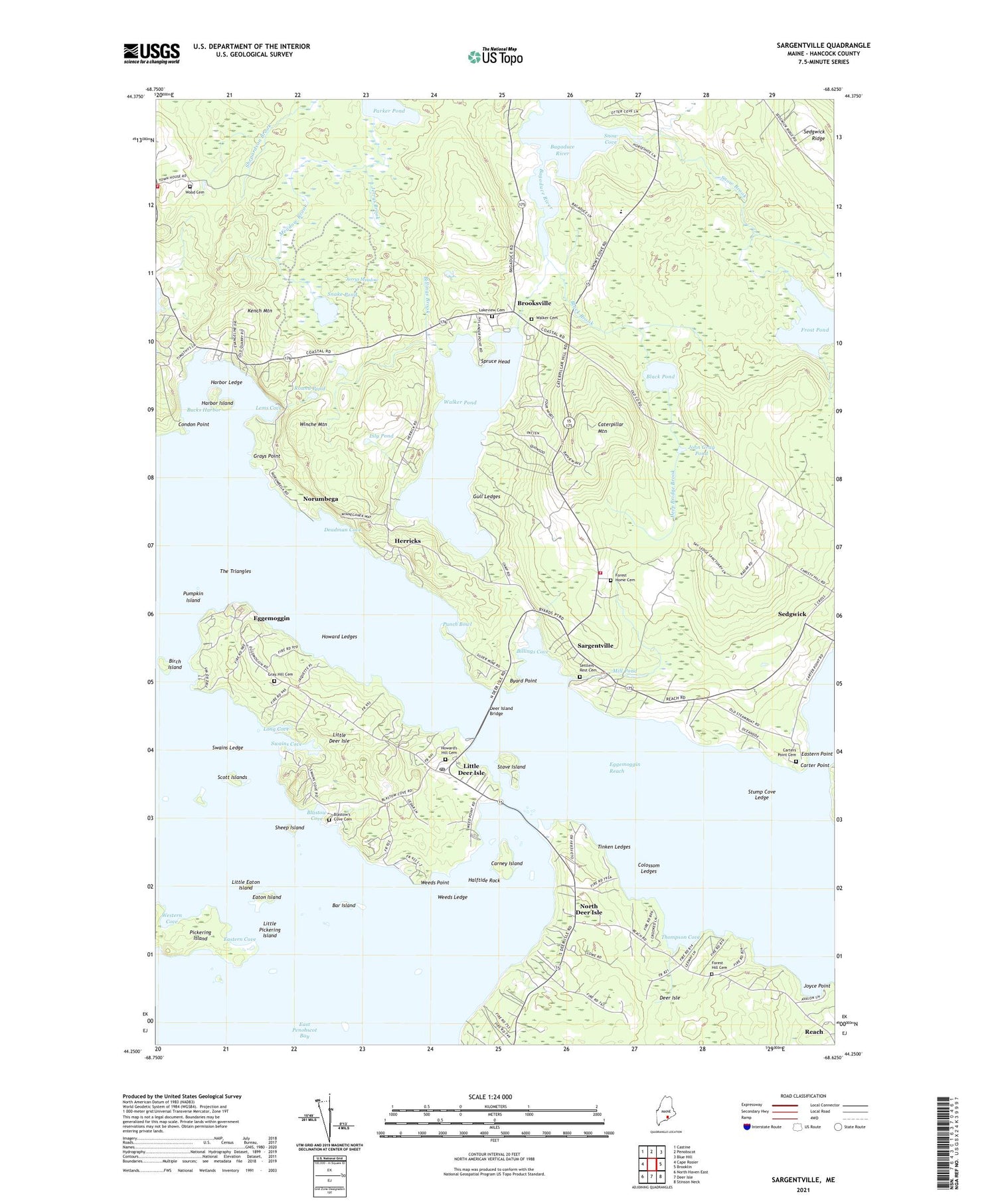
Sargentville Maine US Topo Map
Couldn't load pickup availability
2021 topographic map quadrangle Sargentville in the state of Maine. Scale: 1:24000. Based on the newly updated USGS 7.5' US Topo map series, this map is in the following counties: Hancock. The map contains contour data, water features, and other items you are used to seeing on USGS maps, but also has updated roads and other features. This is the next generation of topographic maps. Printed on high-quality waterproof paper with UV fade-resistant inks.
Quads adjacent to this one:
West: Cape Rosier
Northwest: Castine
North: Penobscot
Northeast: Blue Hill
East: Brooklin
Southeast: Stinson Neck
South: Deer Isle
Southwest: North Haven East
Contains the following named places: Bar Island, Benjamin River, Billings Brook, Billings Cove, Birch Island, Black Brook, Black Corner, Black Pond, Blastow Cove, Brooksville, Brooksville Free Public Library, Brooksville Volunteer Fire Department Main Station, Bucks Harbor, Byard Point, Carney Island, Carter Point, Carters Point Cemetery, Caterpillar Mountain, Colossom Ledges, Deadman Cove, Deep Bridge Brook, Deer Island Bridge, Eastern Cove, Eastern Point, Eaton Island, Eccemoccin Church, Eggemoggin, Eggemoggin Christian Academy, Eggemoggin Reach, Forest Hill Cemetery, Forest Home Cemetery, Frost Pond, Grays Hill Cemetery, Grays Point, Gull Ledges, Halftide Rock, Harbor Island, Harbor Ledge, Herricks, Howard Ledges, Howards Hill Cemetery, Jerrys Brook, Jerrys Meadow, John Gray Pond, Joyce Point, Kench Mountain, Lakeview Cemetery, Lems Cove, Lily Pond, Little Deer Isle, Little Deer Isle Post Office, Little Eaton Island, Little Pickering Island, Long Cove, Meadow Brook, Mill Pond, North Deer Isle, Norumbega, Number Three Chapel, Open Door School, Parker Pond, Pickering Island, Pumpkin Island, Pumpkin Island Light Station, Punch Bowl, Round Pond, Sargentville, Sargentville Public Library, Saunders Memorial Church, Scott Islands, Sedgwick Elementary School, Sedgwick Ridge, Sedgwick Town Landing, Sedgwick Volunteer Fire Department Sargentville Station, Sheep Island, Snake Pond, Snow Brook, Snow Cove, South Brooksville, Spruce Head, Stave Island, Stump Cove Ledge, Swains Cove, Swains Ledge, The Triangles, Thompson Cove, Tinken Ledges, Town of Sedgwick, Walker Pond, Walker Pond Dam, Weeds Ledge, Weeds Point, Western Cove, Winche Mountain, Wood Cemetery, ZIP Codes: 04650, 04673, 04676


