MyTopo
Seboeis Lake Maine US Topo Map
Couldn't load pickup availability
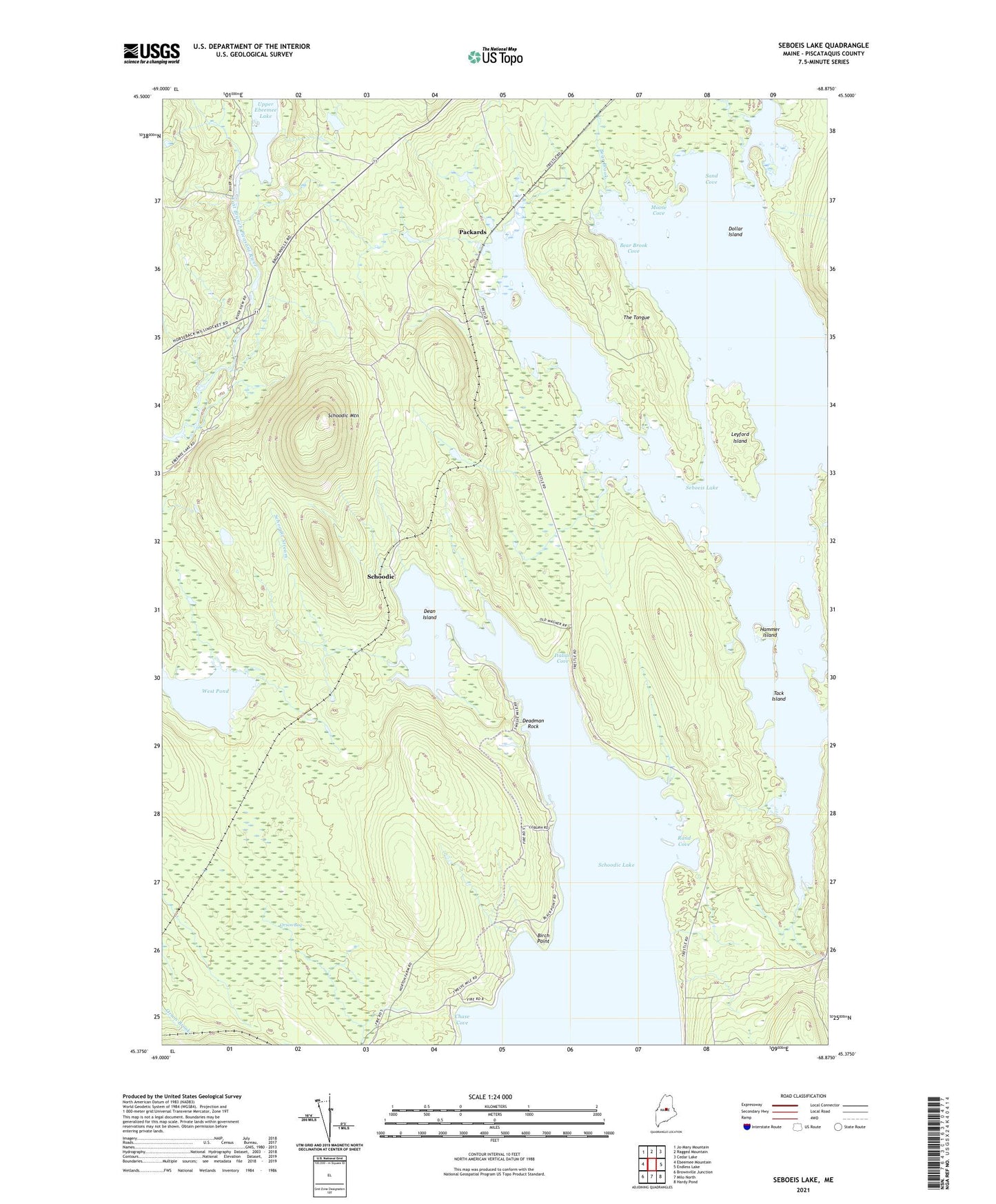
2021 topographic map quadrangle Seboeis Lake in the state of Maine. Scale: 1:24000. Based on the newly updated USGS 7.5' US Topo map series, this map is in the following counties: Piscataquis. The map contains contour data, water features, and other items you are used to seeing on USGS maps, but also has updated roads and other features. This is the next generation of topographic maps. Printed on high-quality waterproof paper with UV fade-resistant inks.
Quads adjacent to this one:
West: Ebeemee Mountain
Northwest: Jo-Mary Mountain
North: Ragged Mountain
Northeast: Cedar Lake
East: Endless Lake
Southeast: Hardy Pond
South: Milo North
Southwest: Brownville Junction
Contains the following named places: Bear Brook, Bear Brook Cove, Birch Point, Carry Trail, Chase Cove, Deadman Rock, Dean Island, Dollar Island, East Pond, Hammer Island, Hay Brook, Italian Cove, Jordan Brook, Leyford Island, Moose Cove, Northwest Pond, Norton Trail, Packards, Packards Trail, Plantation of Lake View, Pleasant River Trail, Pocomoonshine Branch, Rand Cove, Sand Cove, Schoodic, Schoodic Mountain, Shallow Pond, T4 R9 NWP, Tack Island, The Tongue