MyTopo
Spinney Brook Maine US Topo Map
Couldn't load pickup availability
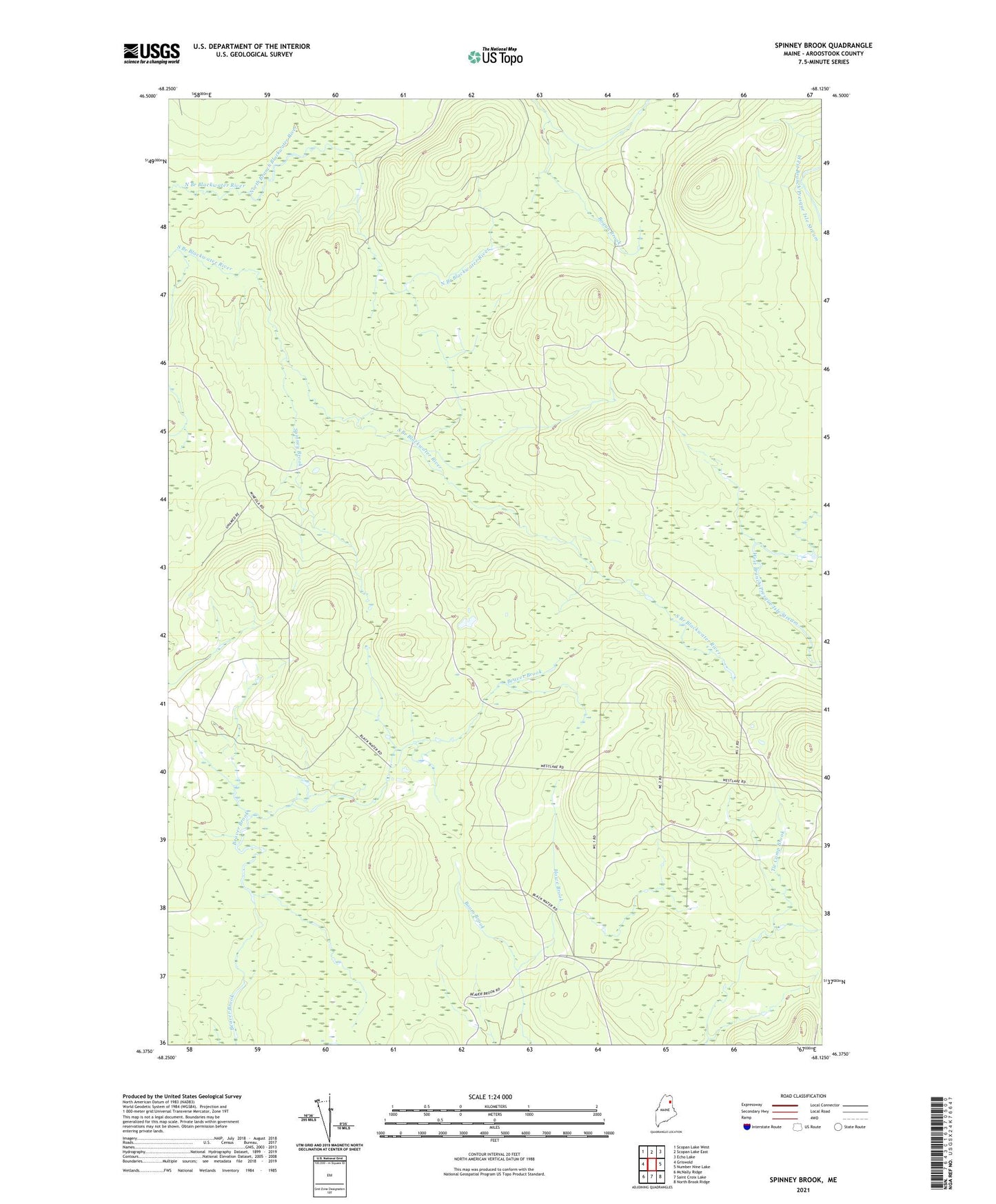
2024 topographic map quadrangle Spinney Brook in the state of Maine. Scale: 1:24000. Based on the newly updated USGS 7.5' US Topo map series, this map is in the following counties: Aroostook. The map contains contour data, water features, and other items you are used to seeing on USGS maps, but also has updated roads and other features. This is the next generation of topographic maps. Printed on high-quality waterproof paper with UV fade-resistant inks.
Quads adjacent to this one:
West: Griswold
Northwest: Scopan Lake West
North: Scopan Lake East
Northeast: Echo Lake
East: Number Nine Lake
Southeast: North Brook Ridge
South: Saint Croix Lake
Southwest: McNally Ridge
This map covers the same area as the classic USGS quad with code o46068d2.
Contains the following named places: Bliss Camp, Boom Brook, Mineola Hunting Camp, Rips Dam, Spinney Brook, T9 R4 WELS, Unorganized Territory of Central Aroostook