MyTopo
Scopan Lake East Maine US Topo Map
Couldn't load pickup availability
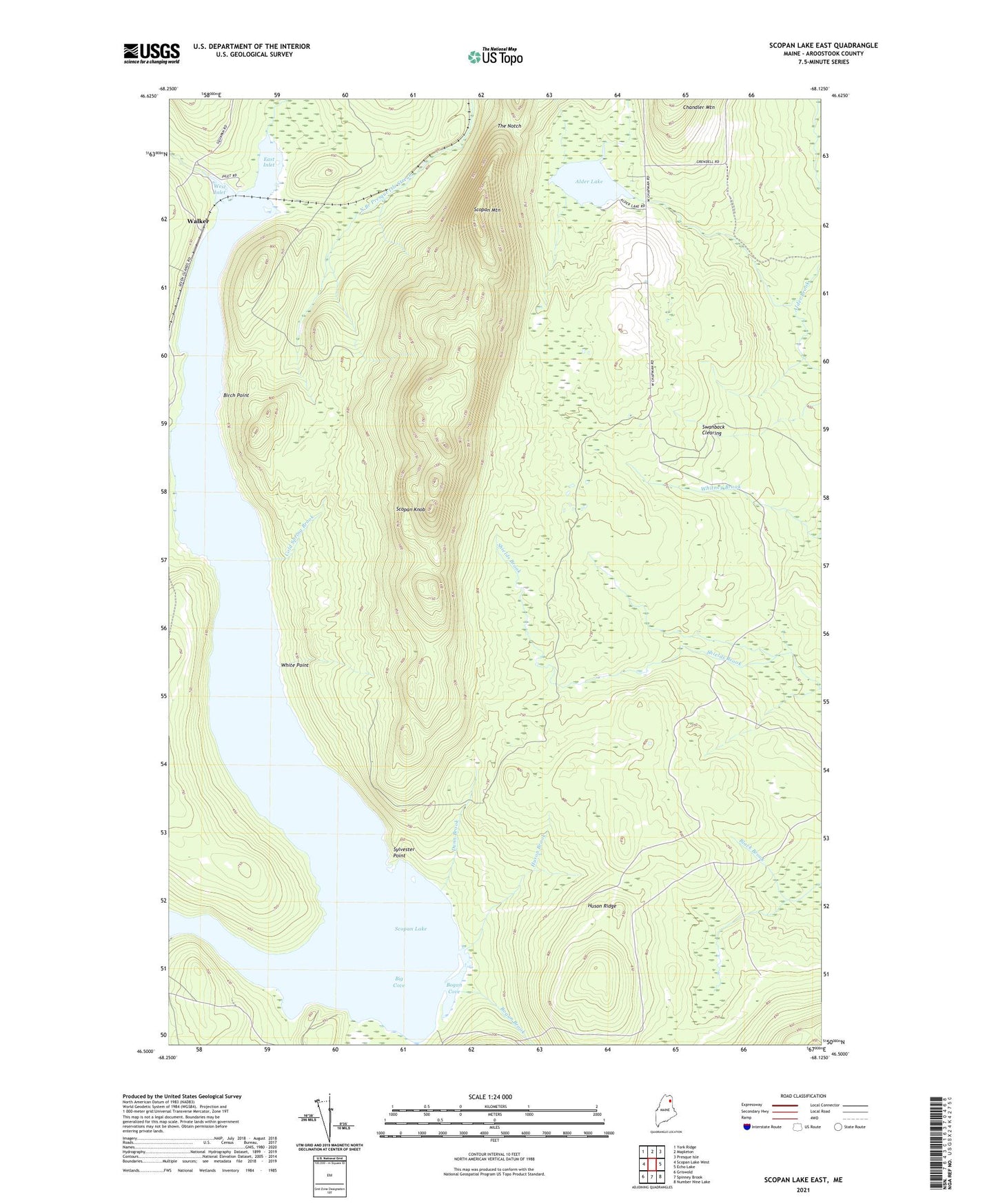
2024 topographic map quadrangle Scopan Lake East in the state of Maine. Scale: 1:24000. Based on the newly updated USGS 7.5' US Topo map series, this map is in the following counties: Aroostook. The map contains contour data, water features, and other items you are used to seeing on USGS maps, but also has updated roads and other features. This is the next generation of topographic maps. Printed on high-quality waterproof paper with UV fade-resistant inks.
Quads adjacent to this one:
West: Scopan Lake West
Northwest: York Ridge
North: Mapleton
Northeast: Presque Isle
East: Echo Lake
Southeast: Number Nine Lake
South: Spinney Brook
Southwest: Griswold
Contains the following named places: Alder Lake, Big Cove, Birch Point, Bogan Brook, Bogan Cove, Cold Spring Brook, Dunn Brook, East Inlet, Huson Brook, Huson Landing, Huson Ridge, Scopan Inlet, Scopan Knob, Scopan Lake, Scopan Mountain, Squapan Fire Tower, Swanback Clearing, Sylvester Point, T11 R4 WELS, The Notch, Township of Scopan, Walker, West Branch Scopan Inlet, West Inlet, White Point