MyTopo
Number Nine Lake Maine US Topo Map
Couldn't load pickup availability
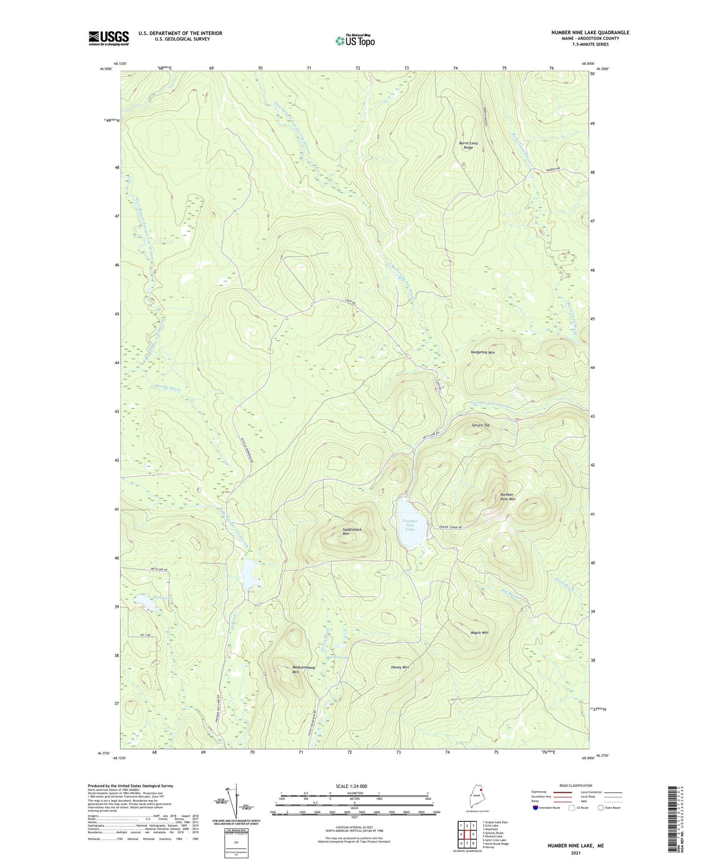
2024 topographic map quadrangle Number Nine Lake in the state of Maine. Scale: 1:24000. Based on the newly updated USGS 7.5' US Topo map series, this map is in the following counties: Aroostook. The map contains contour data, water features, and other items you are used to seeing on USGS maps, but also has updated roads and other features. This is the next generation of topographic maps. Printed on high-quality waterproof paper with UV fade-resistant inks.
Quads adjacent to this one:
West: Spinney Brook
Northwest: Scopan Lake East
North: Echo Lake
Northeast: Westfield
East: Packard Lake
Southeast: Harvey
South: North Brook Ridge
Southwest: Saint Croix Lake
This map covers the same area as the classic USGS quad with code o46068d1.
Contains the following named places: Brandy Brook, Burnt Land Ridge, Finnemore Camp, Hedgehog Mountain, Hovey Mountain, Hovey Swamp, Mahan Camp, Maple Mountain, Meduxnekeag Mountain, Number Nine Lake, Number Nine Mountain, Presque Isle Lake, Saddleback Mountain, Spruce Top, T9 R3 WELS, West Lake