MyTopo
North Brook Ridge Maine US Topo Map
Couldn't load pickup availability
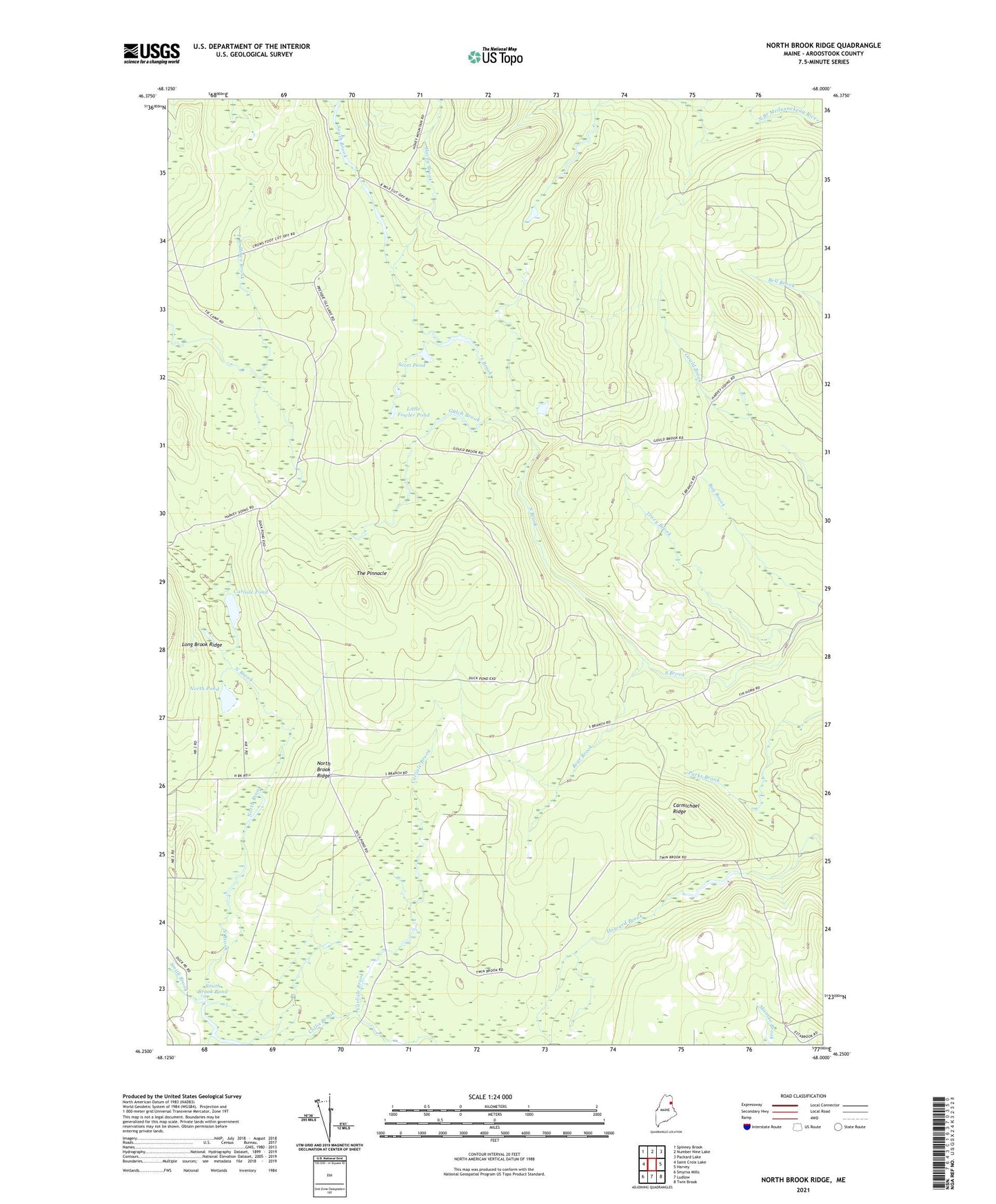
2024 topographic map quadrangle North Brook Ridge in the state of Maine. Scale: 1:24000. Based on the newly updated USGS 7.5' US Topo map series, this map is in the following counties: Aroostook. The map contains contour data, water features, and other items you are used to seeing on USGS maps, but also has updated roads and other features. This is the next generation of topographic maps. Printed on high-quality waterproof paper with UV fade-resistant inks.
Quads adjacent to this one:
West: Saint Croix Lake
Northwest: Spinney Brook
North: Number Nine Lake
Northeast: Packard Lake
East: Harvey
Southeast: Twin Brook
South: Ludlow
Southwest: Smyrna Mills
This map covers the same area as the classic USGS quad with code o46068c1.
Contains the following named places: Bear Brook, Carlisle Brook, Carlisle Pond, Carmichael Ridge, Dudley Township, Gulch Brook, Hovey Brook, Little Fowler Pond, Millers Camp, North Brook, North Brook Ridge, North Pond, Scott Pond, Smith Brook Pond, T8 R3 WELS, The Pinnacle, Tracy Brook