MyTopo
Mud Lake Maine US Topo Map
Couldn't load pickup availability
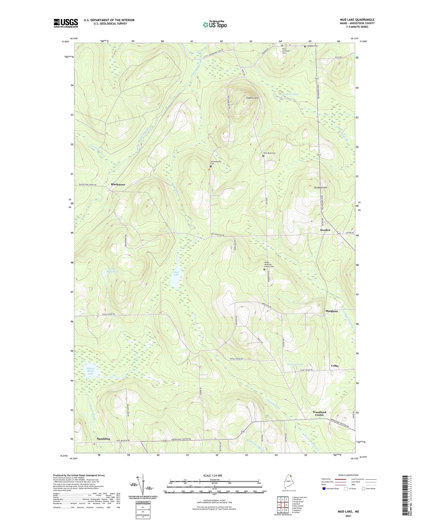
2024 topographic map quadrangle Mud Lake in the state of Maine. Scale: 1:24000. Based on the newly updated USGS 7.5' US Topo map series, this map is in the following counties: Aroostook. The map contains contour data, water features, and other items you are used to seeing on USGS maps, but also has updated roads and other features. This is the next generation of topographic maps. Printed on high-quality waterproof paper with UV fade-resistant inks.
Quads adjacent to this one:
West: Hanford
Northwest: Square Lake East
North: Stockholm
Northeast: Picard Brook
East: New Sweden
Southeast: Caribou
South: Washburn
Southwest: Bull Brook
This map covers the same area as the classic USGS quad with code o46068h2.
Contains the following named places: Alexander Brook, Blackstone, Carlson Pond, Colby, Factory Brook, First Baptist Church, Fogelin Hill, Fogelin Pond, Jacobson Hill, Jemtland Cemetery, Little Mud Pond, Margison, Mud Brook, Mud Lake, New Sweden Consolidated School, Nilsen Ackerson Family Cemetery, Salmon Brook Lake, South Branch Bearsley Brook, Spaulding, Sweden, Town of Perham, Town of Westmanland, West Jemtland Cemetery, West Road Cemetery, Westmanland Cemetery, Westmanland School, Woodland Center, Woodland Church, ZIP Code: 04766