MyTopo
Tumbledown Mountain Maine US Topo Map
Couldn't load pickup availability
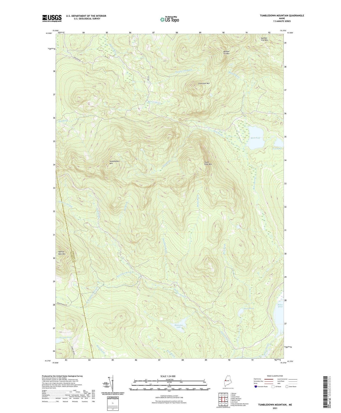
2021 topographic map quadrangle Tumbledown Mountain in the state of Maine. Scale: 1:24000. Based on the newly updated USGS 7.5' US Topo map series, this map is in the following counties: Somerset, Franklin. The map contains contour data, water features, and other items you are used to seeing on USGS maps, but also has updated roads and other features. This is the next generation of topographic maps. Printed on high-quality waterproof paper with UV fade-resistant inks.
Quads adjacent to this one:
West: Kibby Mountain
Northwest: Skinner
North: Holeb
Northeast: Attean Pond
East: Spencer Lake
Southeast: King And Bartlett Lake
South: King And Bartlett Mountain
Southwest: Jim Pond
Contains the following named places: Appleton Township, Baker Stream, Blakeslee Lake, Cold Brook, Davis Brook, Davis Pond, Douglas Pond, Dud Brook, Durgin Brook, Gold Brook, Greenlaw Mountain, Iron Pond, Number Six Brook, Number Six Mountain, Rock Pond, Spaulding Brook, Spencer Bale Mountain, Sweetster Brook, T5 R6 BKP WKR, Three Slide Mountain, Tumbledown Mountain, West Branch Spencer Stream