MyTopo
Vanceboro Maine US Topo Map
Couldn't load pickup availability
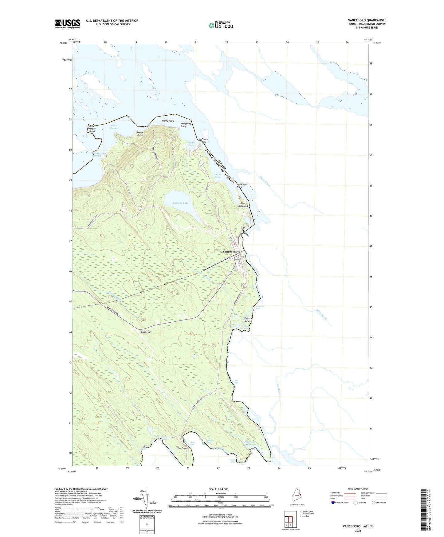
2024 topographic map quadrangle Vanceboro in the state of Maine. Scale: 1:24000. Based on the newly updated USGS 7.5' US Topo map series, this map is in the following counties: Washington. The map contains contour data, water features, and other items you are used to seeing on USGS maps, but also has updated roads and other features. This is the next generation of topographic maps. Printed on high-quality waterproof paper with UV fade-resistant inks.
Quads adjacent to this one:
West: Lambert Lake
South: Loon Bay
Southwest: Simsquish Lake
This map covers the same area as the classic USGS quad with code o45067e4.
Contains the following named places: American Cove, Billy Semple Island, Coldwater Tavern, Elbow Rips, Haley Point, Halls Rips, Hedgehog Point, Horse Cove, Ice House Point, Indian Channel, Joe Georges Rips, LaCoute Lake, LaCoute Point, Little Falls, Mile Rips, Mollie Cove, Nason Point, Pork Rips, Salmon Brook, Spednic Lake, Sussie Hill, The Cape, The Horseback, The Narrows Channel, Town of Vanceboro, Tunnel Rips, Vanceboro, Vanceboro Census Designated Place, Vanceboro Dam, Vanceboro Elementary School, Vanceboro Heliport, Vanceboro Post Office, Vanceboro Volunteer Fire Department, Wingdam Island, Wingdam Rips, ZIP Code: 04491