MyTopo
Lambert Lake Maine US Topo Map
Couldn't load pickup availability
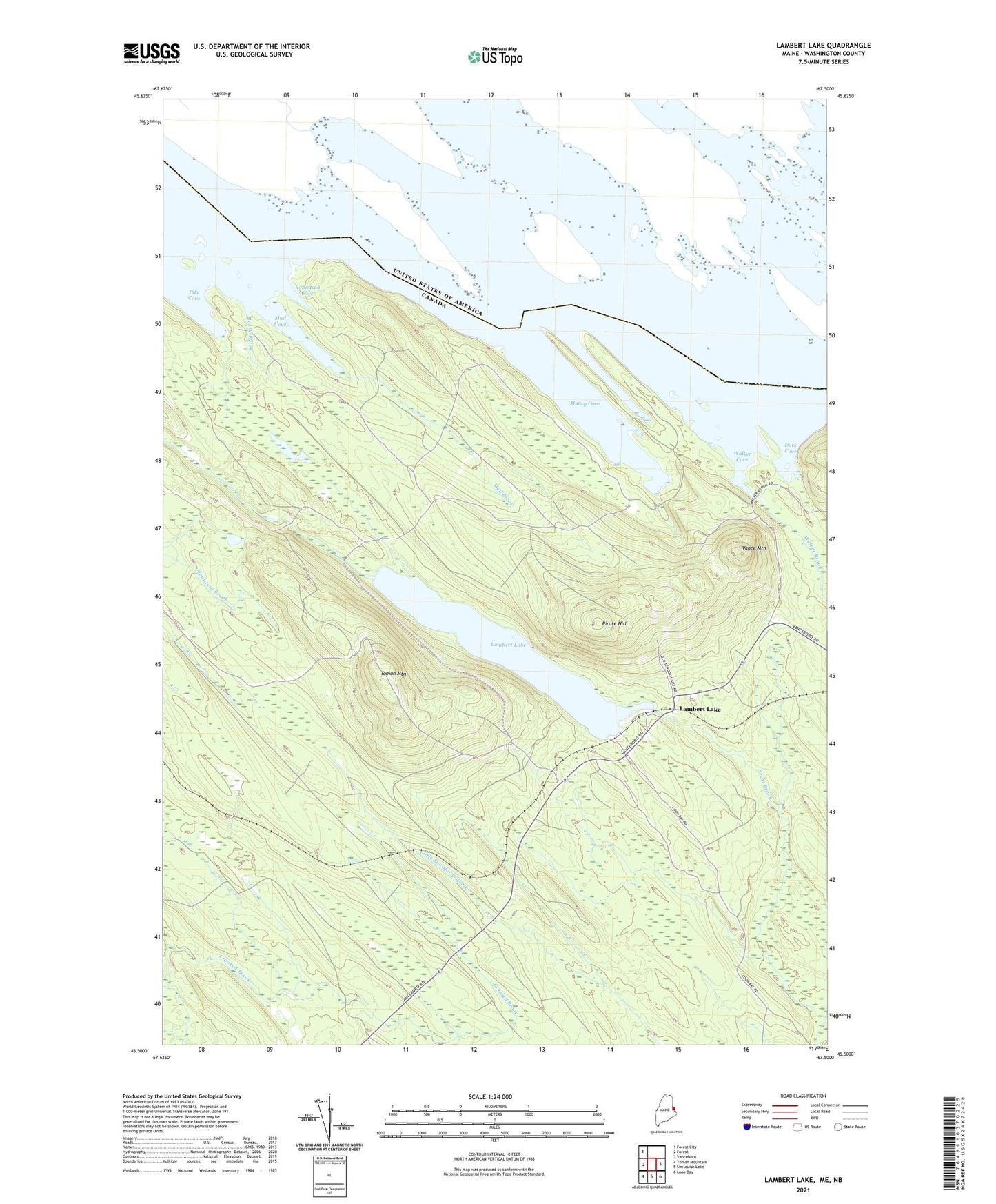
2024 topographic map quadrangle Lambert Lake in the state of Maine. Scale: 1:24000. Based on the newly updated USGS 7.5' US Topo map series, this map is in the following counties: Washington. The map contains contour data, water features, and other items you are used to seeing on USGS maps, but also has updated roads and other features. This is the next generation of topographic maps. Printed on high-quality waterproof paper with UV fade-resistant inks.
Quads adjacent to this one:
West: Forest
Northwest: Forest City
East: Vanceboro
Southeast: Loon Bay
South: Simsquish Lake
Southwest: Tomah Mountain
This map covers the same area as the classic USGS quad with code o45067e5.
Contains the following named places: Crooked Brook, Dark Cove, Lambert Lake, Lambert Lake Township, Mountain Pond, Mud Brook, Mud Cove, Muncy Cove, Pike Cove, Pirate Hill, Robertson Cove, Rocky Brook, T11 R3 NBPP, Todds Farm, Tomah Mountain, Vance Mountain, Walker Brook, Walker Cove, ZIP Code: 04454