MyTopo
Wayne Maine US Topo Map
Couldn't load pickup availability
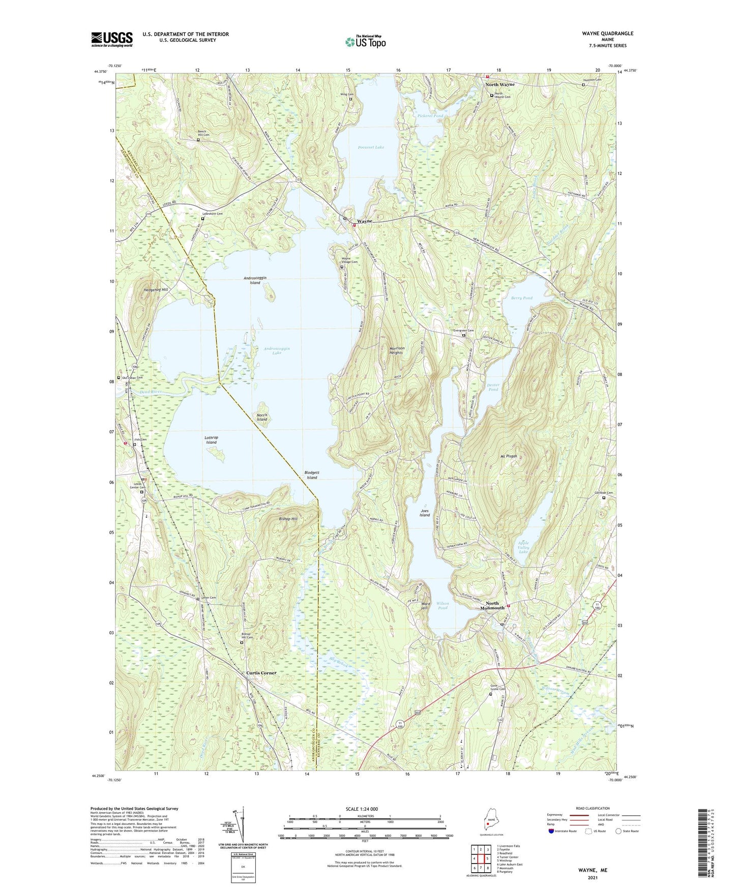
2021 topographic map quadrangle Wayne in the state of Maine. Scale: 1:24000. Based on the newly updated USGS 7.5' US Topo map series, this map is in the following counties: Kennebec, Androscoggin. The map contains contour data, water features, and other items you are used to seeing on USGS maps, but also has updated roads and other features. This is the next generation of topographic maps. Printed on high-quality waterproof paper with UV fade-resistant inks.
Quads adjacent to this one:
West: Turner Center
Northwest: Livermore Falls
North: Fayette
Northeast: Readfield
East: Winthrop
Southeast: Purgatory
South: Monmouth
Southwest: Lake Auburn East
Contains the following named places: Androscoggin Island, Androscoggin Lake, Apple Valley Lake, Apple Valley Lake Dam, Beech Hill Cemetery, Berry Pond, Bishop Hill, Bishop Hill Cemetery, Blodgett Island, Bog Brook, Cary Memorial Library, Curtis Corner, Dead River, Dexter Pond, Evergreen Cemetery, Fish Cemetery, Gardner Brook, Glenside Cemetery, Gove Grove Cemetery, Hales Brook, Hedgehog Hill, Henry L Cottrell School, Huntoon Cemetery, Joes Island, Jones Brook, Lakeshore Cemetery, Leeds, Leeds Center Cemetery, Leeds Central School, Leeds Fire Department, Leeds Post Office, Lothrop Island, Lovejoy Pond Dam, Lower Wilson Stream Dam, Monmouth Academy, Monmouth Middle School, Monmouth Volunteer Fire Department North Station, Morrison Heights, Mount Pisgah, Mud Mills Stream, Norris Island, North Monmouth, North Monmouth Post Office, North Wayne, North Wayne Cemetery, Old Indian Cemetery, Pickerel Pond, Pocasset Lake, Riverbend Campground, Tannery Brook, Town of Wayne, Union Cemetery, Ward Hill, Wayne, Wayne Elementary School, Wayne Post Office, Wayne Village Cemetery, Wayne Village Dam, Wayne Volunteer Fire Department North Wayne Station, Wayne Volunteer Fire Department Village Station, Wilson Pond, Wilson Pond Dam, Wilson Stream Reservoir, Wing Cemetery, ZIP Codes: 04265, 04284