MyTopo
Brandy Pond Maine US Topo Map
Couldn't load pickup availability
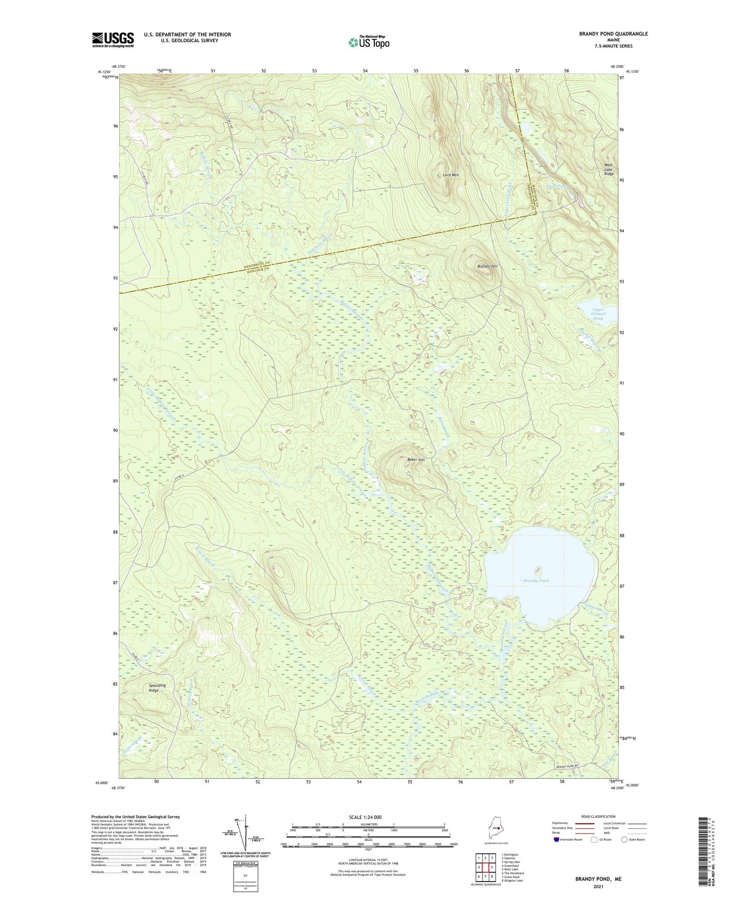
2024 topographic map quadrangle Brandy Pond in the state of Maine. Scale: 1:24000. Based on the newly updated USGS 7.5' US Topo map series, this map is in the following counties: Hancock, Penobscot. The map contains contour data, water features, and other items you are used to seeing on USGS maps, but also has updated roads and other features. This is the next generation of topographic maps. Printed on high-quality waterproof paper with UV fade-resistant inks.
Quads adjacent to this one:
West: Greenfield
Northwest: Burlington
North: Saponac
Northeast: Spring Lake
East: West Lake
Southeast: Alligator Lake
South: Great Pond
Southwest: The Horseback
This map covers the same area as the classic USGS quad with code o45068a3.
Contains the following named places: Baker Hill, Brandy Pond, Brandy Stream, Buffalo Hill, Buffalo Stream, Elm Brook, Guagus Stream, Indian Brook, Little Buffalo Stream, Lord Mountain, Pug Hole Brook, Runt Brook, Scotch Brook, Snail Pond, Spaulding Ridge, T39 MD BPP, Thirty-Nine Tannery, Upper Oxhead Pond