MyTopo
Great Pond Maine US Topo Map
Couldn't load pickup availability
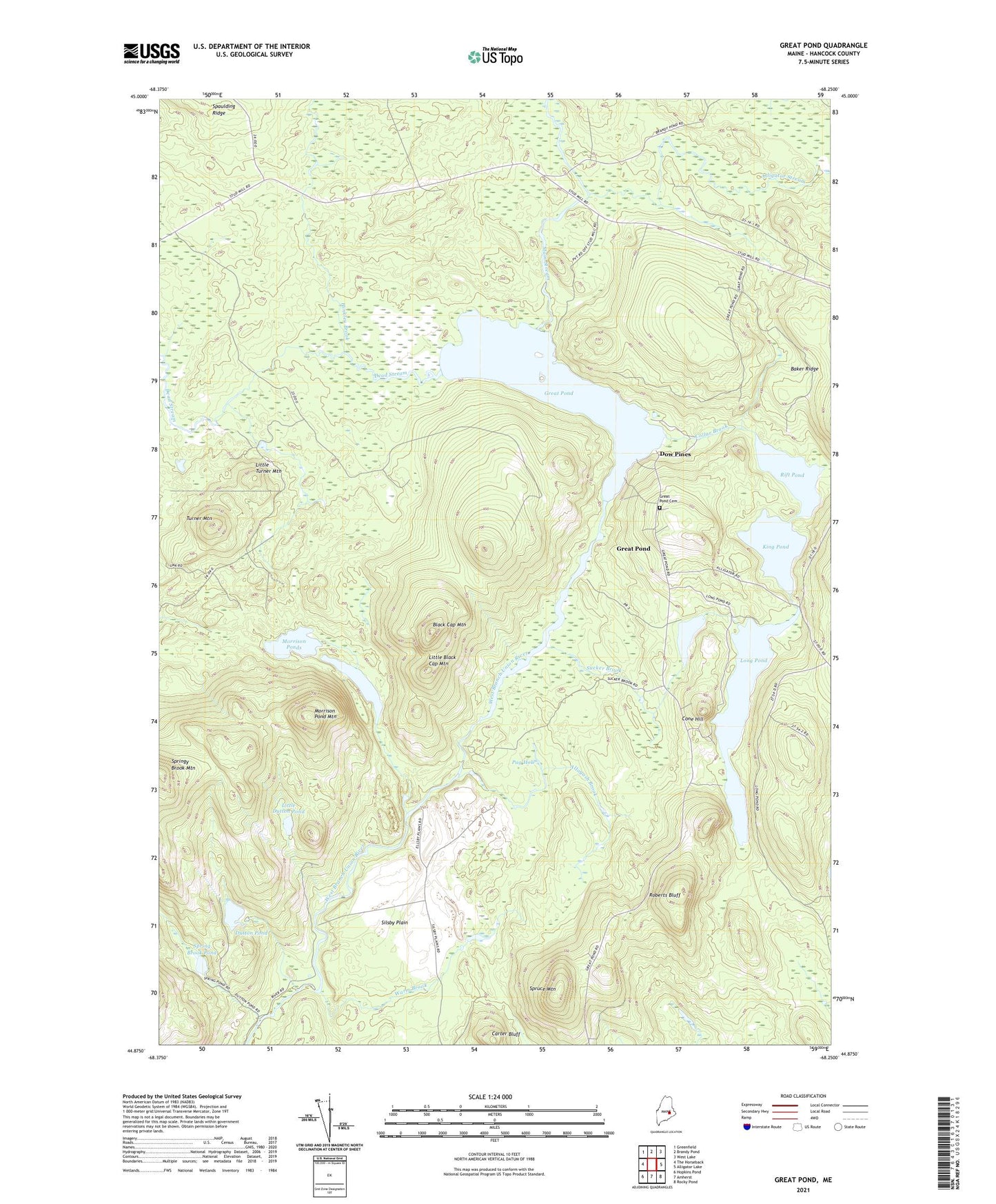
2024 topographic map quadrangle Great Pond in the state of Maine. Scale: 1:24000. Based on the newly updated USGS 7.5' US Topo map series, this map is in the following counties: Hancock, Penobscot. The map contains contour data, water features, and other items you are used to seeing on USGS maps, but also has updated roads and other features. This is the next generation of topographic maps. Printed on high-quality waterproof paper with UV fade-resistant inks.
Quads adjacent to this one:
West: The Horseback
Northwest: Greenfield
North: Brandy Pond
Northeast: West Lake
East: Alligator Lake
Southeast: Rocky Pond
South: Amherst
Southwest: Hopkins Pond
This map covers the same area as the classic USGS quad with code o44068h3.
Contains the following named places: Allagash Brook, Alligator Stream, Black Cap Mountain, Carter Bluff, Collar Brook, Cone Hill, Dead Stream, Dow Pines, Dow Pines Recreation Area, Dutton Pond, Great Pond, Great Pond Cemetery, Hinkley Brook, King Pond, Little Black Cap Mountain, Little Dutton Pond, Little Pond, Little Turner Mountain, Long Pond, Main Stream, Morrison Pond Mountain, Morrison Ponds, Pug Hole, Rift Pond, Roberts Bluff, Silsby Plain, Spring Brook Pond, Springy Brook Mountain, Spruce Mountain, Sucker Brook, The Birches, Town of Great Pond, Turner Mountain, Warm Brook, Washington School, ZIP Code: 04408