
MyTopo
Whitneyville Maine US Topo Map
Couldn't load pickup availability
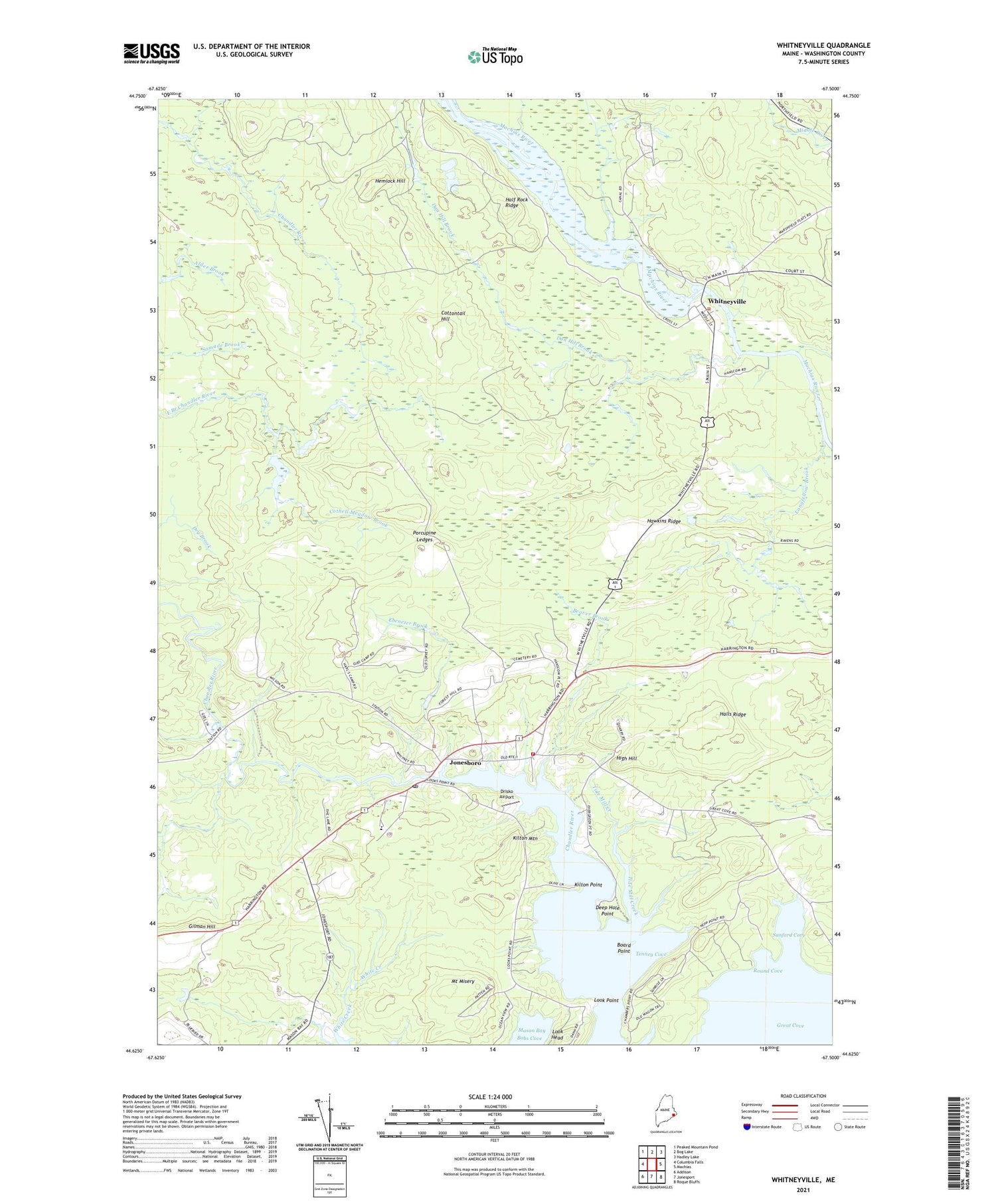
2021 topographic map quadrangle Whitneyville in the state of Maine. Scale: 1:24000. Based on the newly updated USGS 7.5' US Topo map series, this map is in the following counties: Washington. The map contains contour data, water features, and other items you are used to seeing on USGS maps, but also has updated roads and other features. This is the next generation of topographic maps. Printed on high-quality waterproof paper with UV fade-resistant inks.
Quads adjacent to this one:
West: Columbia Falls
Northwest: Peaked Mountain Pond
North: Bog Lake
Northeast: Hadley Lake
East: Machias
Southeast: Roque Bluffs
South: Jonesport
Southwest: Addison
Contains the following named places: Arna Meadow Brook, Beaver Brook, Board Point, Bobs Cove, Cothell Meadow Brook, Cottontail Hill, Dan Hill Brook, Deep Hole Point, Drisko Airport, Dry Brook, Ebenezer Brook, Gilman Hill, Great Cove, Half Rock Ridge, Halls Ridge, Hawkins Ridge, Hemlock Hill, High Hill, Jonesboro, Jonesboro Elementary School, Jonesboro Fire Department, Jonesboro Post Office, Kilton Mountain, Kilton Point, Longfellow Brook, Look Head, Look Point, Mount Misery, Porcupine Ledges, Round Cove, Sanford Cove, Sunkhaze Campground, Tenney Cove, Tide Mill Creek, Town of Jonesboro, Town of Whitneyville, WALZ-FM (Machias), White School, Whitneyville, Whitneyville Congregational Church, Whitneyville Public Library, ZIP Code: 04648


