MyTopo
Wilsons Mills Maine US Topo Map
Couldn't load pickup availability
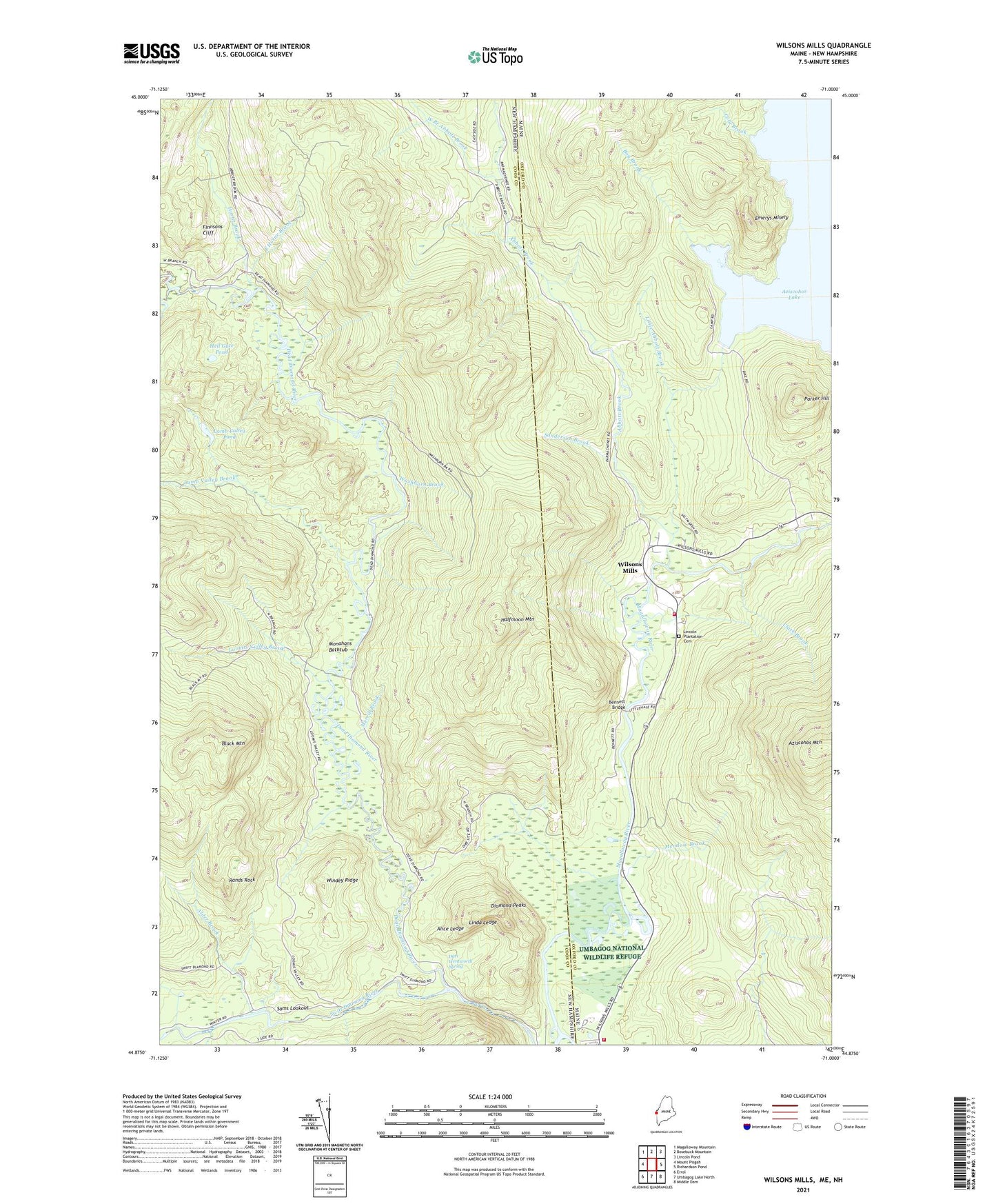
2024 topographic map quadrangle Wilsons Mills in the states of New Hampshire, Maine. Scale: 1:24000. Based on the newly updated USGS 7.5' US Topo map series, this map is in the following counties: Oxford, Coos. The map contains contour data, water features, and other items you are used to seeing on USGS maps, but also has updated roads and other features. This is the next generation of topographic maps. Printed on high-quality waterproof paper with UV fade-resistant inks.
Quads adjacent to this one:
West: Mount Pisgah
Northwest: Magalloway Mountain
North: Bosebuck Mountain
Northeast: Lincoln Pond
East: Richardson Pond
Southeast: Middle Dam
South: Umbagog Lake North
Southwest: Errol
Contains the following named places: Abbott Brook, Abbott Brook Dike, Alder Brook, Alice Ledge, Atkinson and Gilmanton Academy Grant, Aziscohos Lake, Aziscohos Mountain, Bennett Bridge, Bennett Brook, Black Mountain, Bog Brook, Clark Brook, Cold Brook, College Farm, Dart Wentworth Spring, Dead Diamond River, Diamond Peaks, East Horne Brook, Emerys Misery, Finnsons Cliff, Halfmoon Mountain, Hell Gate, Hell Gate Pond, Horne Brook, Lamb Valley Brook, Lamb Valley Pond, Lincoln Plantation Cemetery, Linda Ledge, Little Abbott Brook, Little Dead Diamond River, Loomis Valley Brook, Magalloway Fire Department, Meadow Brook, Merrill Brook, Miller-Quinn Landing Strip, Monahans Bathtub, Parker Hill, Rands Rock, Sams Lookout, Sanderson Brook, Second College Grant, Slewgundy, Stoddards Cabin, Swift Diamond River, The Hand, Washburn Brook, West Branch Abbott Brook, Wilsons Mills, Wilsons Mills Fire Department, Wilsons Mills Post Office, Windey Ridge, ZIP Code: 03579