MyTopo
Love Point Maryland US Topo Map
Couldn't load pickup availability
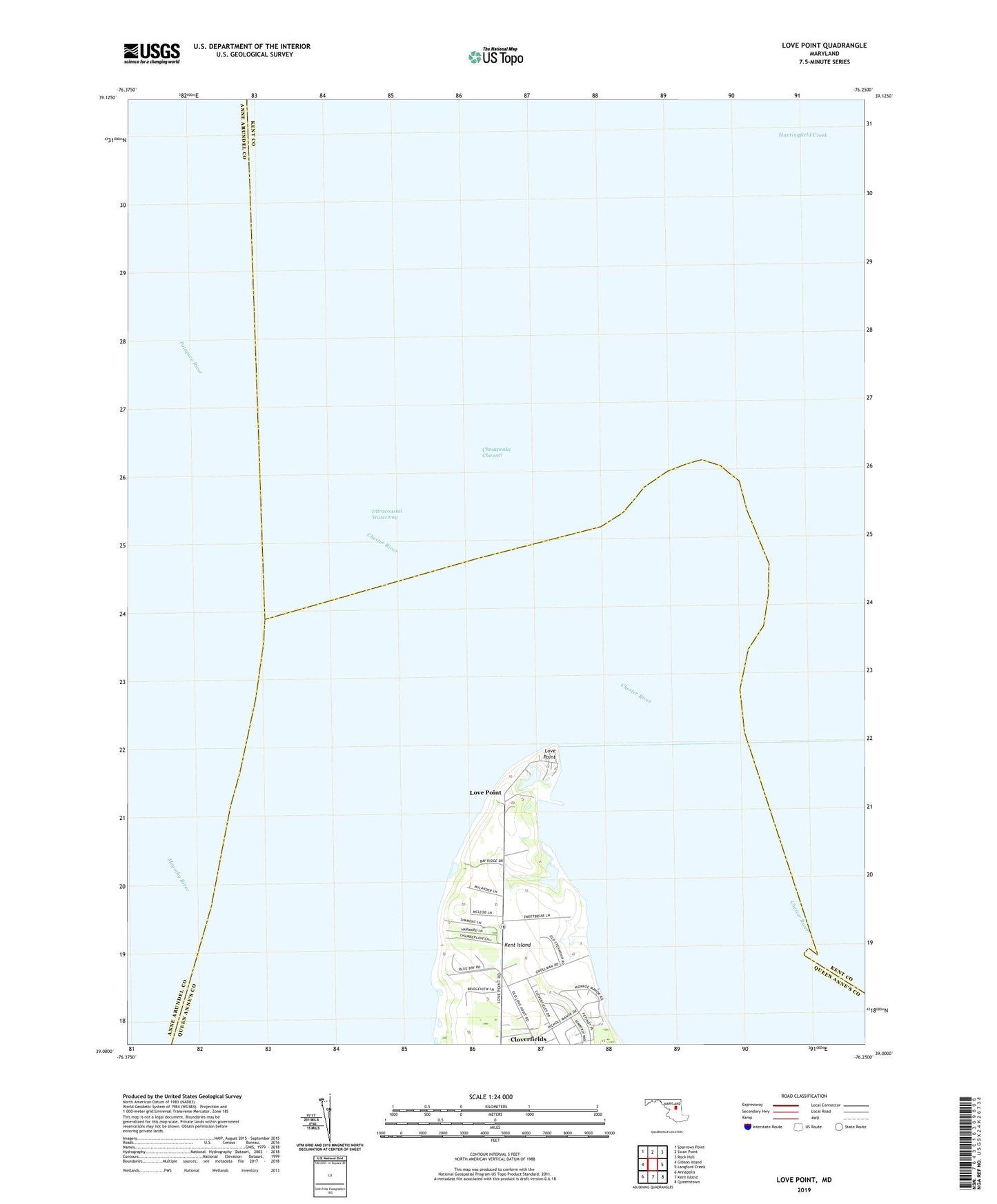
2023 topographic map quadrangle Love Point in the state of Maryland. Scale: 1:24000. Based on the newly updated USGS 7.5' US Topo map series, this map is in the following counties: Queen Anne's, Kent, Anne Arundel. The map contains contour data, water features, and other items you are used to seeing on USGS maps, but also has updated roads and other features. This is the next generation of topographic maps. Printed on high-quality waterproof paper with UV fade-resistant inks.
Quads adjacent to this one:
West: Gibson Island
Northwest: Sparrows Point
North: Swan Point
Northeast: Rock Hall
East: Langford Creek
Southeast: Queenstown
South: Kent Island
Southwest: Annapolis
This map covers the same area as the classic USGS quad with code o39076a3.
Contains the following named places: Bridge View, Camp Saint Martin, Chester River, Chester River Landing, District 5 Edesville, Love Point, Love Point Landing, Love Point Lighthouse, Lower Five Fathoms Buoy, Mylanders Airstrip, Sleamb Wharf