MyTopo
Rhodesdale Maryland US Topo Map
Couldn't load pickup availability
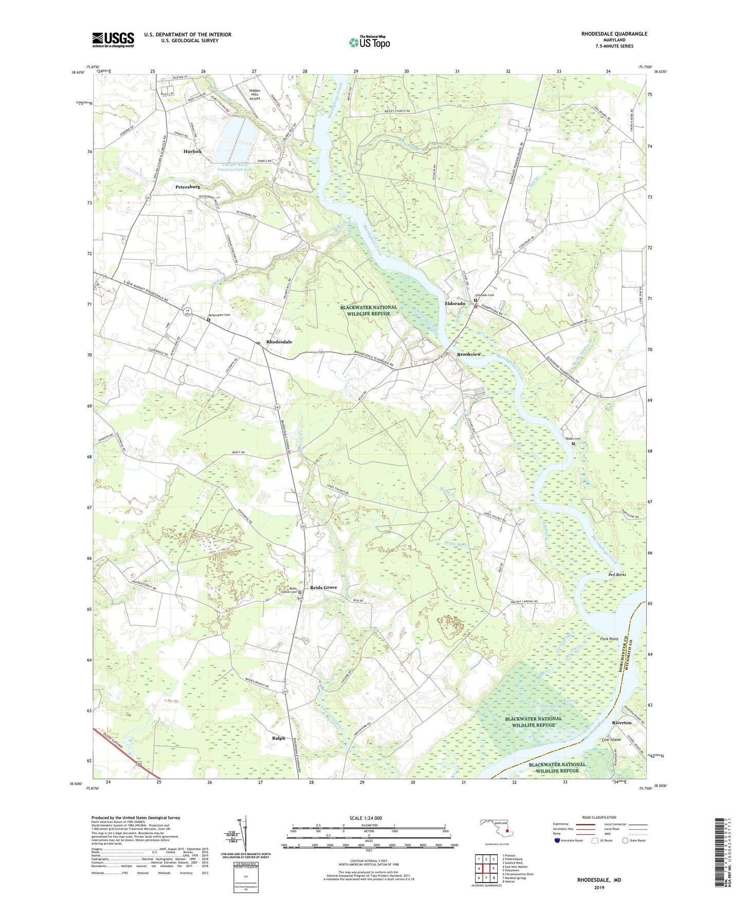
2023 topographic map quadrangle Rhodesdale in the state of Maryland. Scale: 1:24000. Based on the newly updated USGS 7.5' US Topo map series, this map is in the following counties: Dorchester, Wicomico. The map contains contour data, water features, and other items you are used to seeing on USGS maps, but also has updated roads and other features. This is the next generation of topographic maps. Printed on high-quality waterproof paper with UV fade-resistant inks.
Quads adjacent to this one:
West: East New Market
Northwest: Preston
North: Federalsburg
Northeast: Seaford West
East: Sharptown
Southeast: Hebron
South: Mardela Springs
Southwest: Chicamacomico River
This map covers the same area as the classic USGS quad with code o38075e7.
Contains the following named places: Bachelor Creek, Beach Creek, Becky Taylor Branch, Big Creek, Big Creek Marsh, Big Indian Creek, Brohorn Creek, Brookview, Brookview Methodist Church, Camp ESPA, Camp Nanticoke, Chester River Country Club Lake, Cow Island, District 1 Fork, District 3 Vienna, Dorchester County Emergency Medical Services 200, Dukes Cemetery, Eldorado, Eldorado - Brookview Volunteer Fire Company Station 26, Eldorado Cemetery, Eldorado United Methodist Church, Ennalls, Ennalls Wharf, Evangelical Church of God, Fork Landing, Fork Point, Grimes Creek, Hidden Hills Airport, Hollering Point, Hurlock, Hurlock Oxidation Ponds Dam, Krafts Creek, Laytons Ditch, Little Indian Creek, Lone Pine Creek, Marshyhope Creek, Marshyhope Village, McKendree Cemetery, Mill Branch, Mill Creek, Mission School, National Church of God, North Dorchester High School, Owens Creek, Panguash Creek, Petersburg, Puckum Branch, Ralph, Reconow Creek, Red Banks, Reids Grove, Reids Grove Cemetery, Reids Grove United Methodist Church, Rhodesdale, Rhodesdale Post Office, Riverton, Riverton United Methodist Church, Rose Ditch, Shiloh Church, Spears Creek, Stony Bar Creek, The Canal, Town of Brookview, Town of Eldorado, Walnut Landing, Websters Siding, Wesley Church, Wheatley Camp Ground, Wheatley School, Wrights Branch, Zoar United Methodist Church, Zorah Church, ZIP Code: 21659