MyTopo
Hebron Maryland US Topo Map
Couldn't load pickup availability
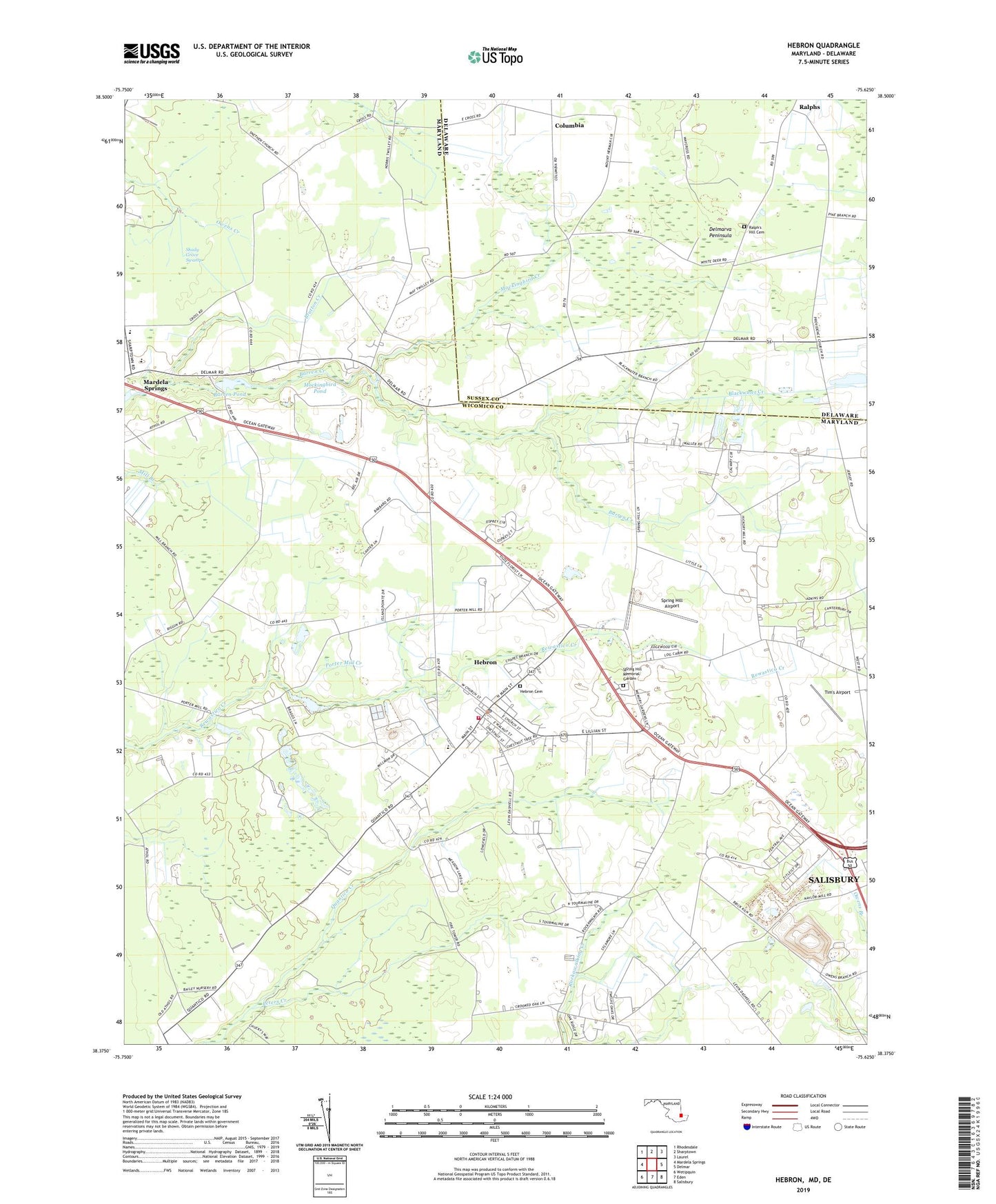
2023 topographic map quadrangle Hebron in the states of Maryland, Delaware. Scale: 1:24000. Based on the newly updated USGS 7.5' US Topo map series, this map is in the following counties: Wicomico, Sussex. The map contains contour data, water features, and other items you are used to seeing on USGS maps, but also has updated roads and other features. This is the next generation of topographic maps. Printed on high-quality waterproof paper with UV fade-resistant inks.
Quads adjacent to this one:
West: Mardela Springs
Northwest: Rhodesdale
North: Sharptown
Northeast: Laurel
East: Delmar
Southeast: Salisbury
South: Eden
Southwest: Wetipquin
This map covers the same area as the classic USGS quad with code o38075d6.
Contains the following named places: Baron Pond Dam, Barren Creek Mill, Barren Pond, Belle Haven, Bennett Farms Garden Center, Blackwater Creek, Bratton Creek, Canterbury, Cedar Acres, Cedar Hurst Village, Cedarhurst Acres, Cedarhurst Village Trailer Park, Chesapeake Fire Museum, Columbia, Crooked Oak, District 15 Hebron, District 9 Salisbury, Double Mill School, Edgewood Park, Elite Acres, Elliots Place, Farmhouse Acres, Gateway Church of Christ, Hebron, Hebron Cemetery, Hebron Lions Park, Hebron Post Office, Hebron Town Hall, Hebron Volunteer Fire Department Station 5, Hebron Woods, Hickory Acres, Horntown Pond, John Wesley United Methodist Church, Kingdom Hall of Jehovah Witness, Mardela Apostolic Church, Mardela Middle and High School, Mockingbird Creek, Mockingbird Pond, Mount Enoch Holy Church, Mount Hermon, Mount Hermon United Methodist Church, Mount Nebo Methodist Episcopal Church, Nelson Memorial Methodist Church, Newland Park, Norfolk Downs, Northwestern Elementary School, Packing House Corner, Parson Landing Strip, Peters Creek, Porter Mill Creek, Porter Mill Estates, Quantico Creek Sod Farms, Ralph's Hill Cemetery, Rewastico Pond, Rockawalkin Community Center, Rockawalking, Rockawalking Acres, Rockawalking Church, Rockawalking Community Hall, Rockawalking Post Office, Rockawalking Village, Saint Luke United Methodist Church, Saint Marks Episcopal Church, Saint Pauls Episcopal Church, Saint Pauls United Methodist Church, Shady Grove Swamp, Snethen United Methodist Church, Spring Hill Airport, Spring Hill Memorial Garden, Susan Beach Corner, Tim's Airport, Town of Hebron, Westside Intermediate School, Wicomico County Parks Police, Wicomico County Volunteer Fire Station Number 5, WJDY-AM (Salisbury), ZIP Codes: 21801, 21830