MyTopo
Ashfield Massachusetts US Topo Map
Couldn't load pickup availability
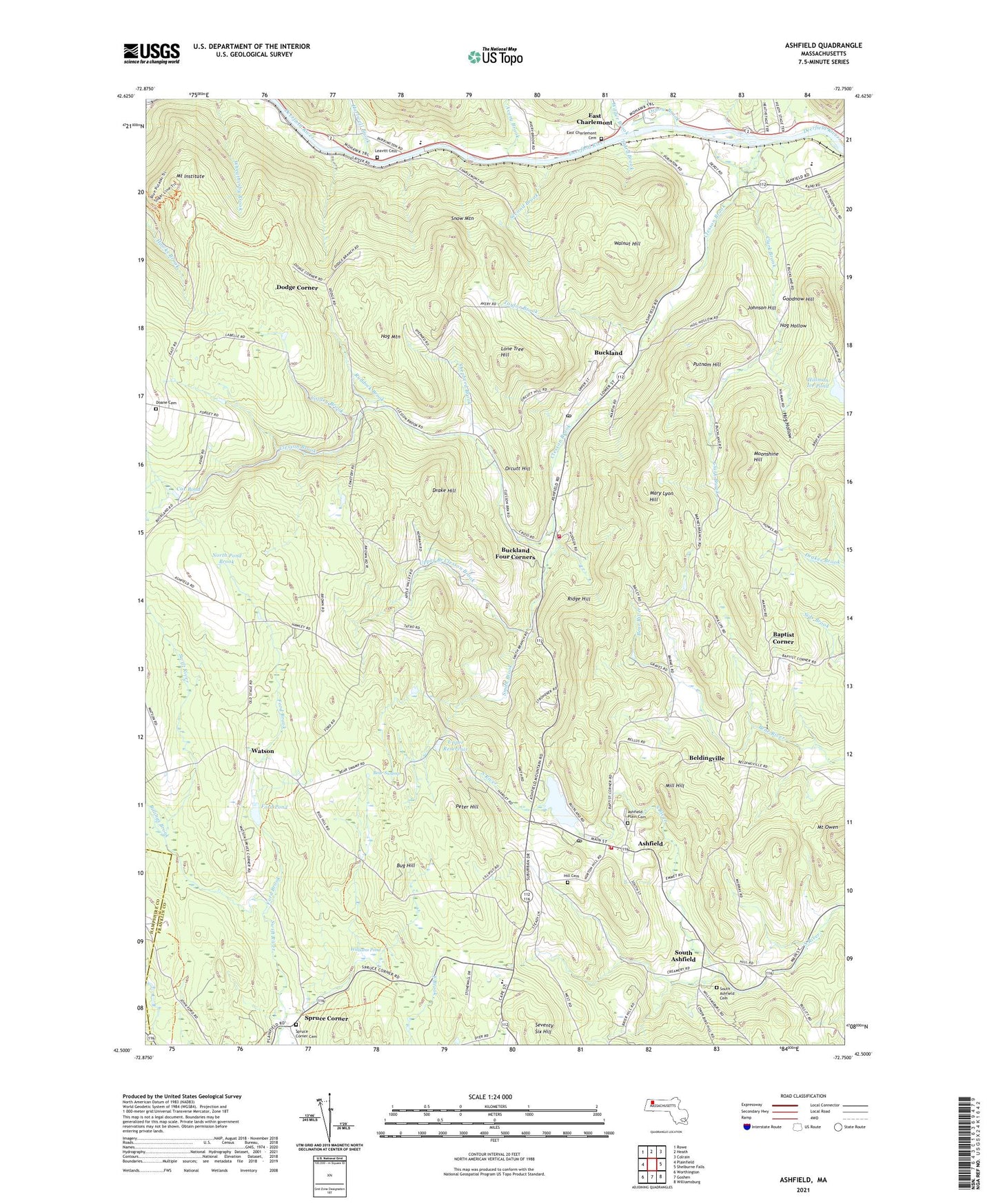
2024 topographic map quadrangle Ashfield in the state of Massachusetts. Scale: 1:24000. Based on the newly updated USGS 7.5' US Topo map series, this map is in the following counties: Franklin, Hampshire. The map contains contour data, water features, and other items you are used to seeing on USGS maps, but also has updated roads and other features. This is the next generation of topographic maps. Printed on high-quality waterproof paper with UV fade-resistant inks.
Quads adjacent to this one:
West: Plainfield
Northwest: Rowe
North: Heath
Northeast: Colrain
East: Shelburne Falls
Southeast: Williamsburg
South: Goshen
Southwest: Worthington
This map covers the same area as the classic USGS quad with code k42072e7.
Contains the following named places: Albee Brook, Ashfield, Ashfield Fire Department, Ashfield Plain Cemetery, Ashfield Police Department, Ashfield Pond, Ashfield Pond Dam, Ashfield Post Office, Avery Brook, Baptist Corner, Bear Swamp, Beldingville, Billings Brook, Buckland, Buckland Fire District, Buckland Four Corners, Buckland Post Office, Buckland Regional High School, Buckland State Forest, Bug Hill, Clark Brook, Clesson Brook, Cooley Brook, Cox Pond, Doane Cemetery, Dodge Corner, Drake Hill, East Charlemont, East Charlemont Cemetery, East Charlemont Church, East Oxbow Brook, First Brook, First Congregational Church, Ford Brook, Ford Pond, Ford Pond Dam, Forget Road Dam, Goodnow Hill, Hartwell Brook, Hawley State Forest, Hill Cemetery, Hillman Ice Pond, Hillman Ice Pond Dam, Hog Hollow, Hog Mountain, Howesville, Johnson Hill, Leavitt Cemetery, Lone Tree Hill, Lower Reservoir, Mary Lyon Church, Mary Lyon Hill, Mill Hill, Moonshine Hill, Mount Institute, Mount Owen, North Pond Brook, Orcutt Hill, Oxbow Brook, Peter Hill, Putnam Hill, Ridge Hill, Ruddock Brook, Saint Johns Episcopal Church, Second Brook, Seventy Six Hill, Shepherd Brook, Smith Brook, Snow Mountain, South Ashfield, Spruce Corner, Taylor Brook, The Academy at Charlemont, Third Brook, Town of Ashfield, Town of Buckland, Upper Branch Clesson Brook, Upper Reservoir, Uppper Reservoir Dam, Walnut Hill, Watson, Wauban Pond, Wilder Brook, Williams Pond, ZIP Codes: 01330, 01338