MyTopo
Goshen Massachusetts US Topo Map
Couldn't load pickup availability
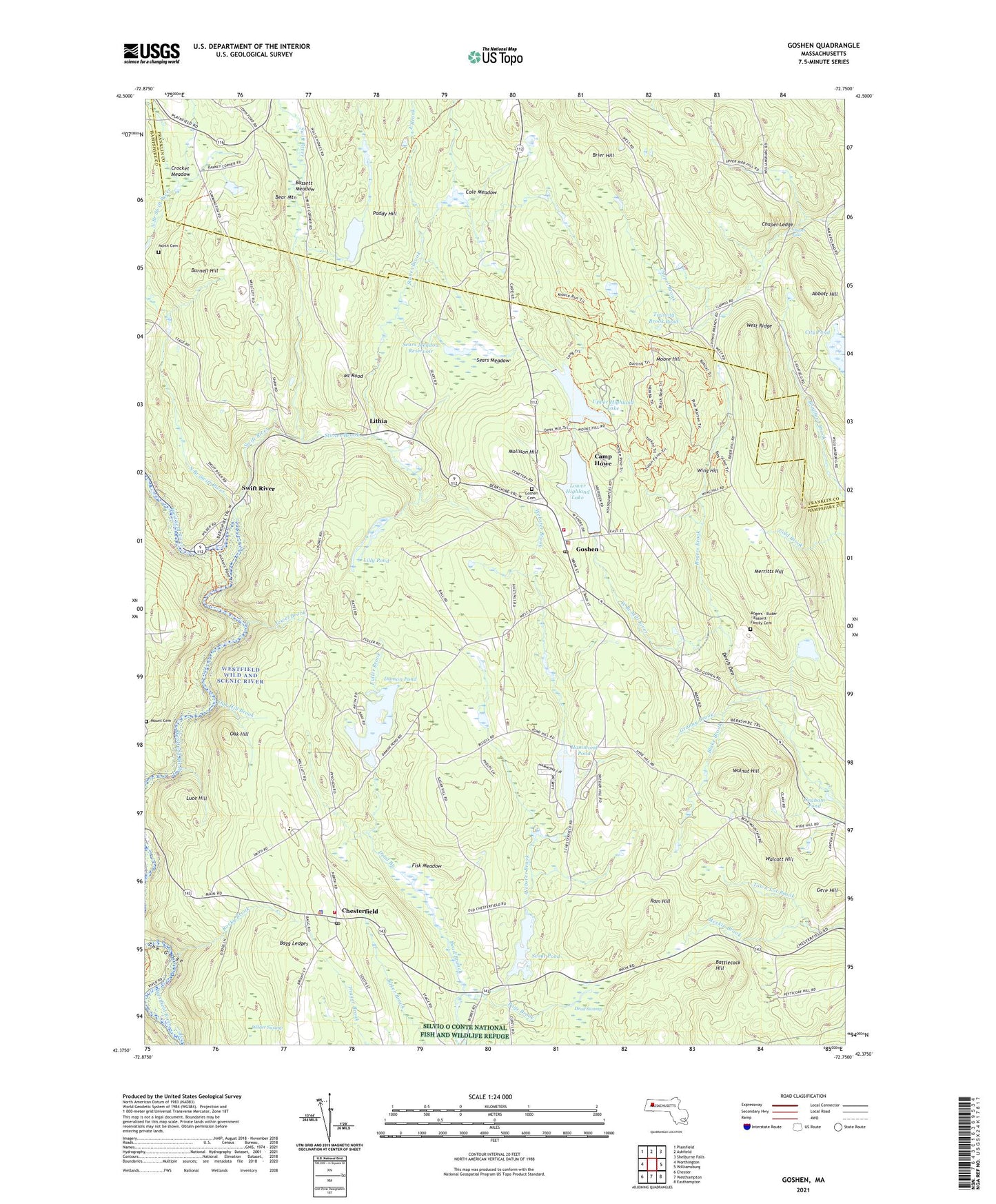
2024 topographic map quadrangle Goshen in the state of Massachusetts. Scale: 1:24000. Based on the newly updated USGS 7.5' US Topo map series, this map is in the following counties: Hampshire, Franklin. The map contains contour data, water features, and other items you are used to seeing on USGS maps, but also has updated roads and other features. This is the next generation of topographic maps. Printed on high-quality waterproof paper with UV fade-resistant inks.
Quads adjacent to this one:
West: Worthington
Northwest: Plainfield
North: Ashfield
Northeast: Shelburne Falls
East: Williamsburg
Southeast: Easthampton
South: Westhampton
Southwest: Chester
This map covers the same area as the classic USGS quad with code k42072d7.
Contains the following named places: Abbott Hill, Bagg Ledges, Bassett Meadow, Battlecock Hill, Bear Mountain, Blake Brook, Brier Hill, Burnell Hill, Camp Holy Cross, Camp Howe, Chapel Brook, Chapel Falls, Chapel Ledge, Chesterfield, Chesterfield Fire Department Station 1, Chesterfield Police Department, Chesterfield Post Office, Chesterfield Town Hall, City Pond, Cole Meadow, Crocket Meadow, Damon Pond, Daughters of the American Revolution State Forest, Davenport School, Dead Swamp, Devils Den, Dresser Brook, East Brook, Fisk Meadow, Fisk Meadow State Wildlife Management Area, Fuller Brook, Gere Hill, Ghoshen Center School, Goshen, Goshen Cemetery, Goshen Fire Department, Goshen Post Office, Goshen Town Police Department, Graham Pond, Granny Brook, Hammond Pond, Highland Ambulance EMS, Highland Lakes, Highland Lakes Lower Lake Dam, Highland Lakes Upper Dam, Highland Lakes Upper Dike, Jewel Brook, Keyes Swamp, Lilly Pond, Lithia, Lower Highland Lake, Luce Hill, Merritts Hill, Mollison Hill, Moore Hill, Mount Cemetery, Mount Rood, Nichols Brook, North Branch Swift River, North Cemetery, Oak Hill, Oak Hill Brook, Paddy Hill, Page Brook, Ram Hill, Rocky Brook, Rogers Brook, Scout Pond, Sears Meadow, Sears Meadow Dam, Sears Meadow Reservoir, Stones Brook, Swift River, Taylor Brook, The Gorge, Town Lot Brook, Town of Chesterfield, Town of Goshen, Twining Brook Pond, Upper Highland Lake, Walcott Hill, Walnut Hill, Webster Brook, West Branch, West Ridge, Wilder Swamp, Wing Hill, ZIP Codes: 01012, 01032, 01096