MyTopo
Cheshire Massachusetts US Topo Map
Couldn't load pickup availability
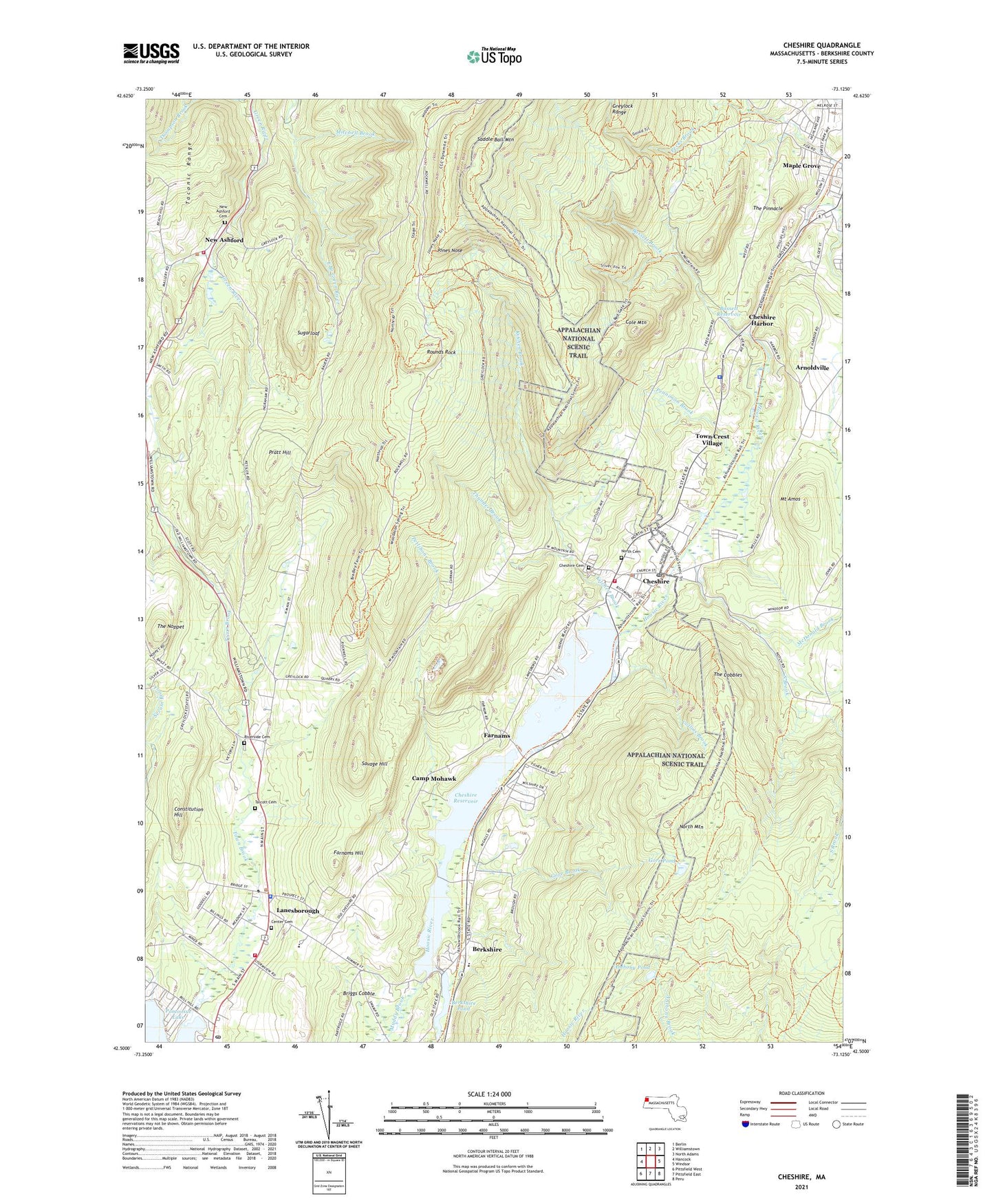
2021 topographic map quadrangle Cheshire in the state of Massachusetts. Scale: 1:24000. Based on the newly updated USGS 7.5' US Topo map series, this map is in the following counties: Berkshire. The map contains contour data, water features, and other items you are used to seeing on USGS maps, but also has updated roads and other features. This is the next generation of topographic maps. Printed on high-quality waterproof paper with UV fade-resistant inks.
Quads adjacent to this one:
West: Hancock
Northwest: Berlin
North: Williamstown
Northeast: North Adams
East: Windsor
Southeast: Peru
South: Pittsfield East
Southwest: Pittsfield West
Contains the following named places: Anthony Pond, Arnoldville, Bassett Brook, Bassett Reservoir, Bassett Reservoir Dam, Berkshire, Berkshire Pond, Berkshire Post Office, Briggs Cobble, Camp Mohawk, Center Cemetery, Cheshire, Cheshire Cemetery, Cheshire Census Designated Place, Cheshire Elementary School, Cheshire Harbor, Cheshire Harbor Hill, Cheshire Harbor Trail, Cheshire Police Department, Cheshire Post Office, Cheshire Public Library, Cheshire Reservoir, Cheshire Reservoir Dam, Cheshire Town Hall, Cheshire Volunteer Fire Department, Cole Mountain, Collins Brook, Constitution Hill, Dean Pond, Dry Brook, Farnams, Farnams Hill, First Baptist Church of Cheshire, Forest Park Country Club, Gore Brook, Gore Pond, Greylock Estates, Halls Tavern, Jones Nose, Kitchen Brook, Lakeview Orchard, Lanesborough, Lanesborough Center Cemetery, Lanesborough Elementary School, Lanesborough Fire Department, Lanesborough Police Department, Lanesborough Post Office, Lanesborough Public Library, Lanesborough Town Hall, Maple Grove, Massachusetts State Police Station B4 Cheshire Barracks, McDonald Brook, Mitchell Brook, Mount Amos, Mount Greylock State Reservation, Muddy Brook, New Ashford, New Ashford Cemetery, New Ashford Fire Department, New Ashford Town Hall, North Mountain, Penniman Brook, Pettibone Brook, Phillips Woolen Mill, Pine Valley Mobile Home Park, Pratt Hill, Riverside Cemetery, Rounds Rock, Saddle Ball Mountain, Saint Lukes Church, Saint Lukes Episcopal Church, Savage Hill, Skyline Country Club, South Brook, Stafford Hill Wildlife Management Area, Starrat Memorial School, Sugarloaf, Talcott Cemetery, The Cobbles, The Noppet, The Pinnacle, Thunder Brook, Town Brook, Town Crest Village, Town of Cheshire, Town of Lanesborough, Town of New Ashford, ZIP Codes: 01224, 01225