MyTopo
Hancock Massachusetts US Topo Map
Couldn't load pickup availability
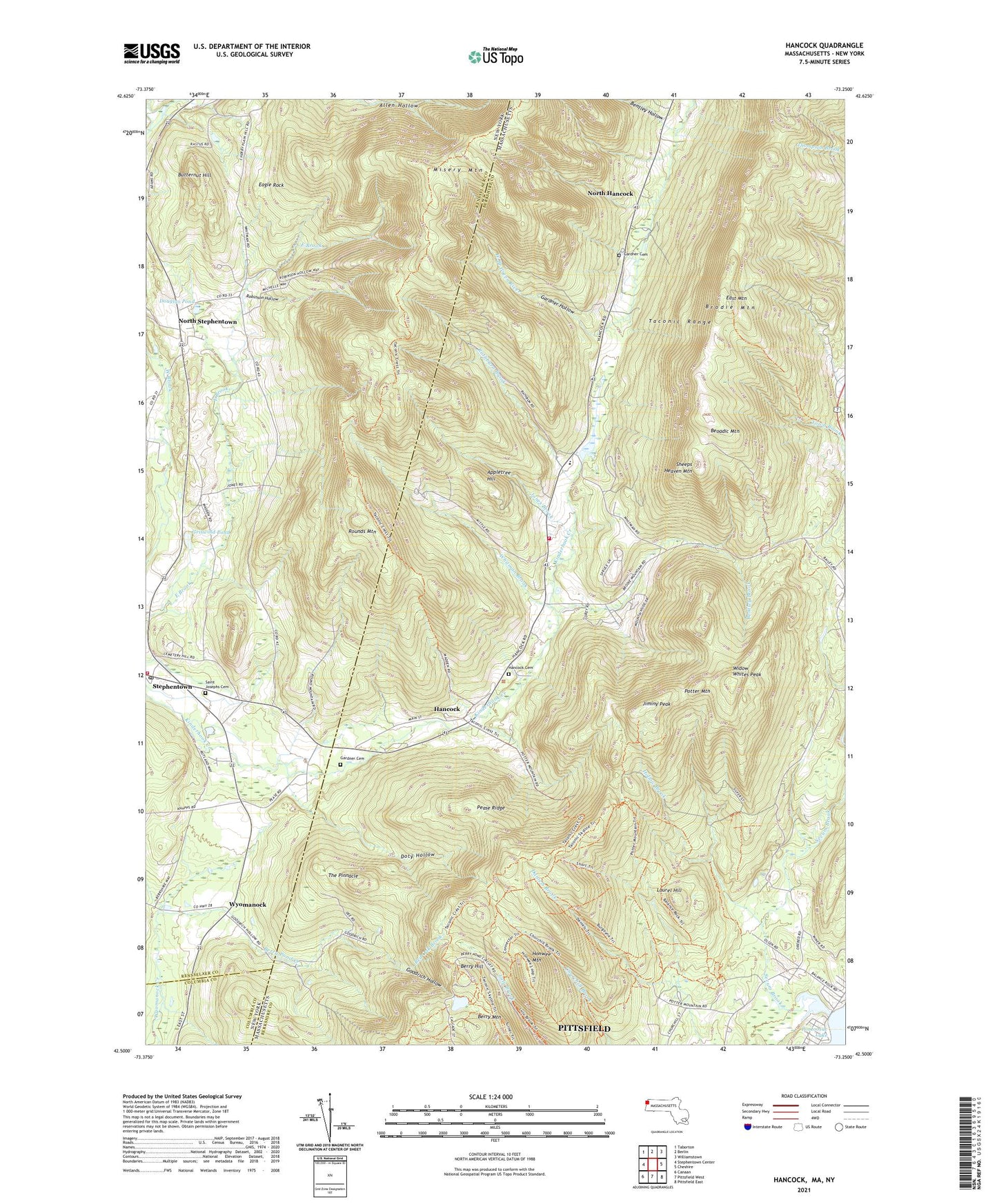
2024 topographic map quadrangle Hancock in the states of Massachusetts, New York. Scale: 1:24000. Based on the newly updated USGS 7.5' US Topo map series, this map is in the following counties: Berkshire, Rensselaer, Columbia. The map contains contour data, water features, and other items you are used to seeing on USGS maps, but also has updated roads and other features. This is the next generation of topographic maps. Printed on high-quality waterproof paper with UV fade-resistant inks.
Quads adjacent to this one:
West: Stephentown Center
Northwest: Taborton
North: Berlin
Northeast: Williamstown
East: Cheshire
Southeast: Pittsfield East
South: Pittsfield West
Southwest: Canaan
Contains the following named places: Appletree Hill, Balance Rock State Park, Bentley Brook, Bentley Hollow, Beoadic Mountain, Berry Hill, Berry Mountain, Berry Pond, Berry Pond Creek, Brodie Mountain, Brodie Mountain Ski Area, Butternut Hill, Chuckleberry Mobile Home Park, Doty Hollow, Douglas Pond, Eagle Rock, East Mountain, Evangelical Community Church, Forbush Wildlife Sanctuary, Gardner Cemetery, Gardner Hollow, Goodrich Hollow, Griswold Pond, Hancock, Hancock Cemetery, Hancock Central School, Hancock Fire Department Station 1 Headquarters, Hancock Police Department, Hancock Post Office, Hancock Town Hall, Hollow Brook, Honwee Mountain, Jiminy Peak, Jiminy Peak Ski Area, Jones Brook, Laurel Hill, North Hancock, North Stephentown, Pease Ridge, Potter Mountain, Rathburn Brook, Red Oak Brook, Robinson Hollow, Rounds Mountain, Saint Josephs Cemetery, Secum Brook, Sheeps Heaven Mountain, Stephentown, Stephentown Fire District 1, Stephentown Post Office, Stone Wall Hill Farm, Sugar Bush Farm, The Pinnacle, Town of Hancock, Whitman Brook, Widow Whites Peak, Wyomanock, ZIP Code: 01237