MyTopo
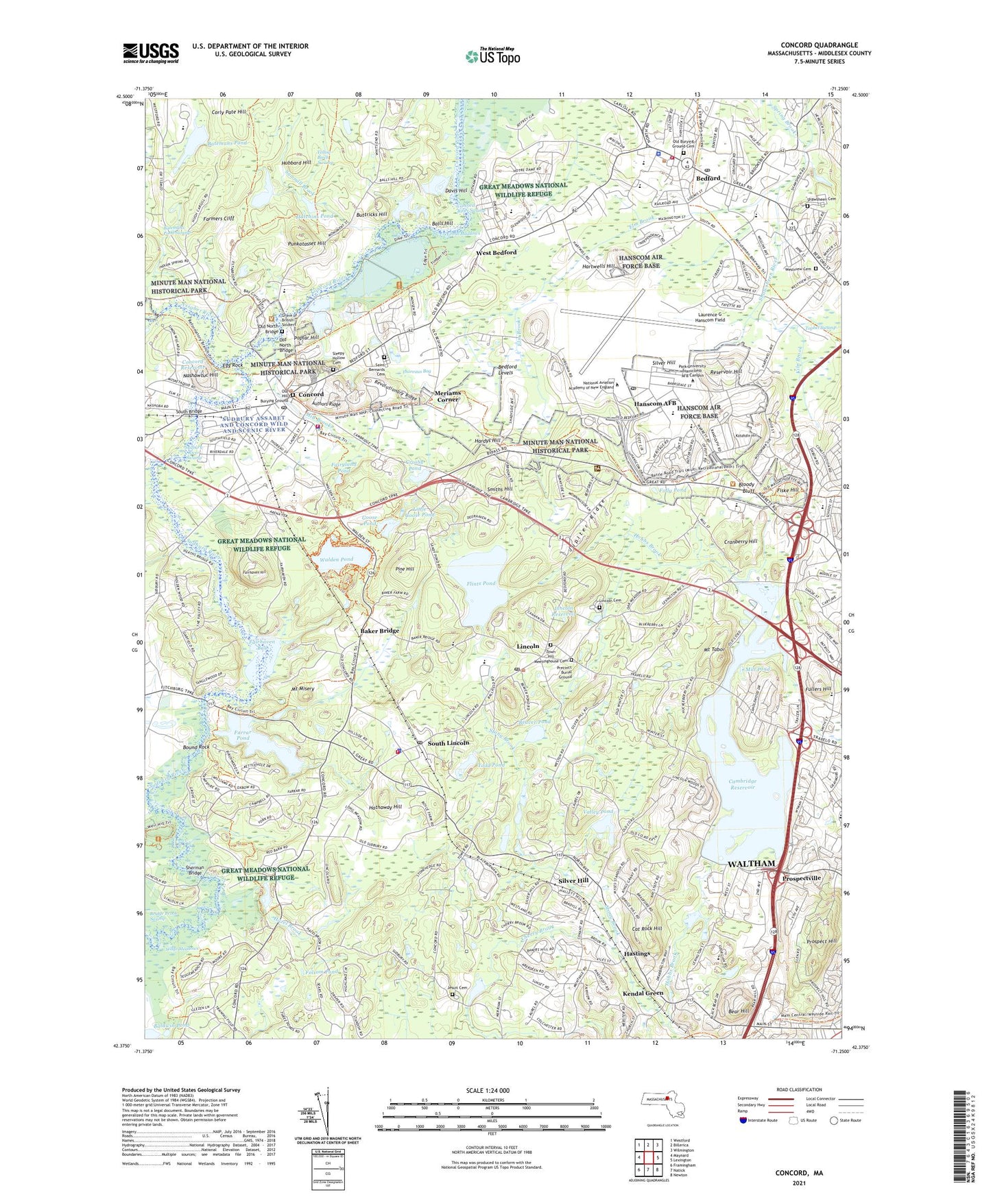
Concord Massachusetts US Topo Map
Couldn't load pickup availability
2024 topographic map quadrangle Concord in the state of Massachusetts. Scale: 1:24000. Based on the newly updated USGS 7.5' US Topo map series, this map is in the following counties: Middlesex. The map contains contour data, water features, and other items you are used to seeing on USGS maps, but also has updated roads and other features. This is the next generation of topographic maps. Printed on high-quality waterproof paper with UV fade-resistant inks.
Quads adjacent to this one:
West: Maynard
Northwest: Westford
North: Billerica
Northeast: Wilmington
East: Lexington
Southeast: Newton
South: Natick
Southwest: Framingham
Contains the following named places: Alcott Elementary School, Alcott House Museum, Antiquarian House, Assabet River, Authors Ridge, Baker Bridge, Baldwin Pond, Balls Hill, Banks School, Batemans Pond, Batemans Pond Dam, Batemans Pond Swamp, Battle Road Visitor Center, Battle Road Visitors Center, Bear Hill, Beaver Pond, Bedford, Bedford Army Air Field, Bedford Center Historic District, Bedford High School, Bedford Levels, Bedford Post Office, Bedford Shopping Center, Bellerica Mall, Bloody Angles, Bloody Bluff, Bound Rock, Buttricks Hill, Cambridge Reservoir, Campion Center, Carroll School, Cat Rock Hill, Cat Rock Park, Center Elementary School, Center School, Cherry Brook, Codman House, Codman House Museum, Community Therapeutic Day School, Concord, Concord Academy, Concord Antiquarian Society, Concord Battleground, Concord Depot, Concord Free Public Library, Concord Monument Square-Lexington Road Historic District, Concord Museum, Concord Museum Library, Concord Playground, Concord Post Office, Concord Reservoir, Concord River Swamp, Concord Shopping Center, Concord Visitor Center, Concord-Carlisle High School, Corly Pate Hill, Cranberry Hill, Crosby Pond, Dakins Brook, Davis Hill, DeCordova and Dana Museum, Decordova Museum and Sculpture Park, Decordova Museum and Sculpture Park Library, Douglas MacArthur School, Drumlin Farm Bird Sanctuary, Dugan Brook, Ebenezer Fiske House Site, Egg Rock, Elm Brook, Elm Brook Conservation Area, Emerson House, Emerson School, Fairhaven Bay, Fairhaven Hill, Fairyland Pond, Farmers Cliff, Farrar Pond, Farrington Memorial, Fenn School, Fiske Hill, Flints Pond, Folly Pond, Folsom Pond, Fullers Hill, Goose Pond, Grave of British Soldiers, Great Meadows, Great Meadows National Wildlife Refuge, Gropius House, Hanscom Air Force Base, Hanscom Air Force Base Census Designated Place, Hanscom Air Force Base Post Office, Hanscom Middle School, Hanscom Primary School, Hanscom School, Hardys Hill, Hartwell, Hartwell School, Hartwell Tavern, Hartwell Town Forest, Hartwells Hill, Hastings, Hathaway Hill, Hatheway Environmental Resource Library, Hawthorne School, Hazel Brook, Hobbs Brook, Horizon Hill Heliport, Hubbard Hill, Hutchins Pond, Idylwide, Iron Mine Brook, Jesuit Cemetery, John Buttrick House Post Office, John Glen Middle School, Josiah Nelson House Site, Jupiter Ridge, Katahdin Hill, Katahdin Woods, Kendal Green, Kendal Green Station, Kiln Brook, Laurence G Hanscom Field, Lexington Office Research Park, Lieutenant Elezer Davis School, Lincoln, Lincoln Cemetery, Lincoln Center Historic District, Lincoln Center Post Office, Lincoln Laboratory Library and Information Services, Lincoln Post Office, Lincoln Public Library, Lincoln Reservoir, Lincoln Station, Lincoln Town Hall, Little Goose Pond, Little Meadow Conservation Area, Lost Pond, Louisa May Alcott Memorial Association Library, Maria Hastings School, Marl and Clay Bed, Marvin Street Play Area, Massachusetts Center for Career and Technical Education Library, McCusker Pond, Meriams Corner, Mill Brook, Mill Pond, Millipore Heliport, Minute Man Monument, Minute Man National Historical Park, Minute Man Vocational Technical School, Minuteman Regional High School, Minuteman Research Park, Mount Misery, Mount Tabor, Nashawtuc Hill, North Bridge Visitor Center, Old Hill Burying Ground, Old Manse, Old North Bridge, Orchard House, Page School, Pantry Brook, Paul Revere Capture Site, Pierce Park, Pine Hill, Pine Meadows Country Club, Plain, Poplar Hill, Precinct Burial Ground, Prospect Hill, Prospect Hill Heliport, Prospect Hill Ski Area, Prospectville, Punkatasset Hill, Raytheon Heliport, Reservoir Hill, Revolutionary Ridge, Ripley School, Saint Bernards Cemetery, Samuel Hartwell Farm Site, Sandy Pond Dam, Sawmill Brook, Sedge Meadows, Sherman Bridge, Silver Hill, Silver Hill Station, Site of Thoreaus Cabin, Sleepy Hollow Cemetery, Smith School, Smiths Hill, South Bridge, South Lincoln, Spencer Brook, Spring Brook, Springs Brook Park, Sudbury Assabet and Concord Wild and Scenic River, Sudbury River, Sudbury River Swamp, Tabitha Nelson Farm Site, The Brooks School, The Great Road Shopping Center, The Wayside, Thoreau Lyceum, Thoreaus Bog, Todd Pond, Tophet Swamp, Town Hill Meetinghouse Cemetery, Town of Bedford, Town of Concord, Town of Lincoln, Valley Pond, Village Shopping Center, Walden Pond, Walden Pond State Reservation, Walden Street School for Girls, Waltham Industrial Center, Waltham Research and Development Park, Warner Pond, West Bedford, Weston College, Westview Cemetery, White Cedar Swamp Conservation Area, Willard Common, William Smith House, WIQH-FM (Concord), Wright Tavern, Xavier School, Yellow Birch Swamp, Yellow Orchard Bed, ZIP Codes: 01730, 01731, 01742, 01773, 02451


