MyTopo
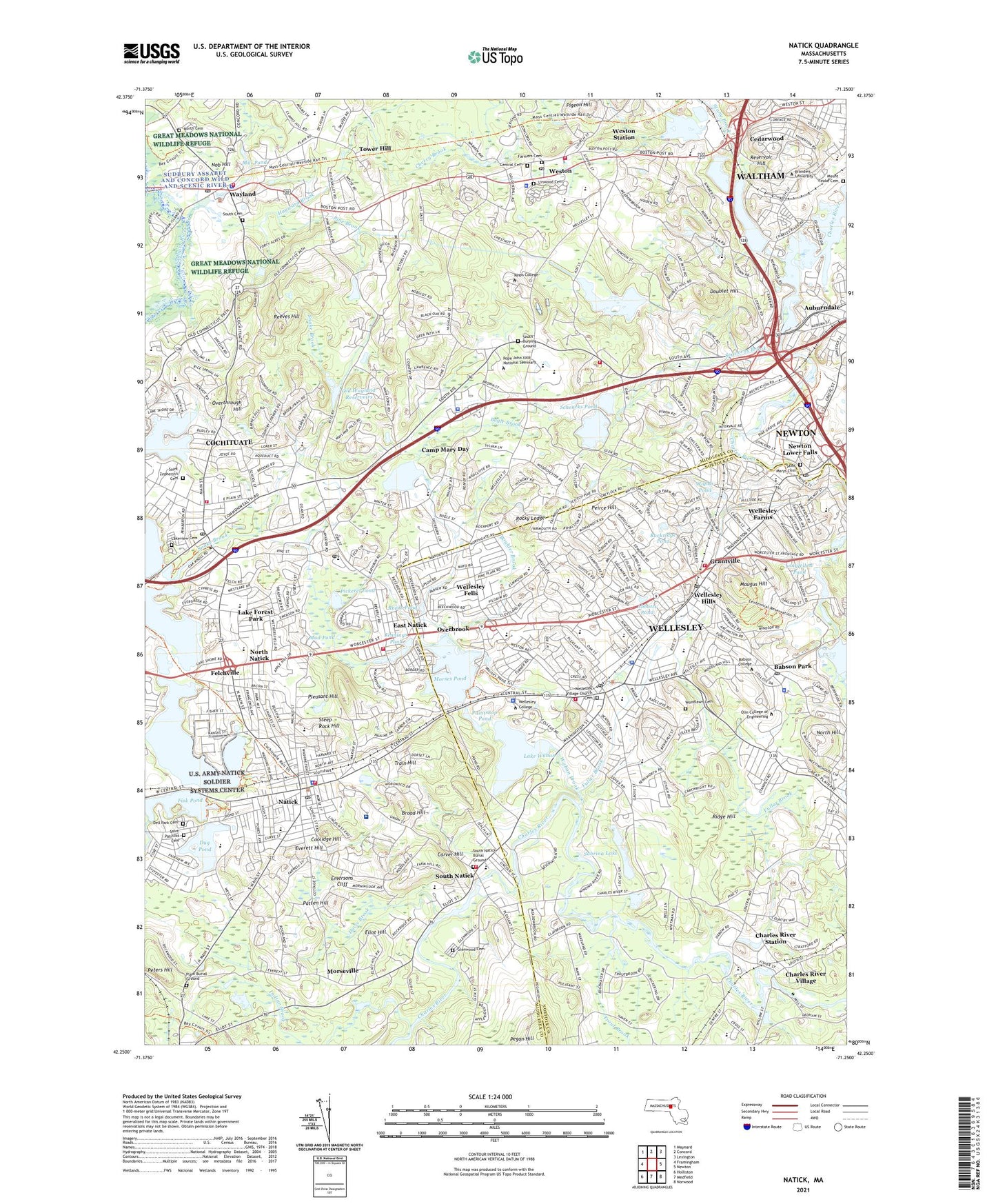
Natick Massachusetts US Topo Map
Couldn't load pickup availability
2024 topographic map quadrangle Natick in the state of Massachusetts. Scale: 1:24000. Based on the newly updated USGS 7.5' US Topo map series, this map is in the following counties: Middlesex, Norfolk. The map contains contour data, water features, and other items you are used to seeing on USGS maps, but also has updated roads and other features. This is the next generation of topographic maps. Printed on high-quality waterproof paper with UV fade-resistant inks.
Quads adjacent to this one:
West: Framingham
Northwest: Maynard
North: Concord
Northeast: Lexington
East: Newton
Southeast: Norwood
South: Medfield
Southwest: Holliston
Contains the following named places: Abbotts Pond, Academy of the Assumption, Anniversary Park East, Auburndale Park, Babson College, Babson Park, Bennett-Hemenway Elementary School, Bogle Brook, Boston Post Road Historic District, Boulder Brook, Braintree Hospital Rehabilitation Unit, Brandeis University, Brandeis-Roberts Station, Broad Hill, Broadmoore Audubon Reservation, Brook School, Brown School, Camp Mary Day, Carver Hill, Cedarwood, Central Cemetery, Charles River Dam at South Natick, Charles River Hospital East, Charles River Reservoir, Charles River Station, Charles River Village, Chickering School, Childrens Park, Chypit School, Claxton Field, Cochituate, Cochituate Census Designated Place, Cochituate Center Shopping Center, Cochituate State Park, Cochrane Dam, Commonwealth Shopper, Coolidge Hill, Coolidge Junior High School, Cordingly Dam, County School, Dana Hall School, Davis Brook, Dell Park Cemetery, Doublet Hill, Dowse Orchards, Dudley Pond, Dudley Pond Dam, Dug Pond, Dwight School, East Natick, East Natick Industrial Park, Edwards Plain-Dowses Corner Historic District, Eliot Hill, Emersons Cliff, Ernest F Upham School, Everett Hill, Farmers Cemetery, Felchville, Fisk Pond, Fisk Pond Dam, Fuller Brook, Glenwood Cemetery, Grantville, Hamilton School, Happy Hollow School, Hayward Brook, Hummewell Estates Historic District, Hundreds Woods, Hunnewell Playground, Hunnewell School, Jennings Pond, John D Hardy School, Johnson Elementary School, Katherine Lee Bates School, Kelly Memorial Field, Kingsbury School, Lake Forest Park, Lake Waban, Lake Waban Dam, Lakeview Cemetery, Lanson Park, Leonard Morse Hospital, Lilja Elementary School, Lincoln School, Linden Shopping Center, Linwood Cemetery, Loker School, Longfellow Pond, Lower Falls Park, Marino Lookout Farm, Martin Golf Course, Maugus Hill, McIntosh Corner Historic District, Meadow Brook School, Memorial Field, Metropolitan Park, MetroWest Medical Center, Mill Brook, Mill Pond, Morses Pond, Morses Pond Dam, Morseville, Mount Feake Cemetery, Mud Pond, Murphy School, Natick, Natick 9 and 27 Shopping Center, Natick Center Historic District, Natick High School, Natick Laboratories, Natick Reservoir, Natick Station, Needham Disposal Area, Newman Elementary School, Newton Lower Falls, Newton Lower Falls Dam, Newton Lower Falls Historic District, Noanet Brook, Nob Hill, Nonesuch Pond, North Cemetery, North Hill, North Natick, Norumbega Reservoir, Norumbega Reservoir Dam and East Dike, Norumbega Reservoir Dikes Number 2, Norumbega Reservoir Dikes Number 3, Noruumberga Reservoir Dike Number 4, Oak Grove School, Oblate College, Old Wayland Reservoirs, Overbrook, Overthrough Hill, Paintshop Pond, Patten Hill, Pegan Hill, Peirce Hill, Pelham Island, Perrin School, Peters Hill, Phillip School, Pickerel Pond, Pigeon Hill, Pine Brook, Pine Brook Country Club, Plain Burial Ground, Pleasant Hill, Reeds Pond, Reeves Hill, Regis College, Reservoir Hill, Ridge Hill, River School, Rockridge Pond, Rocky Ledge, Sabrina Lake, Saint Johns School, Saint Marys Cemetery, Saint Patricks Cemetery, Saint Patricks School, Saint Zepherin's Cemetery, Sandy Burr Country Club, Schencks Pond, Schencks Pond Dam, Schofield School, Seaverns Brook, Sherwood Plaza, Snake Brook, Snake Brook Dam, Soldier Systems Center Natick, Somerville Psychiatric Hospital, South Burying Ground, South Cemetery, South Natick, South Natick Burial Ground, South Natick High School, Sprague School, Steep Rock Hill, Stony Brook, Tower Hill, Town of Natick, Town of Wayland, Town of Wellesley, Town of Weston, Trade High School, Train Hill, Trout Brook, United States Property and Fiscal Office Heliport, Waban Brook, Walnut Hill School, Warren School, Wash Brook, Wayland, Wayland Center Historic District, Wayland High School, Wayland Junior High School, Wayland Shopping Center, WBRS-FM (Waltham), Wellesley, Wellesley Census Designated Place, Wellesley College Simpson Health Services Medical Center, Wellesley Country Club, Wellesley Disposal Area, Wellesley Farms, Wellesley Farms Station, Wellesley Fells, Wellesley High School, Wellesley Hills, Wellesley Hills Station, Wellesley Junior High School, Wellesley Shopping Center, Wellesley Square Station, Wellesley Station, Wellington Farm Historic District, Wesley College, Weston, Weston Golf Club, Weston High School, Weston Junior High School, Weston Junoir High School, Weston Reservoir, Weston Station, WHDH-AM (Boston), Wights Pond, Wilson Middle School, Woodlawn Cemetery, Woodlawn School, WRCA-AM (Waltham), WZLY-FM (Wellesley), ZIP Codes: 01760, 02457, 02462, 02481, 02482, 02493


