MyTopo
Fall River East Massachusetts US Topo Map
Couldn't load pickup availability
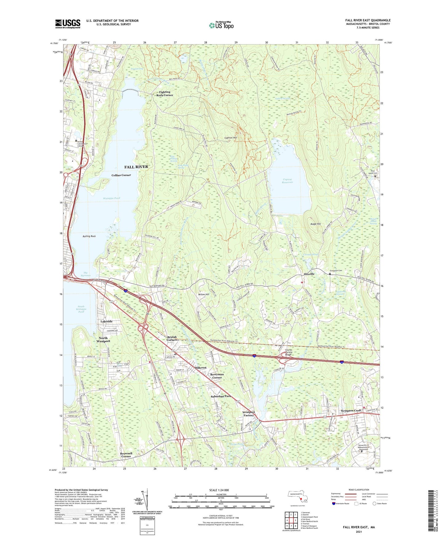
2024 topographic map quadrangle Fall River East in the state of Massachusetts. Scale: 1:24000. Based on the newly updated USGS 7.5' US Topo map series, this map is in the following counties: Bristol. The map contains contour data, water features, and other items you are used to seeing on USGS maps, but also has updated roads and other features. This is the next generation of topographic maps. Printed on high-quality waterproof paper with UV fade-resistant inks.
Quads adjacent to this one:
West: Fall River
Northwest: Somerset
North: Assonet
Northeast: Assawompset Pond
East: New Bedford North
Southeast: New Bedford South
South: Head of Westport
Southwest: Tiverton
Contains the following named places: Alert Ambulance Service, Alice A Macomber School, Berryman Corner, Beulah Corners, Blossom Brook, Bread and Cheese Brook, Bristol Community College East Campus, Brownell Corner, Calvary Church, Camp Interlocken, Castle Brook, Charles Christie Bridge, City of Fall River, Colebrook Swamp, Collins Corner, Copicut Hill, Copicut Reservoir, Copicut River, Copicut Swamp, Cornell Pond, Cornell Pond Lower Dam, Dartmouth Fire Department District 3 Station 1 Headquarters, Dartmouth Fire Department District 3 Station 2, Evergreen Cemetery, Fall River High School, Fighting Rock Corner, First Christian Church, Flint Village High School, Forge Pond, George H Potter School, Greenwood Park School, Hemlock Station, Hicksville Station, Hillcrest, Hixville, Kempton Croft, King Philip Brook, King Philip Spring, King Phillips Swamp, Lakeside, Miller Brook, Montessori School of Angels, New Bedford Rod and Gun Club, Noquochoke Lake, Noquochoke Lake Dam, North Westport, North Westport Census Designated Place, North Westport Post Office, Our Lady of Grace Church, Pine Island Cemetery, Pond Swamp, Queen Gutter Brook, Richies Heliport, Ridge Hill, Rolling Rock, Saint George Church, Saint George School, Shingle Island River, Shingle Island Swamp, Southeastern Massachusetts University, Suburban Park, The Narrows, Watuppa Pond, Watuppa Reserve, Westport Factory, Westport Fire Department Station 2, Westport Post Office, WSMU-FM (North Dartmouth), Yellow Hill, ZIP Codes: 02720, 02747