MyTopo
Hampden Massachusetts US Topo Map
Couldn't load pickup availability
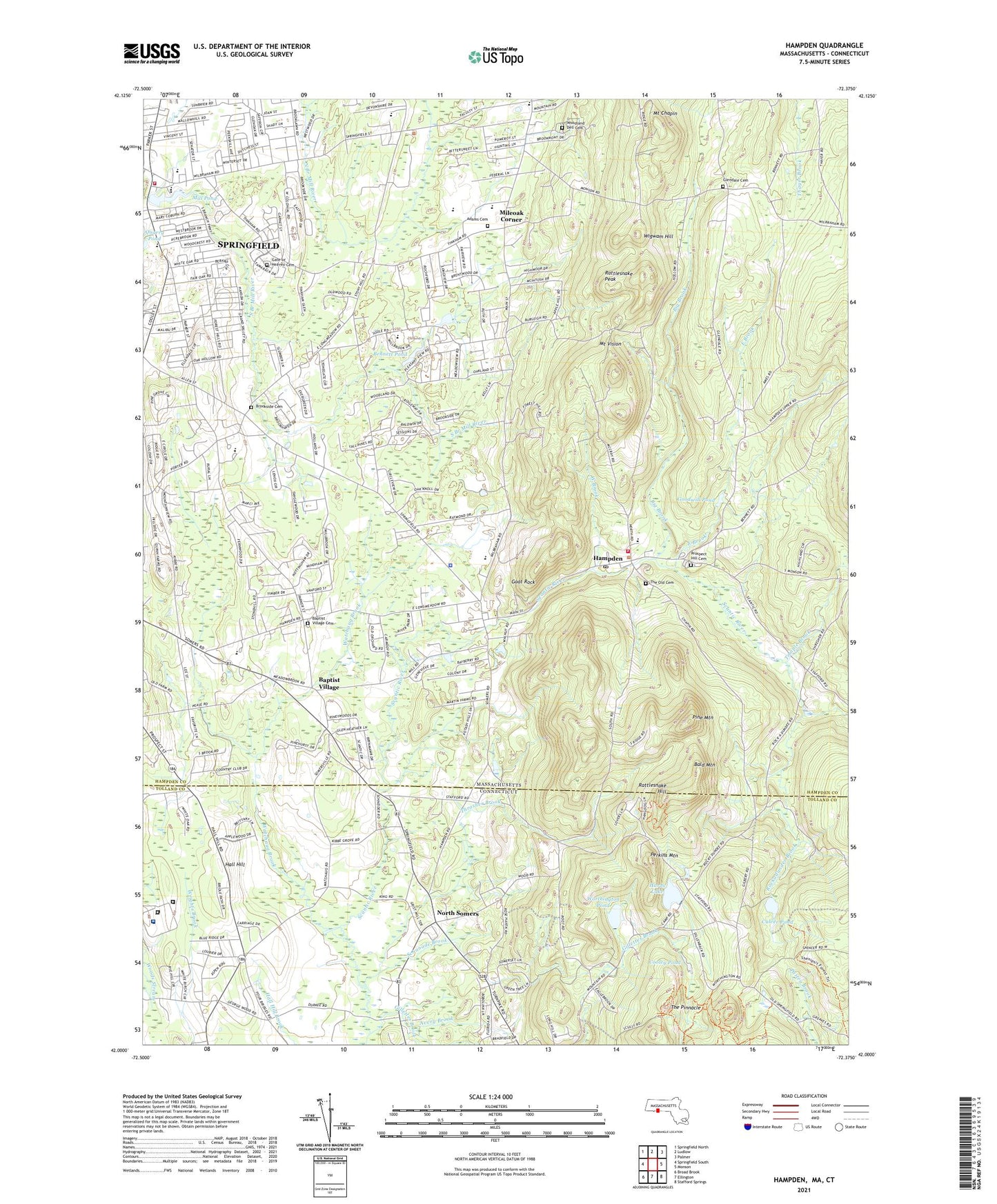
2024 topographic map quadrangle Hampden in the states of Massachusetts, Connecticut. Scale: 1:24000. Based on the newly updated USGS 7.5' US Topo map series, this map is in the following counties: Hampden, Tolland. The map contains contour data, water features, and other items you are used to seeing on USGS maps, but also has updated roads and other features. This is the next generation of topographic maps. Printed on high-quality waterproof paper with UV fade-resistant inks.
Quads adjacent to this one:
West: Springfield South
Northwest: Springfield North
North: Ludlow
Northeast: Palmer
East: Monson
Southeast: Stafford Springs
South: Ellington
Southwest: Broad Brook
This map covers the same area as the classic USGS quad with code o42072a4.
Contains the following named places: Academy Historic District, Adams Cemetery, Avery Brook, Bald Mountain, Baptist Village, Baptist Village Academy, Bennett Pond, Bennett Pond Dam, Big Brook, Big D Plaza Shopping Center, Childrens Museum, Christ the King Lutheran Church, Connecticut Department of Corrections Hospital, Cooley Pond, Crane Park, Culver Pond, East Brook, East Longmeadow Rod and Gun Club, Elmcrest Country Club, Emilie Steere Library, Federated Community Church, First Baptist Church, Gate of Heaven Cemetery, Gerrish Park, Gillettes Brook, Goat Rock, Goodwill Pond, Green Meadows Elementary School, Hall Hill, Hampden, Hampden Country Club, Hampden Fire Department, Hampden Memorial Recreational Park, Hampden Mini-Mall Shopping Center, Hampden Post Office, Hampden Public Library, Hampden Town Hall, Hampden Town Police Department, Hurds Lake, Hurds Lake Dam, Laughing Brook Wildlife Sanctuary, Mary M Walsh School, Meadow Brook School, Mile Tree School, Mileoak Corner, Mill Pond, Mill Pond Dam, Mill Pond School, Minnechaug Regional High School, Minnechaug Regional High School Media Center, Mount Chapin, Mount Vision, Mountain View Heliport, Mountain View School, North Somers, Northern Correctional Institution, Old Meeting House Museum, Osborn Correctional Institution, Perkins Mountain, Pine Mountain, Pioneer Valley Montessori School, Prospect Hill Cemetery, Quarry Pond, Rattlesnake Hill, Rattlesnake Peak, Rice Fruit Farm, Rockadundee Brook, Rockwell Dam, SABIS International Charter School, Saint Catherine of Siena Parish Church, Scantic, Schanade Brook, Sixteen Acres Shopping Center, Skerry Brook, Soule Road School, Springfield Fire Department Station 12, Springfield Shopping Mall, Stony Hill Road School, Sunny Knoll Airport, Temple Brook, The Little Red Schoolhouse, The Old Cemetery, The Pinnacle, Thornton Burgess Middle School, Thrasher Brook, Town of East Longmeadow, Town of Hampden, United Church, Valley Farms Airport, Veterans Golf Course, Watchaug Brook, Wenworth Farm Dam, West Brook, Wigwam Hill, Wilbraham, Wilbraham Academy, Wilbraham and Monson Academy, Wilbraham Country Club, Wilbraham Regional High School, Wilbraham Town Hall, Wilbraham Wildlife Area, Woodland Dell Cemetery, ZIP Codes: 01028, 01036, 01128, 01129