MyTopo
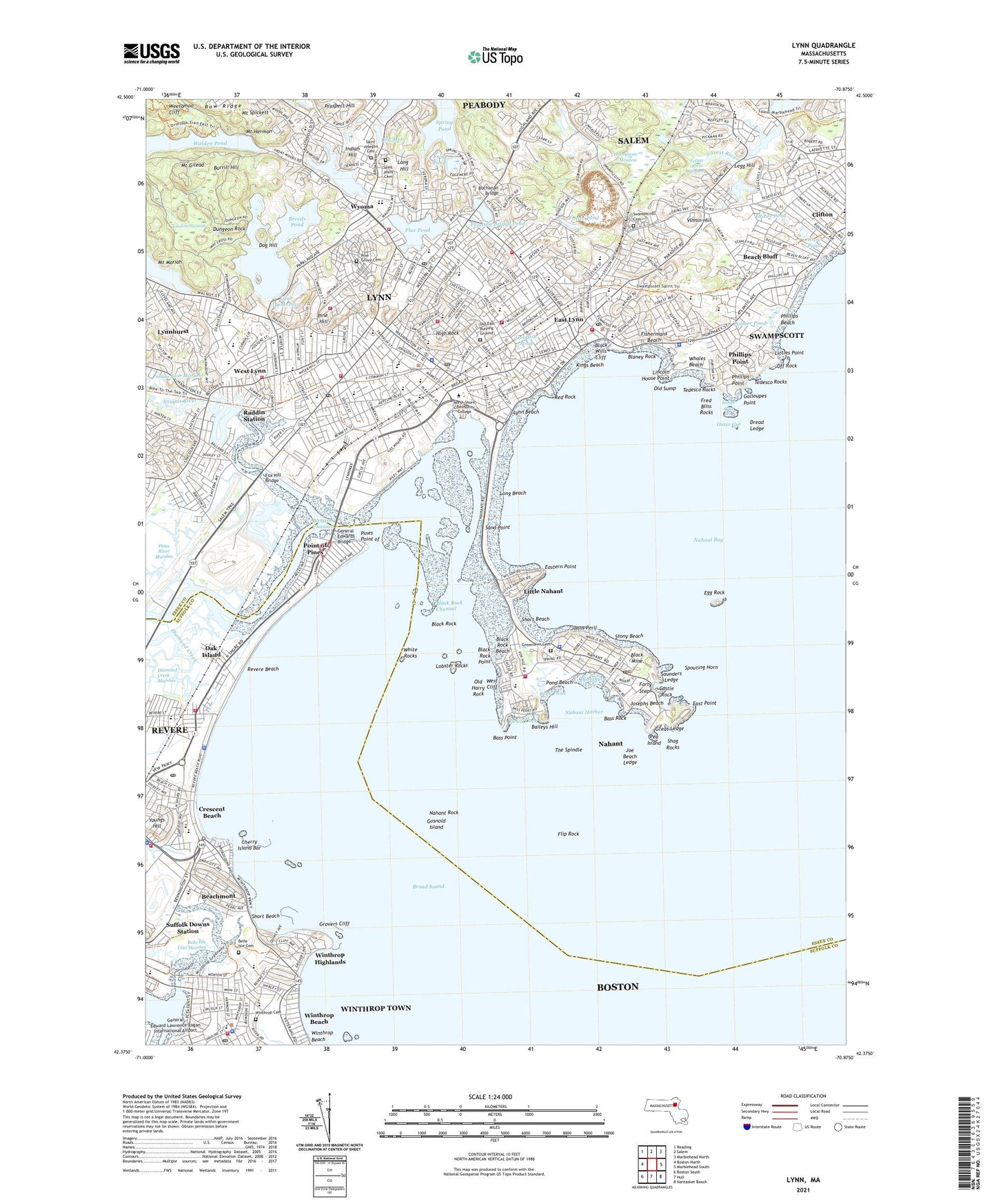
Lynn Massachusetts US Topo Map
Couldn't load pickup availability
2024 topographic map quadrangle Lynn in the state of Massachusetts. Scale: 1:24000. Based on the newly updated USGS 7.5' US Topo map series, this map is in the following counties: Essex, Suffolk. The map contains contour data, water features, and other items you are used to seeing on USGS maps, but also has updated roads and other features. This is the next generation of topographic maps. Printed on high-quality waterproof paper with UV fade-resistant inks.
Quads adjacent to this one:
West: Boston North
Northwest: Reading
North: Salem
Northeast: Marblehead North
East: Marblehead South
Southeast: Nantasket Beach
South: Hull
Southwest: Boston South
This map covers the same area as the classic USGS quad with code k42070d7.
Contains the following named places: Abbott Park, Aborn School, Aldworth School, Baileys Hill, Barry Park, Bass Point, Bass Rock, Beach Bluff, Beach Bluff Station, Beachmont, Bear Pond, Beaver Brook, Belle Isle Inlet, Belle Isle Inlet Marshes, Birch Pond Dam, Black Marsh Channel Light, Black Mine, Black Rock, Black Rock Beach, Black Rock Channel, Black Rock Point, Black Rocks Light, Black Wills Cliff, Blaney Rock, Breed School, Breeds Pond, Breeds Pond Outlet Dam, Brickett Elementary School, Broad Sound, Browns Pond, Buchanan Bridge, Burrill Hill, Burrill School, Callahan Elementary School, Castle Rock, Central Square Historic District, Cherry Island Bar, City of Lynn, City of Revere, City of Winthrop Town, Clark School, Clark Street Playground, Clifton, Clifton Station, Cobbet Junior High School, Community Hospital, Crescent Beach, Crescent Beach Station, Diamond Creek Marshes, Dog Hill, Dorothy Cove, Dread Ledge, Dungeon Rock, E J Harrington School, East Lynn, East Lynn Station, East Point, East Saugus Station, Eastern Point, Egg Rock, Egg Rock Light, Fishermans Beach, Flax Pond, Flax Pond Playground, Flip Rock, Floating Bridge Pond, Forest River, Forest River Marshes, Forty Steps, Foster Pond, Fox Hill Bridge, Frazier Field, Fred Bliss Rocks, Fredericks Park, Frog Pond, Galloupes Point, Gatchell Green, GEAA Field, Gear Plant Heliport, General Edwards Bridge, Goldfish Pond, Gosnold Island, Great Ledge, Greenlawn Cemetery, Grovers Cliff, High Rock, Highland School, Highland Station, Hood Playground, Indian Hill, Ingalls School, Ingalls Station, Ingleside Park, Inner Gut, Isolation Hospital, Jackson Park, Joe Beach Ledge, Johns Peril, Josephs Beach, Kelly Green Golf Course, Kiley Playground, Kings Beach, Legg Hill, Lewis Cove, Lewis School, Lily Mere, Lincoln House Point, Little Nahant, Littles Point, Lobster Rocks, Long Beach, Long Hill, Long Hill Orchard Heliport, Lynn, Lynn Beach, Lynn Classical High School, Lynn Common, Lynn Common Station, Lynn Harbor, Lynn Hospital, Lynn Reservoir, Lynn Reservoir Dam, Lynn Station, Lynn Vocational Technical Institute, Lynn Woods School, Lynn-Central Square Station, Lynngate Plaza, Memorial Park, Miller Field, Mount Gilead, Mount Hermon, Mount Moriah, Mount Pleasant Hospital, Mount Spickett, Nahant, Nahant Bay, Nahant Census Designated Place, Nahant Harbor, Nahant Rock, North Shore School, Oak Island, Oak Island Station, Ocean Spray Station, Off Rock, O'Keefe Alternative High School, Old East Burying Ground, Old Harry Rock, Old Sump, Oliver Pond, Outer Gut, Palmer Pond, Pea Island, Phillips Beach, Phillips Point, Pickering Junior High School, Pine Grove Cemetery, Pine Hill, Pines Point of, Pines River, Point of Pines, Point of Pines Station, Pond Beach, Raddin Station, Red Rock, Rent-A-Tool Heliport, Revere Beach, River Works Station, Saint Jeans Cemetery, Saint Josephs Cemetery, Saint Mary Regional Junior-Senior High School, Saint Michaels School, Saint Patricks School, Saint Pius V Elementary School, Sand Point, Sandy Point Light, Saugus General Hospital, Saugus River, Saunders Ledge, Sewall Anderson School, Shag Rocks, Shirley Station, Short Beach, Short Beach Creek, Shute Brook, Sluice Pond, Sluice Pond Dam, Spouting Horn, Spring Pond, Stony Beach, Suffolk Downs Park, Suffolk Downs Station, Swampscott, Swampscott Cemetery, Swampscott Census Designated Place, Swampscott Mall, Swampscott Station, Tedesco Country Club, Tedesco Rocks, The Five Sisters, The Spindle, Thompsons Meadow, Thurgood Marshall Middle School, Tomlins Swamp, Town of Nahant, Town of Swampscott, Upper Turn Light, Vinnin Hill, Walden Pond East End Dam, Ware Pond, Washington Community School, Weetamoo Cliff, West Cliff, West Lynn, West Lynn Station, Western Channel, Whales Beach, White Rocks, White Rocks Light, William P Connery School, Winthrop, Winthrop Beach, Winthrop Census Designated Place, Winthrop Community Health Center, Winthrop Highlands, WLYN-AM (Lynn), WROL-AM (Boston), WRYT, Wyoma, Youngs Hill, ZIP Codes: 01901, 01902, 01904, 01905, 01907, 01908


