
MyTopo
Nantasket Beach Massachusetts US Topo Map
Couldn't load pickup availability
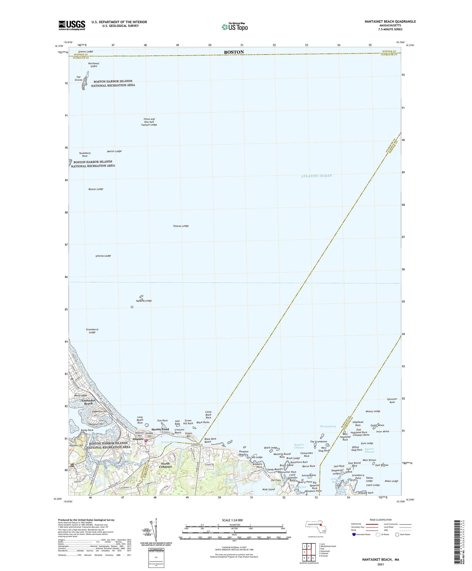
2024 topographic map quadrangle Nantasket Beach in the state of Massachusetts. Scale: 1:24000. Based on the newly updated USGS 7.5' US Topo map series, this map is in the following counties: Plymouth, Norfolk, Suffolk. The map contains contour data, water features, and other items you are used to seeing on USGS maps, but also has updated roads and other features. This is the next generation of topographic maps. Printed on high-quality waterproof paper with UV fade-resistant inks.
Quads adjacent to this one:
West: Hull
Northwest: Lynn
North: Marblehead South
Southeast: Scituate
South: Cohasset
Southwest: Weymouth
Contains the following named places: Atlantic, Atlantic Hill, Barrel Rock, Big Quamino Rock, Black Ledge, Black Rock Beach, Black Rocks, Boston Ledge, Boston Lightship, Brush Island, Brush Ledge, Buckthorn Rock, Center Hill, Chest Ledge, Chittenden Rock, Cohasset Golf Club, Cohasset Harbor, Cohasset Rocks, Crescent Beach, Damon School, Davis Ledge, East Hogshead Rock, East Round Rock, East Shag Rock, East Willies, Eastern Channel, Enos Ledge, Graves Ledge, Graves Light, Green Hill, Green Hill Rock, Gull Island, Gun Rock, Hampton Hill, Harding Ledge, Hog Rock, Hogshead Rock, Hull Fire Department Station 2, Hull Police Department, Hull Post Office, Inner Minot, Irvington Station, Jack Rock, Kenberma, Kenberma Station, Kimballs Point, Little Black Rock, Little Harbor, Little Harbor Reservoir, Little Quamino Rock, Long Beach Rock, Martin Ledge, Mikes Ledge, Mink Island, Minots Ledge, Minots Ledge Light, Minot's Light, Monument Square, Nantasket Beach, Nantasket Post Office, Nantasket Station, Nichols Road Dam, North Cohasset, Northeast Grave, Outer Minot, Panagia Greek Orthodox Church, Paragon Park, Pleasant Beach, Pleasant Beach Heliport, Quarry Point, Rattlesnake Run, Richardsons Brook, Rocky Neck, Rumrunner Rock, Sagamore Hill, Sandy Beach, Sandy Cove, Scituate Neck, Sea Ledge, Seal Rock, Sheppard Ledges, Straits Pond, Straits Pond Dam, Strawberry Ledge, Strawberry Point, Surfside Station, Sutton Hole Light, Sutton Rocks, Sylvester Rock, Tewksbury Rock, The Flats, The Gangway, The Grampuses, The Graves, The Graves Light, Thieves Ledge, Three and One-half Fathom Ledge, Tobias Ledge, Town of Cohasset, Turkey Hill Run, Ultonia Ledge, Utonia Ledge, West Hogshead Rock, West Shag Rock, West Willies, Westerly Round Rock, Western Channel, White Head, Windmill Point


