MyTopo
Norton Massachusetts US Topo Map
Couldn't load pickup availability
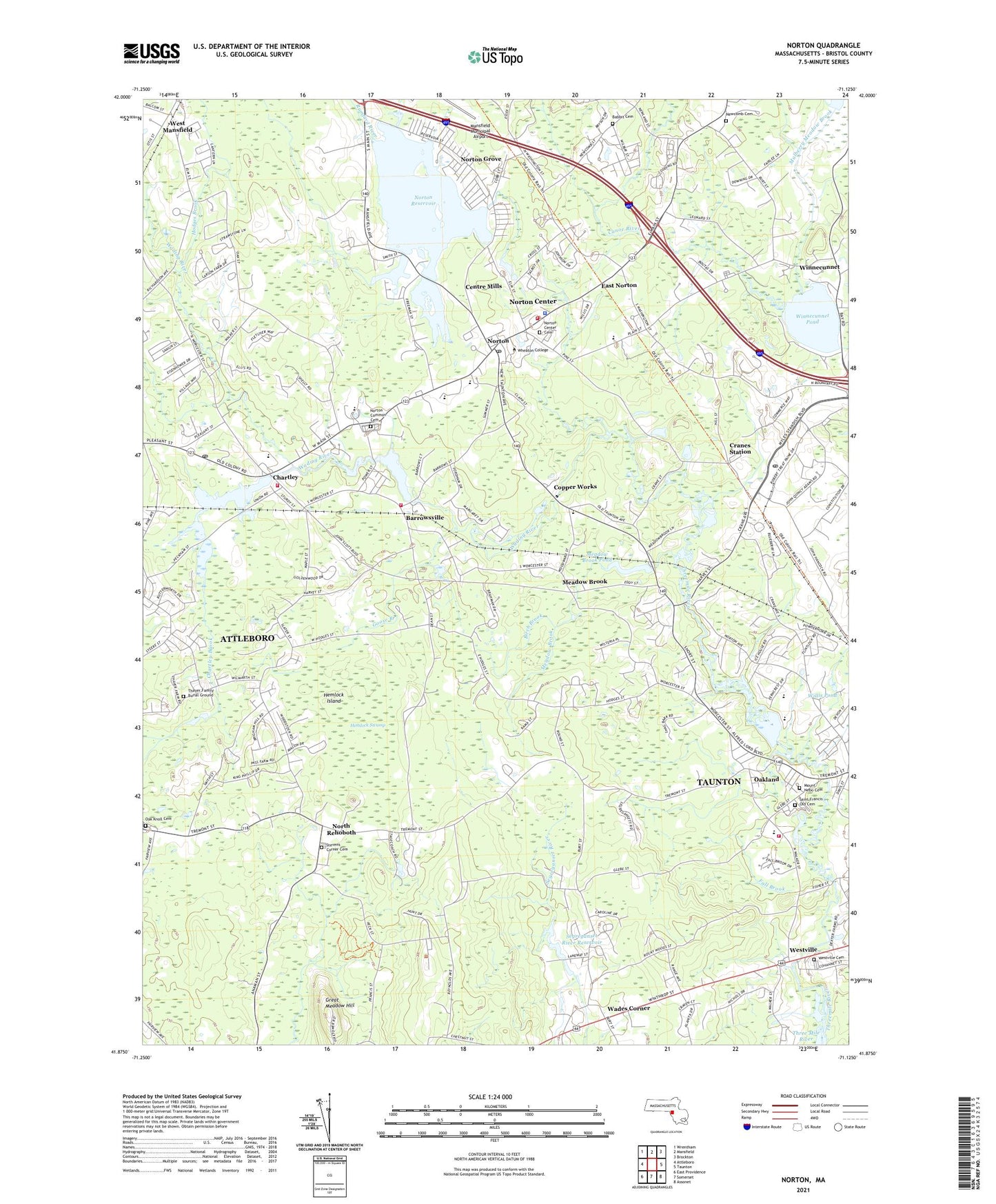
2024 topographic map quadrangle Norton in the state of Massachusetts. Scale: 1:24000. Based on the newly updated USGS 7.5' US Topo map series, this map is in the following counties: Bristol. The map contains contour data, water features, and other items you are used to seeing on USGS maps, but also has updated roads and other features. This is the next generation of topographic maps. Printed on high-quality waterproof paper with UV fade-resistant inks.
Quads adjacent to this one:
West: Attleboro
Northwest: Wrentham
North: Mansfield
Northeast: Brockton
East: Taunton
Southeast: Assonet
South: Somerset
Southwest: East Providence
Contains the following named places: Attleboro Rod and Gun Club, Babbit Cemetery, Barrowsville, Barrowsville Pond, Bearcroft Station, Benjamin Friedman Middle School, Bethel Mission Church, Birch Brook, Camp Finburg, Camp Read, Canoe River, Centre Mills, Chartley, Chartley Brook, Chartley Pond, Chartley Pond Dam, Chartley Post Office, Comcast Center, Copper Works, Cranes Station, Dever State School, East Norton, Edmund Hatch Bennett School, Fall Brook, Fernandes Raynham Shopping Center, Friedman Middle School Library Media Center, Goose Branch, Great Meadow Hill, Hemlock Island, Hemlock Swamp, Henri A Yelle School, Hodges Brook, J C Solmonese School, Joseph C Chamberlain School, Josiah Newcomb Cemetery, L G Nourse Elementary School, Lovering Colony State Hospital, Meadow Brook, Meadow Brook Pond, Meadowbrook Pond Dam, Millipore Heliport, Mount Nebo Cemetery, Mulberry Meadow Brook, New Testament School, North Rehoboth, Norton, Norton Center Cemetery, Norton Center Census Designated Place, Norton Common Cemetery, Norton Fire Department, Norton Fire Department Alarm Division, Norton Fire Department Station 1, Norton Fire Department Station 2 Headquarters, Norton Furnace, Norton Furnace Station, Norton Grove, Norton High School, Norton Police Department, Norton Post Office, Norton Reservoir, Norton Reservoir Dam, Oak Knoll Cemetery, Oakland, Project SPOKE Collaborative School, Rehoboth State Forest, Rumford River, Saint Francis Old Cemetery, Saint Marys Church, Saint Pauls Church, Segreganset River Dam, Segreganset River Reservoir, Sheppards Factory Pond, Spanish Church of God, Stevens Corner Cemetery, Taunton Fire Department Oakland Station, Taunton Post Office, The Country School, Three Mile River, Town of Norton, Wades Corner, Wading River, West Mansfield, Westville, Westville Cemetery, Wheaton College, Willis Pond, Winnecunnet, Winnecunnet Pond, ZIP Code: 02766