MyTopo
Squibnocket Massachusetts US Topo Map
Couldn't load pickup availability
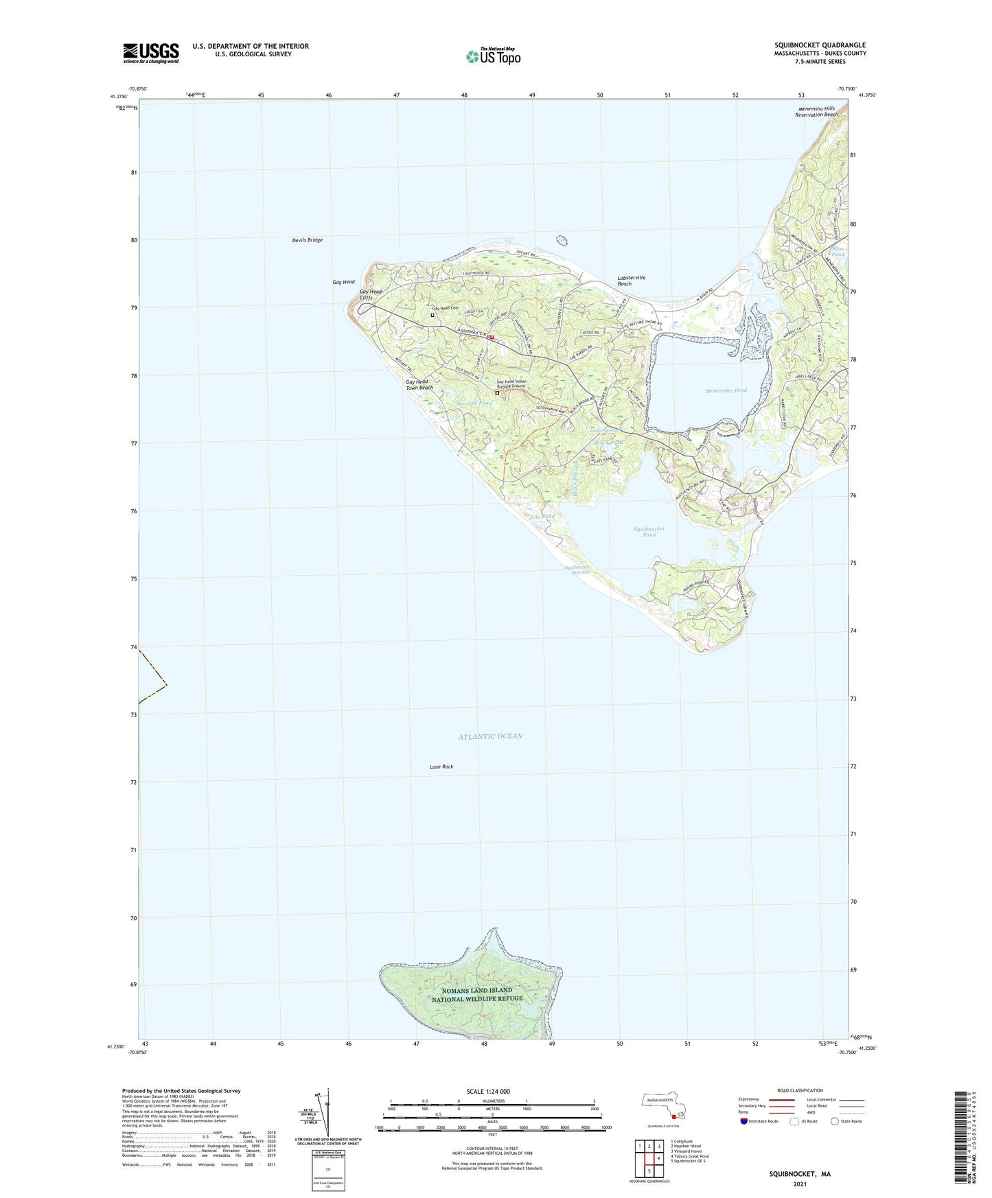
2024 topographic map quadrangle Squibnocket in the state of Massachusetts. Scale: 1:24000. Based on the newly updated USGS 7.5' US Topo map series, this map is in the following counties: Dukes. The map contains contour data, water features, and other items you are used to seeing on USGS maps, but also has updated roads and other features. This is the next generation of topographic maps. Printed on high-quality waterproof paper with UV fade-resistant inks.
Quads adjacent to this one:
Northwest: Cuttyhunk
North: Naushon Island
Northeast: Vineyard Haven
East: Tisbury Great Pond
South: Squibnocket OE S
This map covers the same area as the classic USGS quad with code o41070c6.
Contains the following named places: Aquinnah Census Designated Place, Aquinnah Fire Department, Aquinnah Police Department, Black Brook, Black Pond, Bliss Pond, Cooks Springs, Devils Bridge, Dutcher Dock, Edys Island, Gay Head, Gay Head Cemetery, Gay Head Cliffs, Gay Head Coast Guard Station, Gay Head Indian Burying Ground, Gay Head Lighthouse, Gay Head Town Beach, Indian Lands, Lily Pond, Lobsterville, Lobsterville Beach, Lone Rock, Long Beach, Long Point, Menamsha Creek Entrance Jetty Light, Menemsha, Menemsha Basin, Menemsha Beach, Menemsha Bight, Menemsha Creek, Menemsha Hills Reservation, Menemsha Hills Reservation Beach, Menemsha Pond, Nashaquitsa, Nashaquitsa Cliffs, Nashaquitsa Pond, Nomans Land, Nomans Land Island National Wildlife Refuge, Occooch Pond, Old Man, Peases Point, Squibnocket, Squibnocket Beach, Squibnocket Bight, Squibnocket Herring Run, Squibnocket Marshes, Squibnocket Point, Squibnocket Pond, Squibnocket Ridge, Stonewall Beach, Stonewall Pond, Town of Aquinnah, Town of Chilmark, Wampanoag-Aquinnah Trust Land, Zacks Cliffs, ZIP Code: 02535