MyTopo
Naushon Island Massachusetts US Topo Map
Couldn't load pickup availability
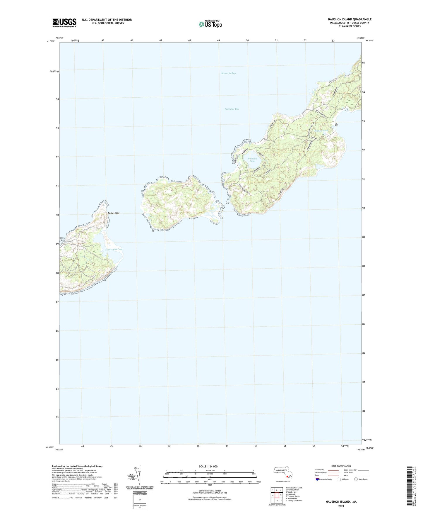
2024 topographic map quadrangle Naushon Island in the state of Massachusetts. Scale: 1:24000. Based on the newly updated USGS 7.5' US Topo map series, this map is in the following counties: Dukes. The map contains contour data, water features, and other items you are used to seeing on USGS maps, but also has updated roads and other features. This is the next generation of topographic maps. Printed on high-quality waterproof paper with UV fade-resistant inks.
Quads adjacent to this one:
West: Cuttyhunk
Northwest: New Bedford South
North: Sconticut Neck
Northeast: Woods Hole
East: Vineyard Haven
Southeast: Tisbury Great Pond
South: Squibnocket
This map covers the same area as the classic USGS quad with code o41070d6.
Contains the following named places: Black Woods, Blaney Pond, Crescent Beach, Elizabeth Islands, Felix Ledge, Fox Point, French Watering Place, Kettle Cove, Lone Rock, Nashawena Island, Naushon Island, Naushon Point, North Point, North Rock, Pasque Island, Quicks Hole, Quicks Hole Pond, Rams Head, Ramshead Woods, Robinsons Hole, Silver Beach, South Bluff, South Rock, Tarpaulin Cove, Tarpaulin Cove Light, Town of Gosnold, Vineyard Sound, West Beach, Westend Pond, ZIP Code: 02543