MyTopo
Tisbury Great Pond Massachusetts US Topo Map
Couldn't load pickup availability
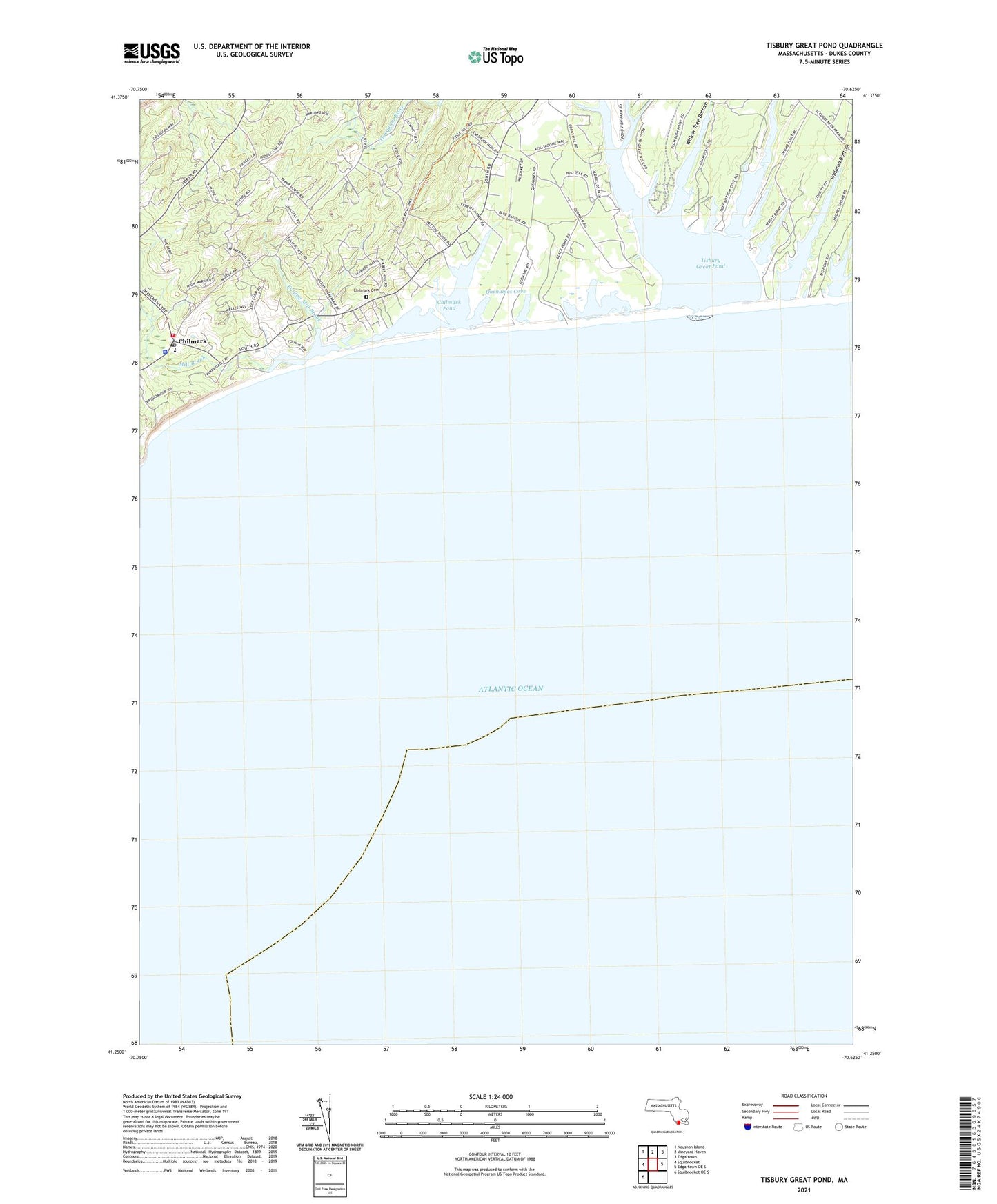
2024 topographic map quadrangle Tisbury Great Pond in the state of Massachusetts. Scale: 1:24000. Based on the newly updated USGS 7.5' US Topo map series, this map is in the following counties: Dukes. The map contains contour data, water features, and other items you are used to seeing on USGS maps, but also has updated roads and other features. This is the next generation of topographic maps. Printed on high-quality waterproof paper with UV fade-resistant inks.
Quads adjacent to this one:
West: Squibnocket
Northwest: Naushon Island
North: Vineyard Haven
Northeast: Edgartown
East: Edgartown OE S
Southwest: Squibnocket OE S
This map covers the same area as the classic USGS quad with code o41070c5.
Contains the following named places: Abel Hill, Allen Point, Black Point Pond, Chilmark, Chilmark Cemetery, Chilmark Community Center, Chilmark Community Church, Chilmark Elementary School, Chilmark Fire Department Station 1 Headquarters, Chilmark Gap Filler Annex, Chilmark Police Department, Chilmark Pond, Chilmark Post Office, Chilmark Public Library, Chilmark Town Hall, Cobbs Point, Deep Bottom Cove, Flat Point, Fulling Mill Brook, Gilberts Cove, Homer Pond, Long Cove, Long Point, Lucy Vincent Beach, Middle Point Cove, Mill Brook, Muddy Cove, Nabs Corner, Peaked Hill, Pear Tree Cove, Plum Bush Point, Prospect Hill, Quansoo, Quenames Cove, Quinnames, Ridge Hill, Short Cove, Squibnocket Post Office, Thumb Cove, Tiah Cove, Tiasquam River, Tisbury Great Pond, Tississa, Tississa Pond, Town Cove, Tri - Town Ambulance, United States Army Air Warning Station Number 6, Wades Cove, Waldron Bottom, Wequobsque Cliffs, Willow Tree Bottom