MyTopo
Cuttyhunk Massachusetts US Topo Map
Couldn't load pickup availability
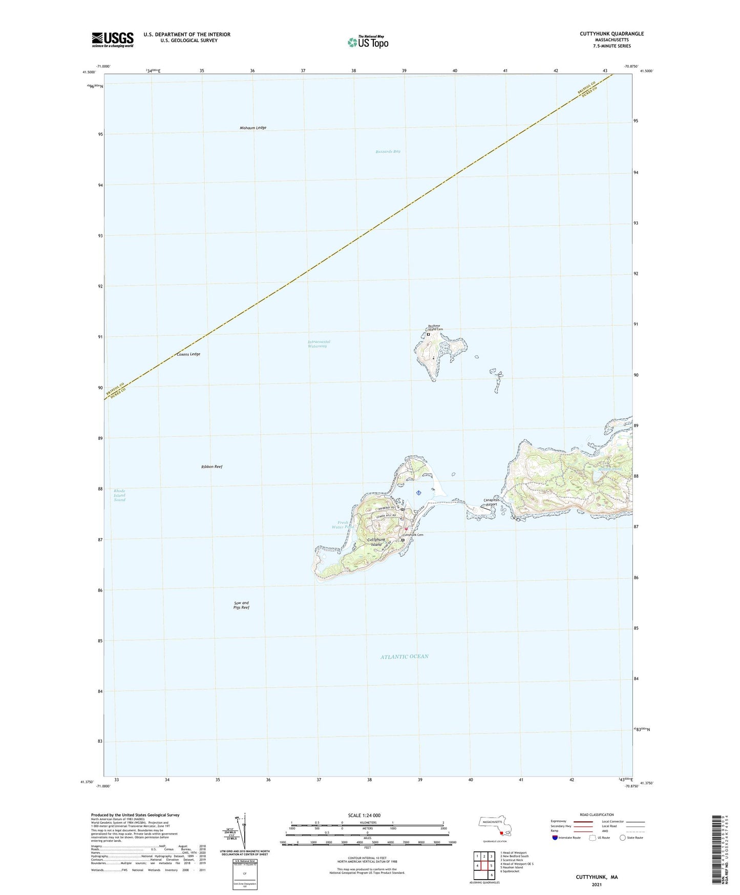
2024 topographic map quadrangle Cuttyhunk in the state of Massachusetts. Scale: 1:24000. Based on the newly updated USGS 7.5' US Topo map series, this map is in the following counties: Dukes, Bristol. The map contains contour data, water features, and other items you are used to seeing on USGS maps, but also has updated roads and other features. This is the next generation of topographic maps. Printed on high-quality waterproof paper with UV fade-resistant inks.
Quads adjacent to this one:
West: Head of Westport OE S
Northwest: Head of Westport
North: New Bedford South
Northeast: Sconticut Neck
East: Naushon Island
Southeast: Squibnocket
This map covers the same area as the classic USGS quad with code o41070d7.
Contains the following named places: Anderson School of Natural History, Baret Island, Canapitsit Airport, Canapitsit Channel, Copicut Neck, Coxens Ledge, Cuttyhunk, Cuttyhunk Cemetery, Cuttyhunk Elementary School, Cuttyhunk Fire Department, Cuttyhunk Harbor, Cuttyhunk Harbor North Jetty Light, Cuttyhunk Harbor Seaplane Base, Cuttyhunk Heliport, Cuttyhunk Island, Cuttyhunk Light, Cuttyhunk Pond, Cuttyhunk Post Office, Edwards Rock, Fresh Water Pond, Gosnold Island, Gull Island, Knox Point, Middle Ground, Middle Ledge, Middle Pond, Mishaum Ledge, Pease Ledge, Penikese Island, Penikese Island Cemetery, Ribbon Reef, Rock Island, Saddleback Hill, Slates Island, Sow and Pigs Reef, The Neck, Westend Pond, Whale Rock, ZIP Code: 02713