MyTopo
Prentiss Bay Michigan US Topo Map
Couldn't load pickup availability
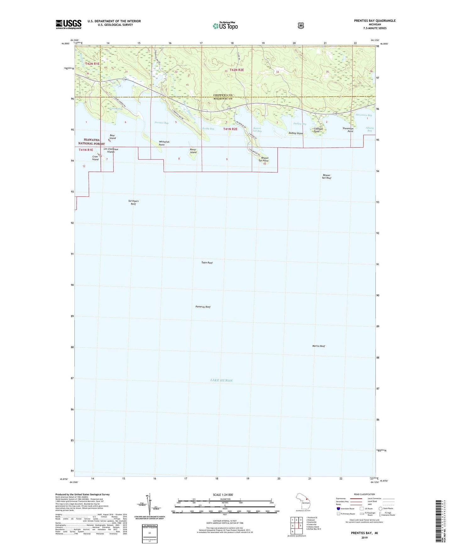
2023 topographic map quadrangle Prentiss Bay in the state of Michigan. Scale: 1:24000. Based on the newly updated USGS 7.5' US Topo map series, this map is in the following counties: Mackinac, Chippewa. The map contains contour data, water features, and other items you are used to seeing on USGS maps, but also has updated roads and other features. This is the next generation of topographic maps. Printed on high-quality waterproof paper with UV fade-resistant inks.
Quads adjacent to this one:
West: Cedarville
Northwest: Pickford SE
North: Stalwart
Northeast: Goetzville
East: Albany Island
Southwest: McRae Bay OE E
This map covers the same area as the classic USGS quad with code o45084h2.
Contains the following named places: Bear Island, Beaver Tail Bay, Beaver Tail Creek, Beaver Tail Point, Beaver Tail Reef, Cadogan Point, Cedar Campus Camp, Crow Island, Dudley Bay, Dudley Island, Loon Lake, Martin Reef, Pomeroy Reef, Prentis Bay Post Office, Prentiss Bay, Prentiss Creek, Rover Island, Scotty Bay, Stevenson Bay, Stevenson Point, Surveyors Reef, Tobin Reef, Whitefish Point