MyTopo
Aloha Michigan US Topo Map
Couldn't load pickup availability
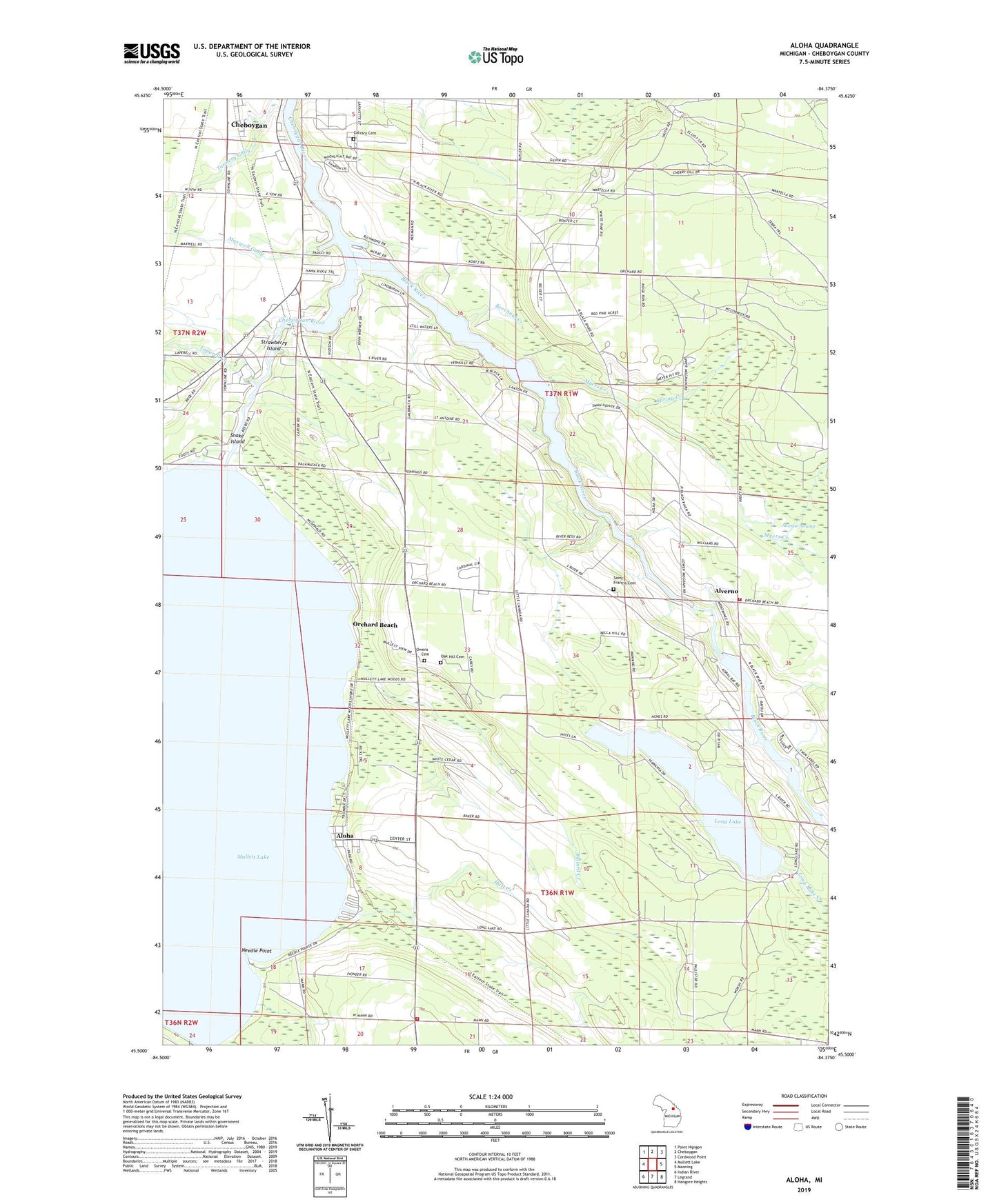
2023 topographic map quadrangle Aloha in the state of Michigan. Scale: 1:24000. Based on the newly updated USGS 7.5' US Topo map series, this map is in the following counties: Cheboygan. The map contains contour data, water features, and other items you are used to seeing on USGS maps, but also has updated roads and other features. This is the next generation of topographic maps. Printed on high-quality waterproof paper with UV fade-resistant inks.
Quads adjacent to this one:
West: Mullett Lake
Northwest: Point Nipigon
North: Cheboygan
Northeast: Cordwood Point
East: Manning
Southeast: Hangore Heights
South: Legrand
Southwest: Indian River
This map covers the same area as the classic USGS quad with code o45084e4.
Contains the following named places: Aloha, Aloha Post Office, Aloha State Park, Aloha Station, Alverno, Alverno Fire Department Station 1, Alverno Fire Department Station 2, Alverno Post Office, Ballard Creek, Beechnut Creek, Black River, Black River School, Calvary Cemetery, Enos School, Hatt Creek, Kingdom Hall of Jehovah's Witnesses, Laperell Creek, Long Lake, Mann Creek, Maxwell Gully, Mullett Lake Woods, Myers Creek, Needle Point, Oak Hill Cemetery, Orchard Beach, Owens Cemetery, Saint Charles Borromeo Church, Saint Francis Cemetery, Saint Francis Church, School Number 1, School Number 2, School Number 3, School Number 4, Shanneck School, Snake Island, Spring Creek, Strawberry Island, Tannery Gully, Tannery School, Township of Aloha, Township of Benton, Waterways Campground, Wing Creek, ZIP Code: 49721