MyTopo
Legrand Michigan US Topo Map
Couldn't load pickup availability
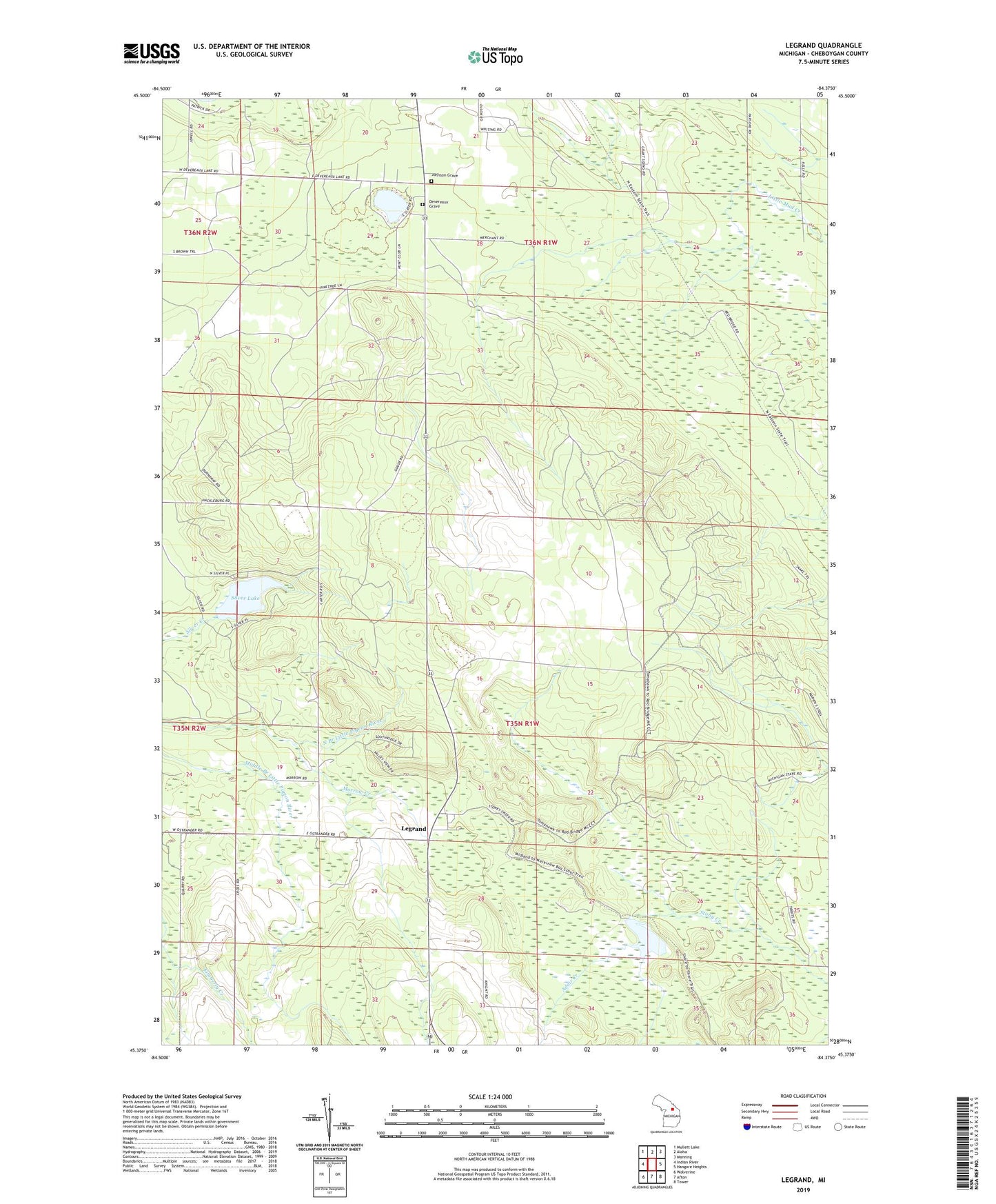
2023 topographic map quadrangle Legrand in the state of Michigan. Scale: 1:24000. Based on the newly updated USGS 7.5' US Topo map series, this map is in the following counties: Cheboygan. The map contains contour data, water features, and other items you are used to seeing on USGS maps, but also has updated roads and other features. This is the next generation of topographic maps. Printed on high-quality waterproof paper with UV fade-resistant inks.
Quads adjacent to this one:
West: Indian River
Northwest: Mullett Lake
North: Aloha
Northeast: Manning
East: Hangore Heights
Southeast: Tower
South: Afton
Southwest: Wolverine
This map covers the same area as the classic USGS quad with code o45084d4.
Contains the following named places: Adair Creek, Afton Stone Quarry, Cheboygan County, Devereaux Grave, Devereaux Lake, Johnson Grave, Kimberly Creek, Legrand, Legrand Post Office, Legrand Station, Morrow Creek, Silver Lake, WGFM-FM (Cheboygan)