MyTopo
Manning Michigan US Topo Map
Couldn't load pickup availability
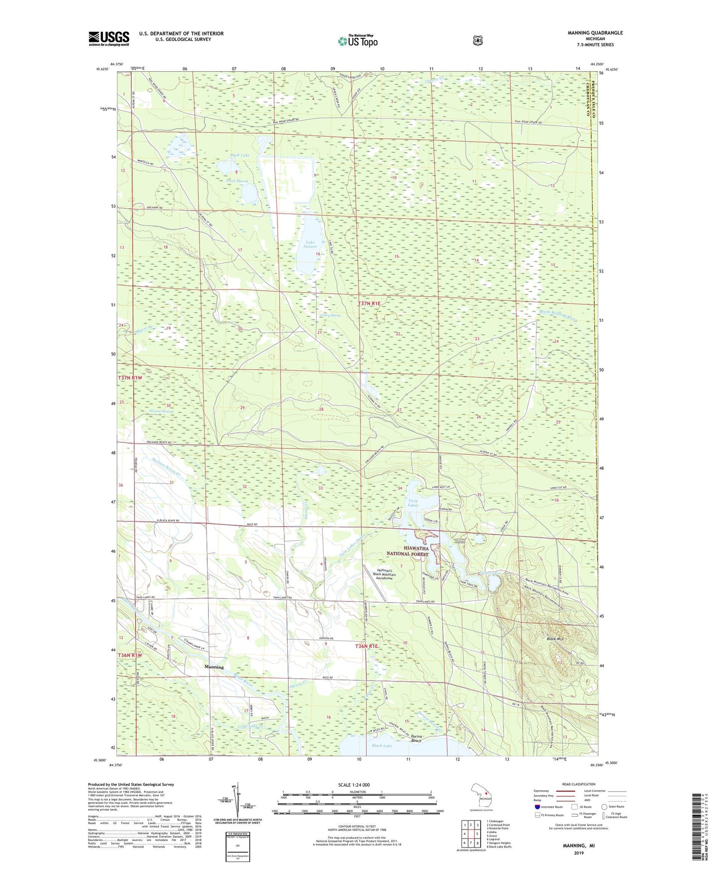
2023 topographic map quadrangle Manning in the state of Michigan. Scale: 1:24000. Based on the newly updated USGS 7.5' US Topo map series, this map is in the following counties: Cheboygan, Presque Isle. The map contains contour data, water features, and other items you are used to seeing on USGS maps, but also has updated roads and other features. This is the next generation of topographic maps. Printed on high-quality waterproof paper with UV fade-resistant inks.
Quads adjacent to this one:
West: Aloha
Northwest: Cheboygan
North: Cordwood Point
Northeast: Ninemile Point
East: Grace
Southeast: Black Lake Bluffs
South: Hangore Heights
Southwest: Legrand
This map covers the same area as the classic USGS quad with code o45084e3.
Contains the following named places: Alverno Swamp, Black Mountain, Black River Church, Cains Creek, Doriva Beach, Doriva Beach Creek, Duck Lake, Duck Marsh, Hoffman's Black Mountain Aerodrome, Lake Sixteen, Linsey Marsh, Long Lake Creek, Manning, Manning Post Office, Mud Lake, Owens Creek, Owens Lookout Tower, School Number 1, Section Seven Creek, Township of Grant, Twin Lakes, Twin Lakes Outlet, Twin Lakes State Forst Campground