MyTopo
Anderson Lake Michigan US Topo Map
Couldn't load pickup availability
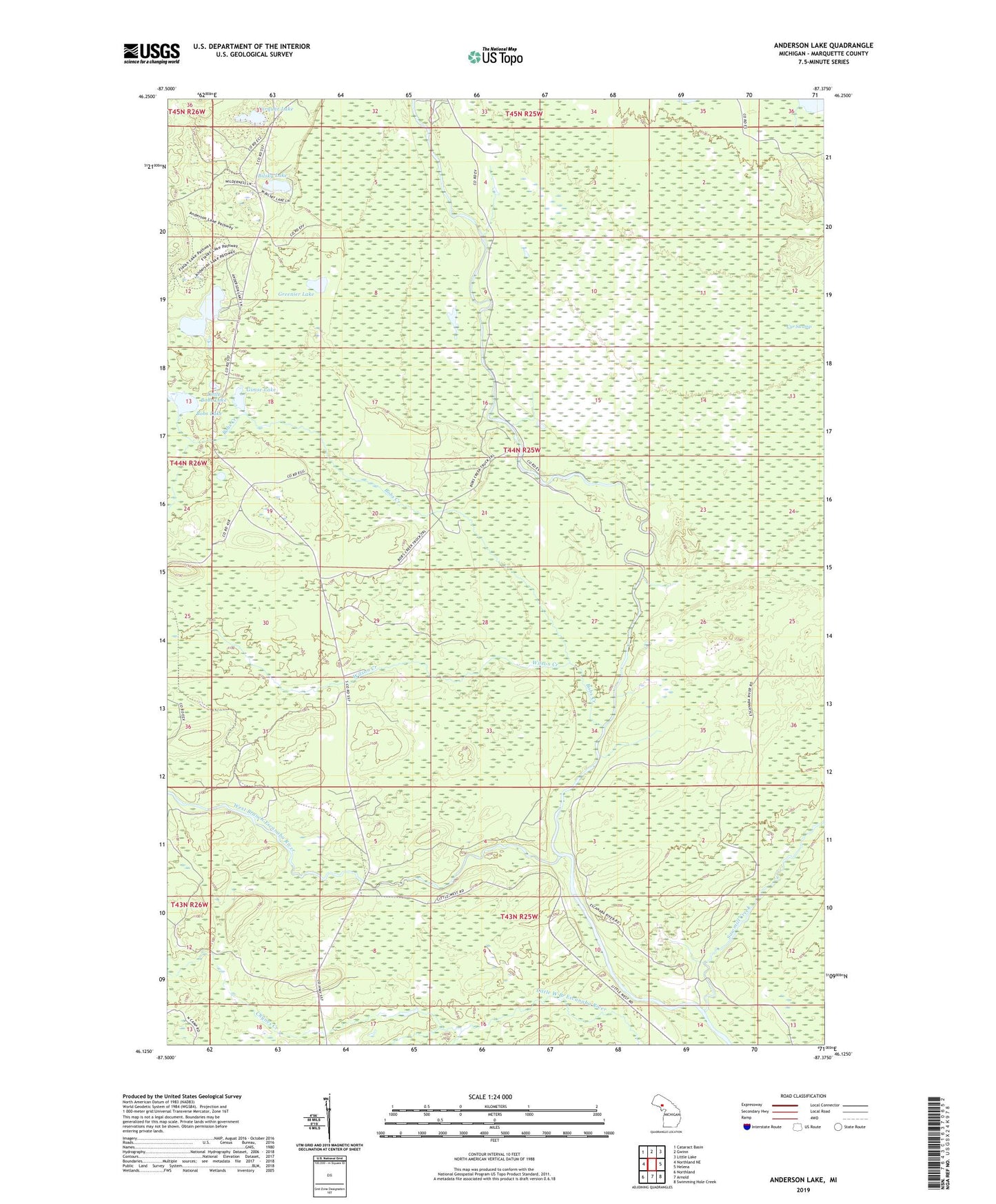
2023 topographic map quadrangle Anderson Lake in the state of Michigan. Scale: 1:24000. Based on the newly updated USGS 7.5' US Topo map series, this map is in the following counties: Marquette. The map contains contour data, water features, and other items you are used to seeing on USGS maps, but also has updated roads and other features. This is the next generation of topographic maps. Printed on high-quality waterproof paper with UV fade-resistant inks.
Quads adjacent to this one:
West: Northland NE
Northwest: Cataract Basin
North: Gwinn
Northeast: Little Lake
East: Helena
Southeast: Swimming Hole Creek
South: Arnold
Southwest: Northland
This map covers the same area as the classic USGS quad with code o46087b4.
Contains the following named places: Anderson Lake, Anderson Lake West State Forest Campground, Beltrame Lake, Bilsky Lake, Bobs Creek, Bobs Lake, Chynes Creek, Cyr Swamp, Farquar Lake, Flacks Lakes, Gardner Mine, Gimse Lake, Greenier Lake, Little Bobs Lake, Lone Pine Creek, Sawmill Creek, Sleighrunner Lake, Tonkowa Lake, West Branch Escanaba River, Wilson Creek