MyTopo
Helena Michigan US Topo Map
Couldn't load pickup availability
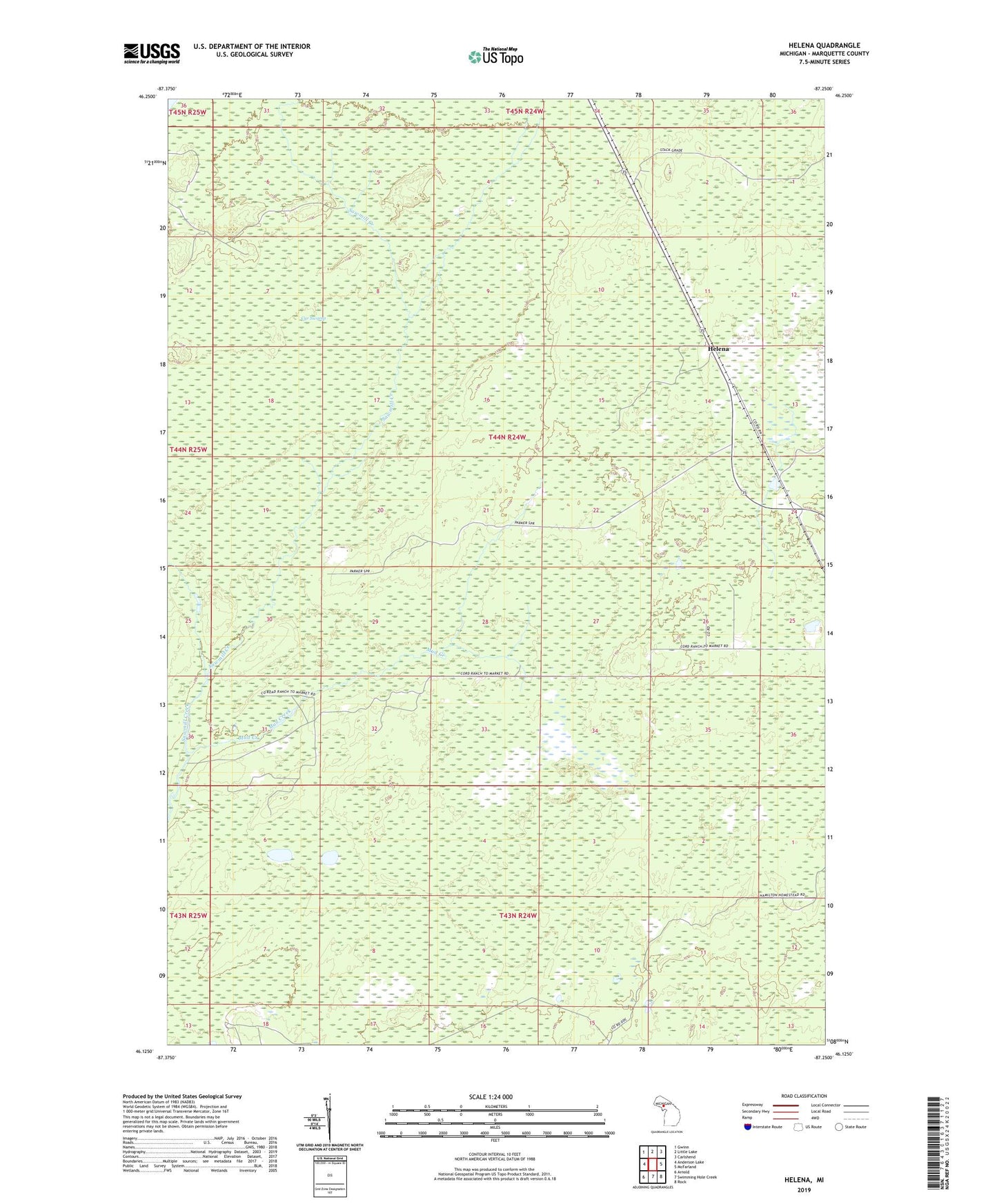
2023 topographic map quadrangle Helena in the state of Michigan. Scale: 1:24000. Based on the newly updated USGS 7.5' US Topo map series, this map is in the following counties: Marquette. The map contains contour data, water features, and other items you are used to seeing on USGS maps, but also has updated roads and other features. This is the next generation of topographic maps. Printed on high-quality waterproof paper with UV fade-resistant inks.
Quads adjacent to this one:
West: Anderson Lake
Northwest: Gwinn
North: Little Lake
Northeast: Carlshend
East: McFarland
Southeast: Rock
South: Swimming Hole Creek
Southwest: Arnold
This map covers the same area as the classic USGS quad with code o46087b3.
Contains the following named places: Helena, Mud Creek, Stack Post Office, Stack Station, Township of Turin