MyTopo
Au Sable Point SW Michigan US Topo Map
Couldn't load pickup availability
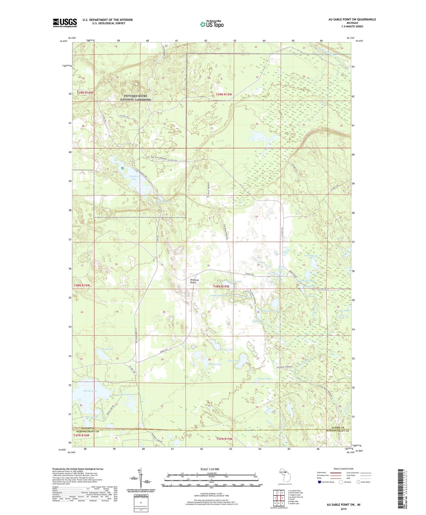
2023 topographic map quadrangle Au Sable Point SW in the state of Michigan. Scale: 1:24000. Based on the newly updated USGS 7.5' US Topo map series, this map is in the following counties: Alger, Schoolcraft. The map contains contour data, water features, and other items you are used to seeing on USGS maps, but also has updated roads and other features. This is the next generation of topographic maps. Printed on high-quality waterproof paper with UV fade-resistant inks.
Quads adjacent to this one:
West: Trappers Lake
North: Au Sable Point
Northeast: Grand Sable Lake
East: Au Sable Point SE
Southeast: Sunken Lake
South: Driggs Lake
Southwest: Cusino
This map covers the same area as the classic USGS quad with code o46086e2.
Contains the following named places: Alger Lake, Birch Lakes, Clyde Lake, Deer Lake, Ewatt Lake, Fishhook Lake, Grass Creek, Kingston Lake, Kingston Lake State Forest Campground, Kingston Plains, Kingston Pond, Kinsey Lake, Loon Creek, Mallard Lake, Mervin Lake, Nevins Lake, Nugent Lake, Pelican Creek, Pelican Lake, Pickerel Lake, Preacher Lake, Weasel Lake, Wise Lake, Wolf Lake