MyTopo
Driggs Lake Michigan US Topo Map
Couldn't load pickup availability
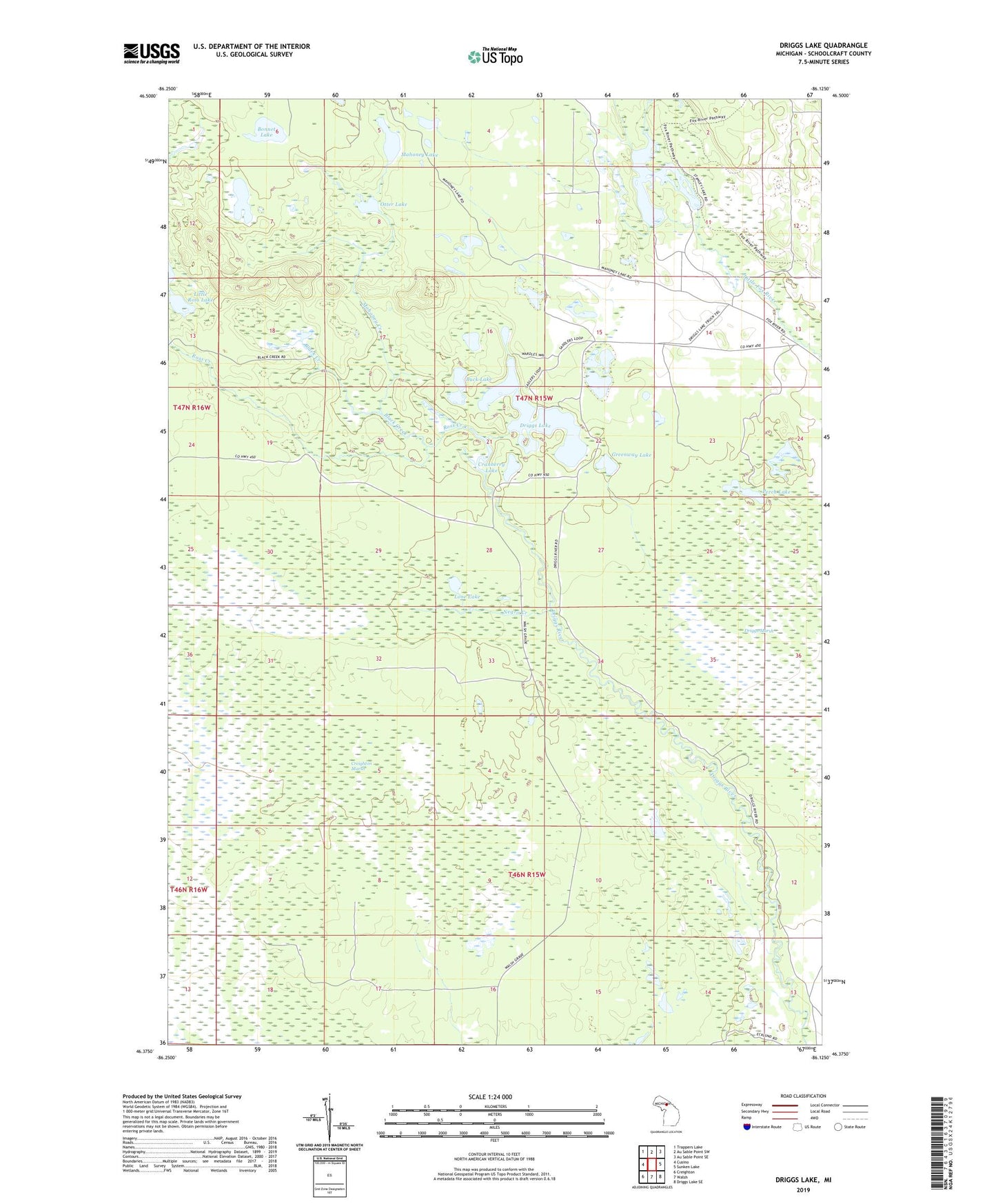
2023 topographic map quadrangle Driggs Lake in the state of Michigan. Scale: 1:24000. Based on the newly updated USGS 7.5' US Topo map series, this map is in the following counties: Schoolcraft. The map contains contour data, water features, and other items you are used to seeing on USGS maps, but also has updated roads and other features. This is the next generation of topographic maps. Printed on high-quality waterproof paper with UV fade-resistant inks.
Quads adjacent to this one:
West: Cusino
Northwest: Trappers Lake
North: Au Sable Point SW
Northeast: Au Sable Point SE
East: Sunken Lake
Southeast: Driggs Lake SE
South: Walsh
Southwest: Creighton
This map covers the same area as the classic USGS quad with code o46086d2.
Contains the following named places: Black Creek, Bonnet Lake, Buck Lake, Cranberry Lake, Driggs Lake, Fork Lake, Grand Sable State Forest, Greenway Lake, Howards Camp, Little Ross Lake, Lone Lake, Mahoney Creek, Mahoney Lake, Negro Creek, Otter Creek, Otter Lake, Perch Lake, Ross Creek, Stanley Lake, Stanley Lake Campground