MyTopo
Buckley Michigan US Topo Map
Couldn't load pickup availability
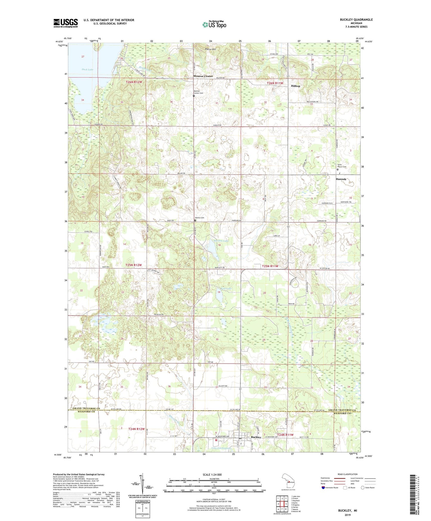
2023 topographic map quadrangle Buckley in the state of Michigan. Scale: 1:24000. Based on the newly updated USGS 7.5' US Topo map series, this map is in the following counties: Grand Traverse, Wexford. The map contains contour data, water features, and other items you are used to seeing on USGS maps, but also has updated roads and other features. This is the next generation of topographic maps. Printed on high-quality waterproof paper with UV fade-resistant inks.
Quads adjacent to this one:
West: Karlin
Northwest: Lake Ann
North: Grawn
Northeast: Mayfield
East: Kingsley
Southeast: Mesick NE
South: Mesick
Southwest: Harlan
This map covers the same area as the classic USGS quad with code o44085e6.
Contains the following named places: Bartlett Lake, Bartlett Post Office, Bartlett School, Brigham Creek, Buckley, Buckley Gospel Tabernacle Church, Buckley Post Office, Buckley Public Library, Buckley School, Buckley Volunteer Fire Department, Buckley Wayside Congregational Church, Canada School, Downs Cemetery, Faith Community Nazarene Church, Fish Lake, Grant United Methodist Church, Gray School, Hannah, Hannah Post Office, Highland School, Hilltop, Mayfield Township Hall, Monroe Center, Monroe Center Cemetery, Monroe Center Post Office, North Branch Anderson Creek, Northern Pines Health Center, Pierce Hill, Saint Mary's Cemetery, Saint Mary's Hannah Catholic Church, Saint Mary's School, Township of Mayfield, Traverse City South KOA Campground, Village of Buckley, West Branch Anderson Creek, Wexford Corner, Wexford Post Office, ZIP Codes: 49620, 49637