MyTopo
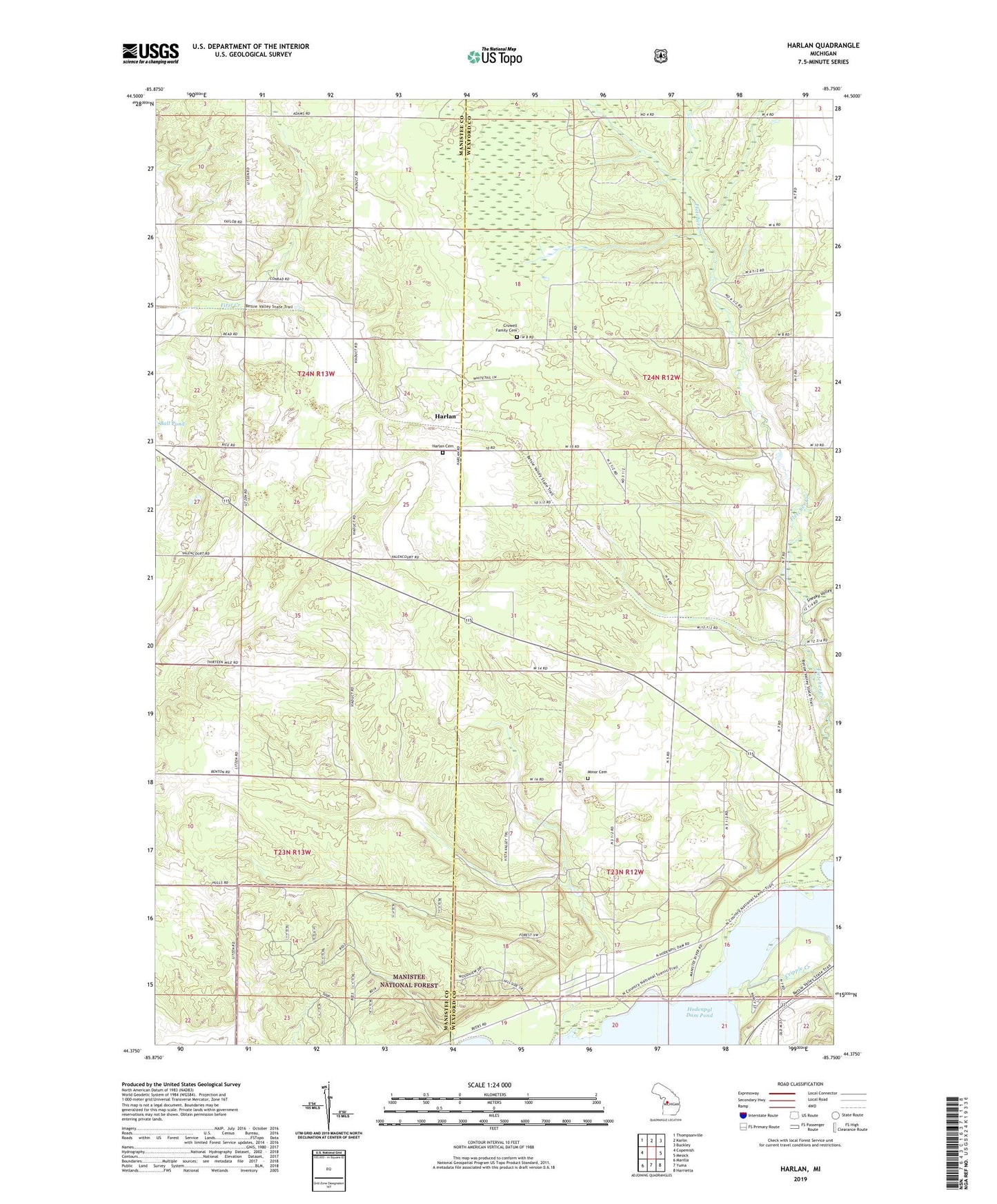
Harlan Michigan US Topo Map
Couldn't load pickup availability
Also explore the Harlan Forest Service Topo of this same quad for updated USFS data
2023 topographic map quadrangle Harlan in the state of Michigan. Scale: 1:24000. Based on the newly updated USGS 7.5' US Topo map series, this map is in the following counties: Wexford, Manistee. The map contains contour data, water features, and other items you are used to seeing on USGS maps, but also has updated roads and other features. This is the next generation of topographic maps. Printed on high-quality waterproof paper with UV fade-resistant inks.
Quads adjacent to this one:
West: Copemish
Northwest: Thompsonville
North: Karlin
Northeast: Buckley
East: Mesick
Southeast: Harrietta
South: Yuma
Southwest: Marilla
This map covers the same area as the classic USGS quad with code o44085d7.
Contains the following named places: Bagnall, Bagnall Station, Bagnell Post Office, Brethren Cemetery, Burton Trailer Park, Carpenter School, Cotton Creek, Cripple Creek, Crowell Family Cemetery, Harlan, Harlan Post Office, Harlan Station, Kingdom Hall, Mesick RV Park, Minar Memorial Cemetery, Sneaky Valley, Spruce Hollow Campground, Township of Springville, Township of Wexford